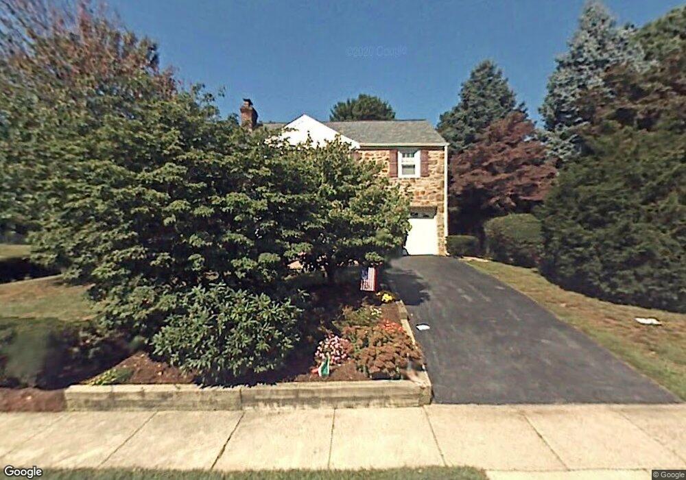
22 Rittenhouse Rd Broomall, PA 19008
Estimated Value: $506,000 - $566,000
3
Beds
2
Baths
1,704
Sq Ft
$315/Sq Ft
Est. Value
About This Home
This home is located at 22 Rittenhouse Rd, Broomall, PA 19008 and is currently estimated at $537,385, approximately $315 per square foot. 22 Rittenhouse Rd is a home located in Delaware County with nearby schools including Worrall Elementary School, Paxon Hollow Middle School, and Marple Newtown Senior High School.
Ownership History
Date
Name
Owned For
Owner Type
Purchase Details
Closed on
May 28, 2002
Sold by
Brecher Alan M and Brecher Deborah T
Bought by
Montanaro Louis D and Montanaro Theresa M
Current Estimated Value
Home Financials for this Owner
Home Financials are based on the most recent Mortgage that was taken out on this home.
Original Mortgage
$175,000
Outstanding Balance
$74,464
Interest Rate
6.9%
Estimated Equity
$462,921
Create a Home Valuation Report for This Property
The Home Valuation Report is an in-depth analysis detailing your home's value as well as a comparison with similar homes in the area
Home Values in the Area
Average Home Value in this Area
Purchase History
| Date | Buyer | Sale Price | Title Company |
|---|---|---|---|
| Montanaro Louis D | $252,500 | Commonwealth Land Title Ins |
Source: Public Records
Mortgage History
| Date | Status | Borrower | Loan Amount |
|---|---|---|---|
| Open | Montanaro Louis D | $175,000 |
Source: Public Records
Tax History
| Year | Tax Paid | Tax Assessment Tax Assessment Total Assessment is a certain percentage of the fair market value that is determined by local assessors to be the total taxable value of land and additions on the property. | Land | Improvement |
|---|---|---|---|---|
| 2025 | $5,092 | $294,660 | $101,400 | $193,260 |
| 2024 | $5,092 | $294,660 | $101,400 | $193,260 |
| 2023 | $4,931 | $294,660 | $101,400 | $193,260 |
| 2022 | $4,837 | $294,660 | $101,400 | $193,260 |
| 2021 | $7,300 | $294,660 | $101,400 | $193,260 |
| 2020 | $4,505 | $156,550 | $50,040 | $106,510 |
| 2019 | $4,451 | $156,550 | $50,040 | $106,510 |
| 2018 | $4,405 | $156,550 | $0 | $0 |
| 2017 | $4,407 | $156,550 | $0 | $0 |
| 2016 | $859 | $156,550 | $0 | $0 |
| 2015 | $877 | $156,550 | $0 | $0 |
| 2014 | $877 | $156,550 | $0 | $0 |
Source: Public Records
Map
Nearby Homes
- Lot 1 Cynwyd
- Lot 2 Cynwyd
- 327 Netherington Dr
- 2606 Springfield Rd
- 118 N Line Rd
- 106 2nd Ave
- 15 Oakland Rd
- 24 Berkley Rd
- 134 4th Ave
- 1 Radnor Dr Unit F4
- 2431 Gilbert St
- 117 Bella Dr Unit 3AD
- 10 Pickwick Ln
- 2739 Stony Creek Rd
- 2213 Windsor Cir
- 301 S New Ardmore Ave
- 106 Gibson Ct
- 106 Eagle Dr
- 104 Gibson Ct
- 104 Eagle Dr
- 20 Rittenhouse Rd
- 26 Rittenhouse Rd
- 19 Harmil Rd
- 17 Harmil Rd
- 18 Rittenhouse Rd
- 15 Harmil Rd
- 21 Harmil Rd
- 28 Rittenhouse Rd
- 25 Rittenhouse Rd
- 16 Rittenhouse Rd
- 23 Rittenhouse Rd
- 13 Harmil Rd
- 29 Rittenhouse Rd
- 23 Harmil Rd
- 30 Rittenhouse Rd
- 21 Rittenhouse Rd
- 11 Harmil Rd
- 14 Rittenhouse Rd
- 25 Harmil Rd
- 31 Rittenhouse Rd
Your Personal Tour Guide
Ask me questions while you tour the home.