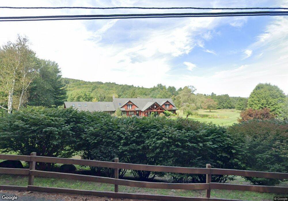
22 Rock a Dundee Rd Hampden, MA 01036
Estimated Value: $1,105,308 - $1,692,000
4
Beds
3
Baths
5,166
Sq Ft
$258/Sq Ft
Est. Value
About This Home
This home is located at 22 Rock a Dundee Rd, Hampden, MA 01036 and is currently estimated at $1,333,769, approximately $258 per square foot. 22 Rock a Dundee Rd is a home located in Hampden County with nearby schools including Minnechaug Regional High School.
Ownership History
Date
Name
Owned For
Owner Type
Purchase Details
Closed on
Apr 19, 2002
Sold by
Cimmino Nt and Basile John A
Bought by
Picknelly Cynthia R
Current Estimated Value
Create a Home Valuation Report for This Property
The Home Valuation Report is an in-depth analysis detailing your home's value as well as a comparison with similar homes in the area
Home Values in the Area
Average Home Value in this Area
Purchase History
| Date | Buyer | Sale Price | Title Company |
|---|---|---|---|
| Picknelly Cynthia R | $805,000 | -- |
Source: Public Records
Mortgage History
| Date | Status | Borrower | Loan Amount |
|---|---|---|---|
| Open | Picknelly Cynthia R | $750,000 | |
| Previous Owner | Picknelly Cynthia R | $500,000 | |
| Previous Owner | Picknelly Cynthia R | $103,515 | |
| Previous Owner | Picknelly Cynthia R | $448,000 |
Source: Public Records
Tax History Compared to Growth
Tax History
| Year | Tax Paid | Tax Assessment Tax Assessment Total Assessment is a certain percentage of the fair market value that is determined by local assessors to be the total taxable value of land and additions on the property. | Land | Improvement |
|---|---|---|---|---|
| 2025 | $17,284 | $1,145,400 | $159,800 | $985,600 |
| 2024 | $15,746 | $1,005,500 | $148,400 | $857,100 |
| 2023 | $14,719 | $872,500 | $148,400 | $724,100 |
| 2022 | $15,302 | $817,400 | $148,400 | $669,000 |
| 2021 | $541 | $764,400 | $148,400 | $616,000 |
| 2020 | $16,017 | $794,900 | $163,400 | $631,500 |
| 2019 | $2,077 | $818,400 | $163,400 | $655,000 |
| 2018 | $16,068 | $803,400 | $163,400 | $640,000 |
| 2017 | $15,498 | $803,400 | $163,400 | $640,000 |
| 2016 | $14,845 | $766,800 | $144,100 | $622,700 |
| 2015 | $14,746 | $776,900 | $144,100 | $632,800 |
Source: Public Records
Map
Nearby Homes
- 59 St Germain Rd
- Lot 2R &3 Chapin Rd
- 179 Chapin Rd
- Lot D South Rd
- 8 S Ridge Rd
- 58 Rocky Dundee Rd
- 0 Mountain Rd Unit 73267162
- 0 Mountain Rd Unit 72942534
- 285 Lower Hampden Rd
- 319 Main St
- 186 Upper Hampden Rd
- 12 & 16 Haas Rd
- Lot 16 Wood Hill Rd
- 41 Martin Farms Rd
- 64 Potash Hill Ln
- 179 Bumstead Rd
- 169 Stafford Rd
- 175 Stafford Rd
- 200 Hampden Rd
- 190 Root Rd
- 32 Rock a Dundee Rd
- 31 Rock a Dundee Rd
- 22 Stafford Rd
- 47 Stafford Rd
- 43 Rock a Dundee Rd
- 2 Stafford Rd
- 320 Scantic Rd
- 325 Scantic Rd
- 70 Rock a Dundee Rd
- 70 Rock-A-dundee Rd
- 23 Stafford Rd
- 300 Scantic Rd
- 303 Scantic Rd
- 34 Thresher Rd
- 48 Stafford Rd
- 307 Scantic Rd
- 61 Rock a Dundee Rd
- 80 Rock a Dundee Rd
- 80 Rock-A-dundee Rd
- 285 Scantic Rd