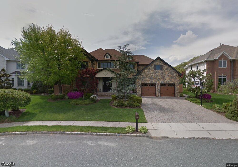
22 Rons Edge Rd Springfield, NJ 07081
Estimated Value: $1,146,000 - $1,731,000
--
Bed
--
Bath
4,452
Sq Ft
$330/Sq Ft
Est. Value
About This Home
This home is located at 22 Rons Edge Rd, Springfield, NJ 07081 and is currently estimated at $1,467,817, approximately $329 per square foot. 22 Rons Edge Rd is a home located in Union County with nearby schools including Jonathan Dayton High School and St James The Apostle School.
Ownership History
Date
Name
Owned For
Owner Type
Purchase Details
Closed on
Jun 6, 2001
Sold by
Golf Edge Llc
Bought by
Brooks David S and Brooks Lesley S
Current Estimated Value
Home Financials for this Owner
Home Financials are based on the most recent Mortgage that was taken out on this home.
Original Mortgage
$310,000
Outstanding Balance
$117,567
Interest Rate
7.08%
Mortgage Type
Stand Alone First
Estimated Equity
$1,350,250
Create a Home Valuation Report for This Property
The Home Valuation Report is an in-depth analysis detailing your home's value as well as a comparison with similar homes in the area
Home Values in the Area
Average Home Value in this Area
Purchase History
| Date | Buyer | Sale Price | Title Company |
|---|---|---|---|
| Brooks David S | $579,000 | -- |
Source: Public Records
Mortgage History
| Date | Status | Borrower | Loan Amount |
|---|---|---|---|
| Open | Brooks David S | $310,000 |
Source: Public Records
Tax History Compared to Growth
Tax History
| Year | Tax Paid | Tax Assessment Tax Assessment Total Assessment is a certain percentage of the fair market value that is determined by local assessors to be the total taxable value of land and additions on the property. | Land | Improvement |
|---|---|---|---|---|
| 2025 | $29,892 | $1,258,600 | $395,300 | $863,300 |
| 2024 | $29,401 | $1,258,600 | $395,300 | $863,300 |
| 2023 | $29,401 | $1,258,600 | $395,300 | $863,300 |
| 2022 | $27,299 | $1,258,600 | $395,300 | $863,300 |
| 2021 | $27,882 | $374,500 | $98,600 | $275,900 |
| 2020 | $27,447 | $374,500 | $98,600 | $275,900 |
| 2019 | $27,076 | $374,500 | $98,600 | $275,900 |
| 2018 | $26,590 | $374,500 | $98,600 | $275,900 |
| 2017 | $25,859 | $374,500 | $98,600 | $275,900 |
| 2016 | $25,357 | $374,500 | $98,600 | $275,900 |
| 2015 | $25,062 | $374,500 | $98,600 | $275,900 |
| 2014 | $24,590 | $374,500 | $98,600 | $275,900 |
Source: Public Records
Map
Nearby Homes
- 126 Fieldstone Dr
- 20 Kew Dr
- 294 Mountain Ave
- 64 S Springfield Ave
- 559 S Springfield Ave Unit 559
- 2 S Audlen Terrace
- 701 Mountain Ave
- 262 Mountain Ave
- 13 Evergreen Ave
- 17 Evergreen Ave
- 300 Wilson Rd Unit 24D
- 35 S Derby Rd
- 28 S Derby Rd
- 102 Irwin St
- 5D Stone Hill Rd Unit 27
- 5B Troy Dr Unit 1
- 874 Mountain Ave
- 24 Brook St
- 64 Highlands Ave
- 66A Troy Dr Unit A
- 20 Rons Edge Rd
- 501 Ashwood Rd
- 24 Rons Edge Rd
- 505 Ashwood Rd
- 18 Rons Edge Rd
- 26 Rons Edge Rd
- 458 Mountain Ave
- 19 Rons Edge Rd
- 21 Rons Edge Rd
- 509 Ashwood Rd
- 500 Ashwood Rd
- 513 Ashwood Rd
- 16 Rons Edge Rd
- 506 Ashwood Rd
- 78 Sherwood Rd
- 15 Rons Edge Rd
- 14 Rons Edge Rd
- 517 Ashwood Rd
- 510 Ashwood Rd
- 64 Sherwood Rd