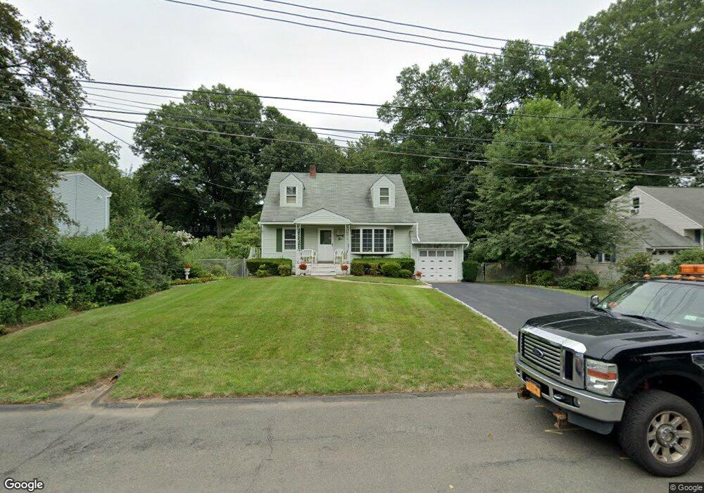
22 Rowan Rd Pearl River, NY 10965
Estimated Value: $650,000 - $771,000
3
Beds
3
Baths
1,545
Sq Ft
$454/Sq Ft
Est. Value
About This Home
This home is located at 22 Rowan Rd, Pearl River, NY 10965 and is currently estimated at $701,870, approximately $454 per square foot. 22 Rowan Rd is a home located in Rockland County with nearby schools including Pearl River High School, St Margaret School, and Our Lady of Mercy Academy.
Ownership History
Date
Name
Owned For
Owner Type
Purchase Details
Closed on
Feb 10, 2022
Sold by
Luccketti Nicholas M
Bought by
Cirilli Michael and Cirilli Veronica
Current Estimated Value
Home Financials for this Owner
Home Financials are based on the most recent Mortgage that was taken out on this home.
Original Mortgage
$150,000
Outstanding Balance
$139,897
Interest Rate
3.92%
Mortgage Type
Construction
Estimated Equity
$561,973
Purchase Details
Closed on
Mar 16, 2021
Sold by
Luccketti Mary Ann
Bought by
Luccketti Nicholas M
Purchase Details
Closed on
Dec 17, 2007
Sold by
Luccketti Nicholas and Luccketti Mary Ann
Bought by
Luccketti Mary Ann
Create a Home Valuation Report for This Property
The Home Valuation Report is an in-depth analysis detailing your home's value as well as a comparison with similar homes in the area
Home Values in the Area
Average Home Value in this Area
Purchase History
| Date | Buyer | Sale Price | Title Company |
|---|---|---|---|
| Cirilli Michael | $175,000 | None Available | |
| Cirilli Michael | $175,000 | None Available | |
| Luccketti Nicholas M | -- | None Available | |
| Luccketti Nicholas M | -- | None Available | |
| Luccketti Mary Ann | -- | None Available | |
| Luccketti Mary Ann | -- | None Available |
Source: Public Records
Mortgage History
| Date | Status | Borrower | Loan Amount |
|---|---|---|---|
| Open | Cirilli Michael | $150,000 | |
| Closed | Cirilli Michael | $150,000 |
Source: Public Records
Tax History Compared to Growth
Tax History
| Year | Tax Paid | Tax Assessment Tax Assessment Total Assessment is a certain percentage of the fair market value that is determined by local assessors to be the total taxable value of land and additions on the property. | Land | Improvement |
|---|---|---|---|---|
| 2024 | $13,659 | $196,700 | $50,700 | $146,000 |
| 2023 | $13,659 | $196,700 | $50,700 | $146,000 |
| 2022 | $4,330 | $172,500 | $50,700 | $121,800 |
| 2021 | $11,553 | $172,500 | $50,700 | $121,800 |
| 2020 | $8,332 | $172,500 | $50,700 | $121,800 |
| 2019 | $3,271 | $172,500 | $50,700 | $121,800 |
| 2018 | $7,689 | $172,500 | $50,700 | $121,800 |
| 2017 | $7,763 | $172,500 | $50,700 | $121,800 |
| 2016 | $7,500 | $172,500 | $50,700 | $121,800 |
| 2015 | -- | $172,500 | $50,700 | $121,800 |
| 2014 | -- | $172,500 | $50,700 | $121,800 |
Source: Public Records
Map
Nearby Homes
- 359 Orangeburg Rd
- 4 Sunrise Ln
- 74 Oldert Dr
- 60 S Nauraushaun Rd
- 103 S Nauraushaun Rd
- 80 Lenape Rd
- 363 Gilbert Ave
- 10 Mountain View Ave
- 352 Holt Dr
- 210 Rockland Rd
- 14 Staubitz Ave
- 29 Michael Roberts Ct
- 55 Kinsley Grove
- 250 Blauvelt Rd
- 118 & 114 Standish Dr
- 159 Martin Place
- 109 S John St
- 165 Forest Ave
- 87 Pinto Rd
- 99 E Washington Ave
- 16 Rowan Rd
- 28 Rowan Rd
- 477 Orangeburg Rd
- 36 Rowan Rd
- 491 Orangeburg Rd
- 471 Orangeburg Rd
- 465 Orangeburg Rd
- 19 Rowan Rd
- 25 Rowan Rd
- 33 Rowan Rd
- 42 Rowan Rd
- 451 Orangeburg Rd
- 495 Orangeburg Rd
- 499 Orangeburg Rd
- 445 Orangeburg Rd
- 39 Rowan Rd
- 50 Rowan Rd
- 468 Orangeburg Rd
- 474 Orangeburg Rd
- 462 Orangeburg Rd