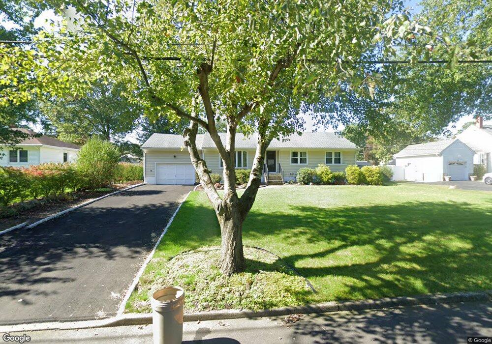
22 Sagamore Rd Parsippany, NJ 07054
Estimated Value: $545,000 - $647,000
--
Bed
--
Bath
1,296
Sq Ft
$471/Sq Ft
Est. Value
About This Home
This home is located at 22 Sagamore Rd, Parsippany, NJ 07054 and is currently estimated at $611,042, approximately $471 per square foot. 22 Sagamore Rd is a home located in Morris County with nearby schools including Rockaway Meadow School, Central Middle School, and Parsippany High School.
Ownership History
Date
Name
Owned For
Owner Type
Purchase Details
Closed on
Aug 7, 2013
Sold by
Zalusky Boguslawa and Wuennenberg Boguslawa J
Bought by
Wuennenberg Boguslawa J and Wuennenberg Glenn R
Current Estimated Value
Home Financials for this Owner
Home Financials are based on the most recent Mortgage that was taken out on this home.
Original Mortgage
$335,000
Outstanding Balance
$79,230
Interest Rate
3.42%
Mortgage Type
New Conventional
Estimated Equity
$531,812
Purchase Details
Closed on
Sep 20, 2002
Sold by
Bell Dave
Bought by
Zalusky Boguslawa
Home Financials for this Owner
Home Financials are based on the most recent Mortgage that was taken out on this home.
Original Mortgage
$245,700
Interest Rate
6.27%
Create a Home Valuation Report for This Property
The Home Valuation Report is an in-depth analysis detailing your home's value as well as a comparison with similar homes in the area
Home Values in the Area
Average Home Value in this Area
Purchase History
| Date | Buyer | Sale Price | Title Company |
|---|---|---|---|
| Wuennenberg Boguslawa J | -- | Title Trust Llc | |
| Zalusky Boguslawa | $351,000 | -- |
Source: Public Records
Mortgage History
| Date | Status | Borrower | Loan Amount |
|---|---|---|---|
| Open | Wuennenberg Boguslawa J | $335,000 | |
| Previous Owner | Zalusky Boguslawa | $245,700 |
Source: Public Records
Tax History Compared to Growth
Tax History
| Year | Tax Paid | Tax Assessment Tax Assessment Total Assessment is a certain percentage of the fair market value that is determined by local assessors to be the total taxable value of land and additions on the property. | Land | Improvement |
|---|---|---|---|---|
| 2025 | $11,241 | $318,800 | $179,400 | $139,400 |
| 2024 | $11,030 | $318,800 | $179,400 | $139,400 |
| 2023 | $11,030 | $318,800 | $179,400 | $139,400 |
| 2022 | $10,291 | $318,800 | $179,400 | $139,400 |
| 2021 | $10,291 | $318,800 | $179,400 | $139,400 |
| 2020 | $10,071 | $318,800 | $179,400 | $139,400 |
| 2019 | $9,790 | $318,800 | $179,400 | $139,400 |
| 2018 | $9,574 | $318,800 | $179,400 | $139,400 |
| 2017 | $9,347 | $318,800 | $179,400 | $139,400 |
| 2016 | $9,178 | $318,800 | $179,400 | $139,400 |
| 2015 | $8,946 | $318,800 | $179,400 | $139,400 |
| 2014 | $8,821 | $318,800 | $179,400 | $139,400 |
Source: Public Records
Map
Nearby Homes
- 60 White Oak Rd
- 188 Edwards Rd
- 260 Old Bloomfield Ave
- 15 Carlson Place
- 10 Manito Ave
- 17 Buckingham Cir
- 53 Gordon Cir Unit 53
- 318 Changebridge Rd
- 30 Manchester Way
- 123 Cardigan Ct Unit 123
- 193 Crown Point Rd Unit 193
- 2 Colony Ct
- 12 Cherokee Ave
- 96 Ball Ave
- 10 Hilldale Rd
- 122 Lake Shore Dr
- 63 U S 46
- 6 Hancock Ct
- 60 Gathering Rd
- 21 Nokomis Ave