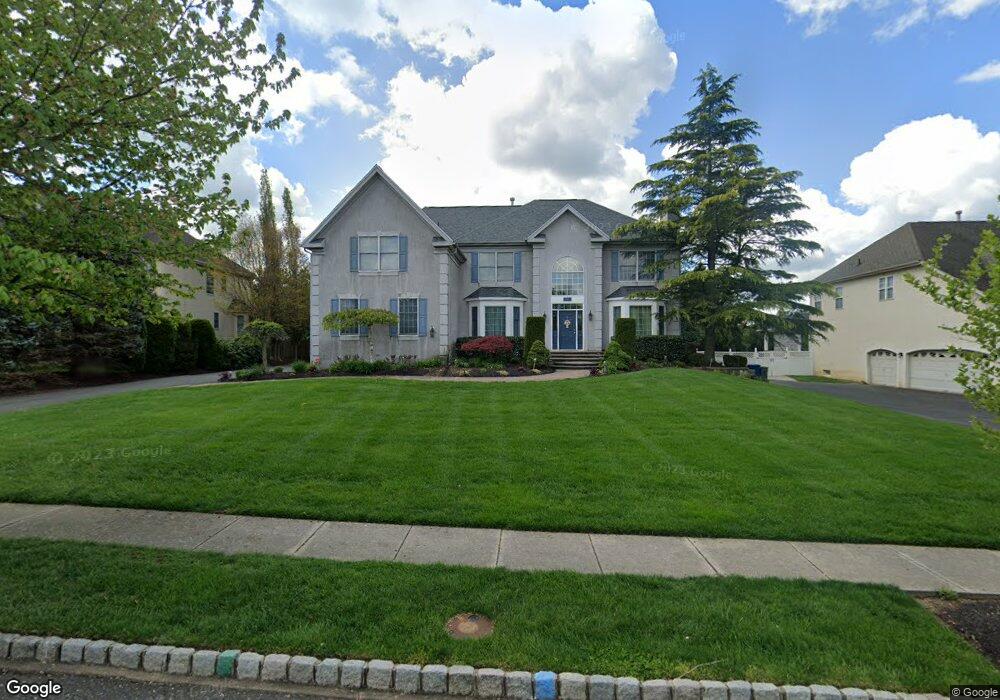
22 Sheffield Dr Moorestown, NJ 08057
Estimated Value: $1,264,702 - $1,523,000
--
Bed
--
Bath
4,096
Sq Ft
$339/Sq Ft
Est. Value
About This Home
This home is located at 22 Sheffield Dr, Moorestown, NJ 08057 and is currently estimated at $1,387,901, approximately $338 per square foot. 22 Sheffield Dr is a home located in Burlington County with nearby schools including South Valley Elementary School, Moorestown Upper Elementary School, and William Allen Middle School.
Ownership History
Date
Name
Owned For
Owner Type
Purchase Details
Closed on
Oct 24, 2001
Sold by
Orleans Corp
Bought by
Kolon Thomas F and Earl Karen M
Current Estimated Value
Home Financials for this Owner
Home Financials are based on the most recent Mortgage that was taken out on this home.
Original Mortgage
$100,000
Interest Rate
6.82%
Mortgage Type
Unknown
Create a Home Valuation Report for This Property
The Home Valuation Report is an in-depth analysis detailing your home's value as well as a comparison with similar homes in the area
Home Values in the Area
Average Home Value in this Area
Purchase History
| Date | Buyer | Sale Price | Title Company |
|---|---|---|---|
| Kolon Thomas F | $596,015 | Settlers Title Agency Lp | |
| -- | $596,000 | -- |
Source: Public Records
Mortgage History
| Date | Status | Borrower | Loan Amount |
|---|---|---|---|
| Closed | -- | $100,000 | |
| Open | -- | $476,800 |
Source: Public Records
Tax History Compared to Growth
Tax History
| Year | Tax Paid | Tax Assessment Tax Assessment Total Assessment is a certain percentage of the fair market value that is determined by local assessors to be the total taxable value of land and additions on the property. | Land | Improvement |
|---|---|---|---|---|
| 2025 | $20,041 | $706,400 | $186,900 | $519,500 |
| 2024 | $19,433 | $706,400 | $186,900 | $519,500 |
| 2023 | $19,433 | $706,400 | $186,900 | $519,500 |
| 2022 | $19,235 | $706,400 | $186,900 | $519,500 |
| 2021 | $18,981 | $706,400 | $186,900 | $519,500 |
| 2020 | $18,861 | $706,400 | $186,900 | $519,500 |
| 2019 | $18,529 | $706,400 | $186,900 | $519,500 |
| 2018 | $18,027 | $706,400 | $186,900 | $519,500 |
| 2017 | $18,183 | $706,400 | $186,900 | $519,500 |
| 2016 | $18,119 | $706,400 | $186,900 | $519,500 |
| 2015 | $17,900 | $706,400 | $186,900 | $519,500 |
| 2014 | $16,996 | $706,400 | $186,900 | $519,500 |
Source: Public Records
Map
Nearby Homes
- 633 E Main St Unit B7
- 57 Brooks Rd
- 526 E Main St
- 514 E Main St
- 39 Bramley Rd
- 97 Brooks Rd
- 5 Murray Rd
- 408 E 2nd St
- 744 Signal Light Rd
- 308 Elm St
- 628 Windsock Way
- 7 Whitetail Ct
- 40 Palmer Dr Unit 110
- 205 E Central Ave
- 863 Golf View Rd
- 693 Garwood Rd
- 133 Plum St Unit 6
- 740 Garwood Rd
- 700 Bentley Ct
- 80 E 3rd St
- 20 Sheffield Dr
- 24 Sheffield Dr
- 22 Windermere Dr
- 18 Sheffield Dr
- 26 Sheffield Dr
- 24 Windermere Dr
- 20 Windermere Dr
- 15 Sheffield Dr
- 17 Sheffield Dr
- 26 Windermere Dr
- 13 Sheffield Dr
- 16 Sheffield Dr
- 2 Dorchester Ln
- 19 Sheffield Dr
- 18 Windermere Dr
- 28 Sheffield Dr
- 4 Dorchester Ln
- 14 Sheffield Dr
- 21 Sheffield Dr
- 21 Windermere Dr