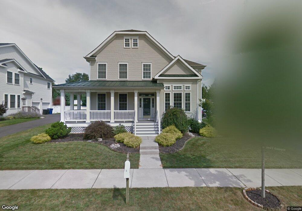
22 Singleton Dr Chesterfield, NJ 08515
Estimated Value: $865,000 - $964,000
Studio
--
Bath
3,634
Sq Ft
$247/Sq Ft
Est. Value
About This Home
This home is located at 22 Singleton Dr, Chesterfield, NJ 08515 and is currently estimated at $898,844, approximately $247 per square foot. 22 Singleton Dr is a home located in Burlington County with nearby schools including Chesterfield Elementary School, Northern Burlington County Regional Middle School, and Northern Burlington County Regional High School.
Ownership History
Date
Name
Owned For
Owner Type
Purchase Details
Closed on
Jan 10, 2007
Current Estimated Value
Home Financials for this Owner
Home Financials are based on the most recent Mortgage that was taken out on this home.
Original Mortgage
$76,000
Interest Rate
5.86%
Mortgage Type
Unknown
Create a Home Valuation Report for This Property
The Home Valuation Report is an in-depth analysis detailing your home's value as well as a comparison with similar homes in the area
Home Values in the Area
Average Home Value in this Area
Purchase History
| Date | Buyer | Sale Price | Title Company |
|---|---|---|---|
| -- | $651,000 | -- |
Source: Public Records
Mortgage History
| Date | Status | Borrower | Loan Amount |
|---|---|---|---|
| Closed | -- | $76,000 | |
| Open | -- | $500,000 |
Source: Public Records
Tax History
| Year | Tax Paid | Tax Assessment Tax Assessment Total Assessment is a certain percentage of the fair market value that is determined by local assessors to be the total taxable value of land and additions on the property. | Land | Improvement |
|---|---|---|---|---|
| 2025 | $18,611 | $541,800 | $102,000 | $439,800 |
| 2024 | $17,863 | $541,800 | $102,000 | $439,800 |
| 2023 | $17,863 | $541,800 | $102,000 | $439,800 |
| 2022 | $17,018 | $541,800 | $102,000 | $439,800 |
| 2021 | $16,747 | $541,800 | $102,000 | $439,800 |
| 2020 | $16,579 | $541,800 | $102,000 | $439,800 |
| 2019 | $16,368 | $541,800 | $102,000 | $439,800 |
| 2018 | $15,994 | $541,800 | $102,000 | $439,800 |
| 2017 | $15,799 | $541,800 | $102,000 | $439,800 |
| 2016 | $15,214 | $541,800 | $102,000 | $439,800 |
| 2015 | $14,509 | $541,800 | $102,000 | $439,800 |
| 2014 | $13,653 | $541,800 | $102,000 | $439,800 |
Source: Public Records
Map
Nearby Homes
- 5 Susannah Dr
- 88 Bordentown Crosswicks Rd
- 63 Recklesstown Way
- 7 Colemantown Dr
- 24 Stevenson Ln
- 45 Bordentown Crosswicks Rd
- 40 Foulkes Ln Unit 11
- 25 Saddle Way
- 2 Thorn Ln
- 25 Chest-Crosswicks Rd
- 210 Recklesstown Way
- 20 Canter Place
- 10 Front St
- 36 Brookdale Way
- 14 Church St
- 18 Crosswicks Chesterfield Rd
- 463 Ward Ave
- 3 Antron Brown Way
- 13 New St
- 65 Fenton Ln
- 20 Singleton Dr
- 24 Singleton Dr
- 26 Singleton Dr
- 18 Singleton Dr
- 12 Farrington Way
- 15 Bullock Way
- 16 Singleton Dr
- 28 Singleton Dr
- 15 Singleton Dr
- 10 Farrington Way
- 7 Farrington Way
- 13 Bullock Way
- 83 Bordentown Crosswicks Rd
- 79 Bordentown Crosswicks Rd
- 81 Bordentown Crosswicks Rd
- 81 Bord-Crosswicks Rd
- 14 Singleton Dr
- 13 Singleton Dr
- 23 Singleton Dr
- 8 Farrington Way
Your Personal Tour Guide
Ask me questions while you tour the home.