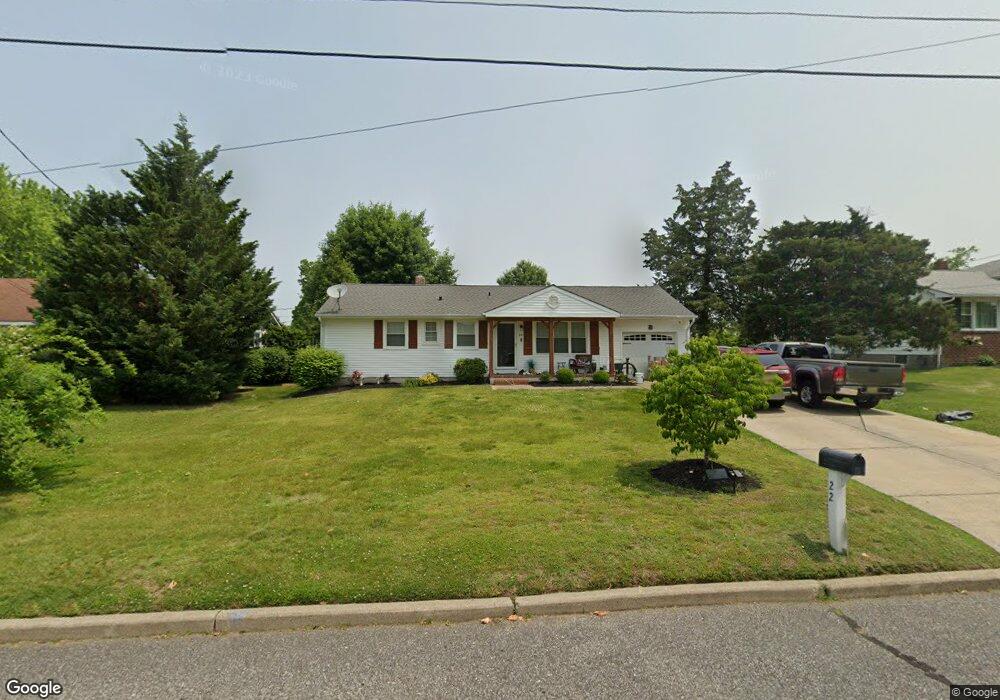
22 Somers Ave Clarksboro, NJ 08020
East Greenwich Township NeighborhoodEstimated Value: $383,000 - $427,000
3
Beds
2
Baths
1,608
Sq Ft
$252/Sq Ft
Est. Value
About This Home
This home is located at 22 Somers Ave, Clarksboro, NJ 08020 and is currently estimated at $404,465, approximately $251 per square foot. 22 Somers Ave is a home located in Gloucester County with nearby schools including Jeffrey Clark School, Samuel Mickle School, and Kingsway Regional Middle School.
Ownership History
Date
Name
Owned For
Owner Type
Purchase Details
Closed on
Apr 10, 2017
Sold by
Gallagher Tara A and Estate Of Barry John Dale
Bought by
22 Somers Llc
Current Estimated Value
Purchase Details
Closed on
Sep 25, 2008
Sold by
Coles Mary E and Coles Beverly May
Bought by
Dale Barry J
Home Financials for this Owner
Home Financials are based on the most recent Mortgage that was taken out on this home.
Original Mortgage
$96,500
Interest Rate
6.5%
Mortgage Type
Purchase Money Mortgage
Create a Home Valuation Report for This Property
The Home Valuation Report is an in-depth analysis detailing your home's value as well as a comparison with similar homes in the area
Home Values in the Area
Average Home Value in this Area
Purchase History
| Date | Buyer | Sale Price | Title Company |
|---|---|---|---|
| 22 Somers Llc | -- | Ta Title Ins Co | |
| Dale Barry J | $166,500 | Secure Title New Jersey Llc |
Source: Public Records
Mortgage History
| Date | Status | Borrower | Loan Amount |
|---|---|---|---|
| Previous Owner | Dale Barry J | $96,500 |
Source: Public Records
Tax History Compared to Growth
Tax History
| Year | Tax Paid | Tax Assessment Tax Assessment Total Assessment is a certain percentage of the fair market value that is determined by local assessors to be the total taxable value of land and additions on the property. | Land | Improvement |
|---|---|---|---|---|
| 2025 | $7,388 | $232,400 | $68,500 | $163,900 |
| 2024 | $7,153 | $232,400 | $68,500 | $163,900 |
| 2023 | $7,153 | $232,400 | $68,500 | $163,900 |
| 2022 | $6,951 | $232,400 | $68,500 | $163,900 |
| 2021 | $6,998 | $232,400 | $68,500 | $163,900 |
| 2020 | $7,030 | $232,400 | $68,500 | $163,900 |
| 2019 | $6,958 | $232,400 | $68,500 | $163,900 |
| 2018 | $5,150 | $156,200 | $58,500 | $97,700 |
| 2017 | $5,083 | $156,200 | $58,500 | $97,700 |
| 2016 | $5,023 | $156,200 | $58,500 | $97,700 |
| 2015 | $4,814 | $156,200 | $58,500 | $97,700 |
| 2014 | $4,517 | $156,200 | $58,500 | $97,700 |
Source: Public Records
Map
Nearby Homes
- 276-280 County House Rd
- 9 Weatherby Ave
- 26 E Cohawkin Rd
- 14 E Cohawkin Rd
- 322 Iannelli Rd
- 209 Charles Corliss Blvd
- 153 Kings Hwy
- 149 Tradewinds Dr
- 53 Currant Dr
- 127 Bell Ave
- 16 Berkley Rd
- 126 Foxwood Terrace
- 121 Weathervane Dr
- 127 Acorn Dr
- 106 Eagleview Terrace
- 380 Concetta Dr
- 17 Higginsville Ln
- 0 Jessups Mill Rd
- 2804 Lamington Ct
- 296 Ogden Station Rd