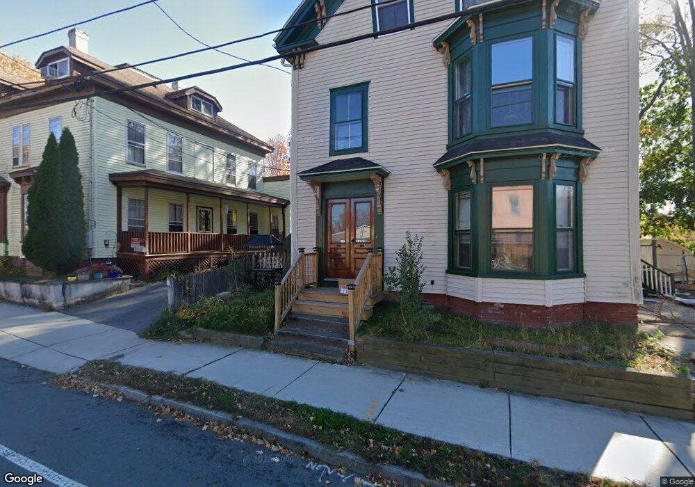
22 Sparhawk St Amesbury, MA 01913
Estimated Value: $468,525 - $746,000
6
Beds
3
Baths
2,501
Sq Ft
$254/Sq Ft
Est. Value
About This Home
This home is located at 22 Sparhawk St, Amesbury, MA 01913 and is currently estimated at $634,381, approximately $253 per square foot. 22 Sparhawk St is a home located in Essex County with nearby schools including Amesbury High School and Amesbury Seventh-Day Adventist School.
Ownership History
Date
Name
Owned For
Owner Type
Purchase Details
Closed on
Feb 9, 2022
Sold by
Schimming Elaine L
Bought by
Baker Cody and White Aurora L
Current Estimated Value
Home Financials for this Owner
Home Financials are based on the most recent Mortgage that was taken out on this home.
Original Mortgage
$300,000
Outstanding Balance
$276,474
Interest Rate
3.56%
Mortgage Type
Purchase Money Mortgage
Estimated Equity
$357,907
Purchase Details
Closed on
Mar 1, 1985
Bought by
Schimming Ernest P
Create a Home Valuation Report for This Property
The Home Valuation Report is an in-depth analysis detailing your home's value as well as a comparison with similar homes in the area
Home Values in the Area
Average Home Value in this Area
Purchase History
| Date | Buyer | Sale Price | Title Company |
|---|---|---|---|
| Baker Cody | $375,000 | None Available | |
| Baker Cody | $375,000 | None Available | |
| Schimming Ernest P | $80,000 | -- |
Source: Public Records
Mortgage History
| Date | Status | Borrower | Loan Amount |
|---|---|---|---|
| Open | Baker Cody | $300,000 | |
| Closed | Baker Cody | $300,000 |
Source: Public Records
Tax History
| Year | Tax Paid | Tax Assessment Tax Assessment Total Assessment is a certain percentage of the fair market value that is determined by local assessors to be the total taxable value of land and additions on the property. | Land | Improvement |
|---|---|---|---|---|
| 2025 | $8,039 | $525,400 | $205,900 | $319,500 |
| 2024 | $7,980 | $510,200 | $194,200 | $316,000 |
| 2023 | $8,495 | $519,900 | $168,800 | $351,100 |
| 2022 | $7,723 | $436,600 | $146,800 | $289,800 |
| 2021 | $7,428 | $407,000 | $113,400 | $293,600 |
| 2020 | $6,324 | $368,100 | $109,000 | $259,100 |
| 2019 | $5,320 | $289,600 | $109,000 | $180,600 |
| 2018 | $5,258 | $276,900 | $103,900 | $173,000 |
| 2017 | $5,524 | $276,900 | $103,900 | $173,000 |
| 2016 | $5,498 | $271,100 | $103,900 | $167,200 |
| 2015 | $5,568 | $271,100 | $103,900 | $167,200 |
| 2014 | $5,685 | $271,100 | $103,900 | $167,200 |
Source: Public Records
Map
Nearby Homes
- 20 Lincoln Ct
- 4 Larnard Ct
- 1 Hillside Ave Unit 3
- 4 Greenwood St
- 8 Winter St
- 15 Wells Ave
- 19 Maple St Unit 21
- 4 Clark St
- 21 River St
- 4 Boardman St
- 253 Main St
- 27 Lake St
- 97 Elm St
- 3 Tremont Ave Unit A
- 48 Orchard St
- 25 Cedar St Unit 4
- 101 Market St Unit B
- 10 Congress St Unit 302
- 21 Congress St
- 7 Hoyt Ave
- 22 Sparhawk St Unit 2
- 18 Sparhawk St Unit 20
- 26 Sparhawk St
- 16 Lincoln Ct
- 16 Lincoln Ct Unit 16,1
- 14 Lincoln Ct
- 14 14 Lincoln Ct
- 12 Lincoln Ct
- 12 Sparhawk St Unit A
- 14 Sparhawk St Unit 14
- 16 Sparhawk St
- 14 Sparhawk St
- 12 Sparhawk St
- 12 Sparhawk St Unit A 12-14-16
- 14 Sparhawk St Unit B
- 12 Lincon Ct Unit 12
- 22 Lincoln Ct
- 8 Lincoln Ct
- 10 Sparhawk St
- 15 Lincoln Ct
Your Personal Tour Guide
Ask me questions while you tour the home.