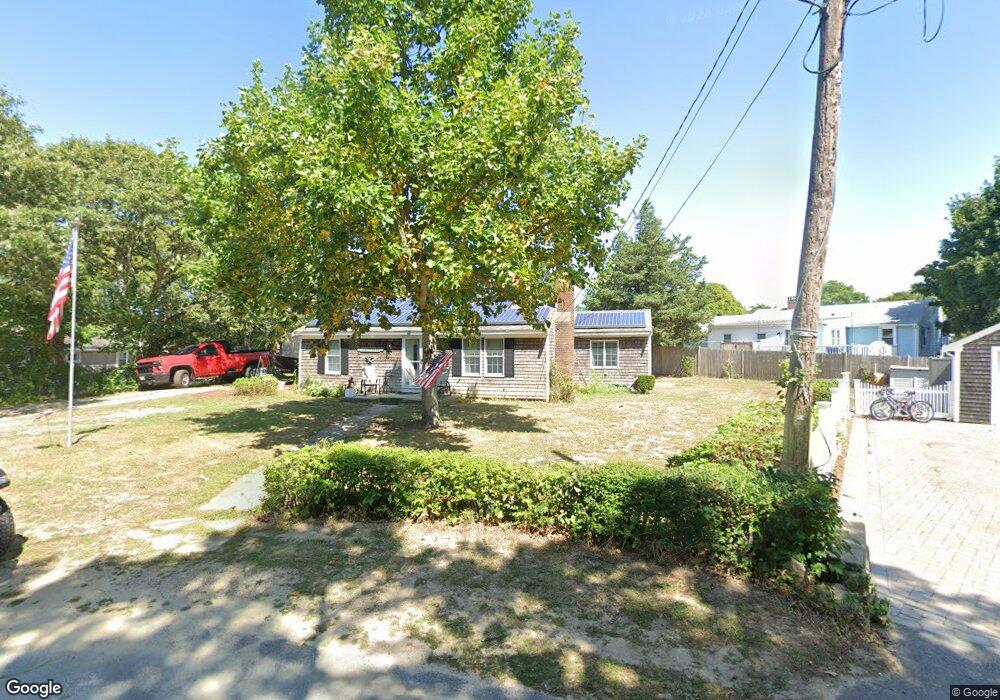
22 Spruce Way Dennis Port, MA 02639
Dennis Port NeighborhoodEstimated Value: $534,000 - $629,000
3
Beds
1
Bath
1,052
Sq Ft
$553/Sq Ft
Est. Value
About This Home
This home is located at 22 Spruce Way, Dennis Port, MA 02639 and is currently estimated at $581,384, approximately $552 per square foot. 22 Spruce Way is a home located in Barnstable County with nearby schools including Dennis-Yarmouth Regional High School and St. Pius X. School.
Ownership History
Date
Name
Owned For
Owner Type
Purchase Details
Closed on
Apr 15, 2008
Sold by
Sharpless Paul W and Sharpless Sally M
Bought by
Sharpless Paul Wayne and Sharpless Sally Mae
Current Estimated Value
Create a Home Valuation Report for This Property
The Home Valuation Report is an in-depth analysis detailing your home's value as well as a comparison with similar homes in the area
Home Values in the Area
Average Home Value in this Area
Purchase History
| Date | Buyer | Sale Price | Title Company |
|---|---|---|---|
| Sharpless Paul Wayne | -- | -- |
Source: Public Records
Mortgage History
| Date | Status | Borrower | Loan Amount |
|---|---|---|---|
| Previous Owner | Sharpless Paul Wayne | $465,000 |
Source: Public Records
Tax History Compared to Growth
Tax History
| Year | Tax Paid | Tax Assessment Tax Assessment Total Assessment is a certain percentage of the fair market value that is determined by local assessors to be the total taxable value of land and additions on the property. | Land | Improvement |
|---|---|---|---|---|
| 2025 | $2,280 | $526,500 | $197,400 | $329,100 |
| 2024 | $2,147 | $489,000 | $189,900 | $299,100 |
| 2023 | $2,056 | $440,300 | $172,600 | $267,700 |
| 2022 | $1,985 | $354,500 | $155,500 | $199,000 |
| 2021 | $5,777 | $316,900 | $152,400 | $164,500 |
| 2020 | $1,769 | $290,000 | $140,700 | $149,300 |
| 2019 | $5,076 | $272,700 | $138,000 | $134,700 |
| 2018 | $4,650 | $264,900 | $142,300 | $122,600 |
| 2017 | $1,567 | $254,800 | $131,300 | $123,500 |
| 2016 | $1,584 | $242,500 | $136,800 | $105,700 |
| 2015 | $1,552 | $242,500 | $136,800 | $105,700 |
| 2014 | $1,436 | $226,100 | $120,400 | $105,700 |
Source: Public Records
Map
Nearby Homes
- 12 Cross St
- 102 Sea St
- 26 Manning Rd
- 159 Center St Unit 22
- 22 Ferncliff Rd
- 402 Old Wharf Rd
- 402 Old Wharf Rd
- 11 Ocean Park W
- 405 Old Wharf Rd Unit B204
- 405 Old Wharf Rd Unit B204
- 10 Candlewood Ln Unit 2-1
- 12 Candlewood Ln Unit 2-9
- 9 Chase Ave Unit 6
- 72 Bassett Ln
- 22 Wixon Rd
- 37-A Beach Hills Rd
- 221 Upper County Rd Unit 2A
- 221 Upper County Rd Unit 2A
- 73 Division St
- 37 Beach Hills Rd