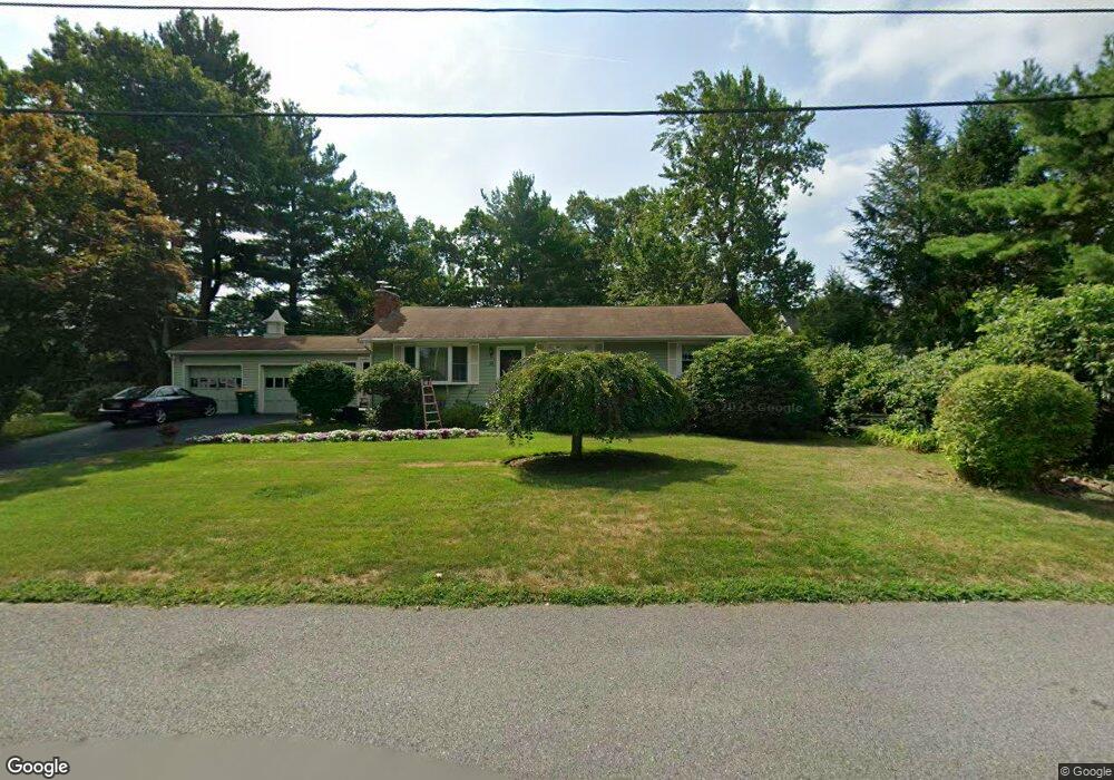
22 Stanson Dr North Attleboro, MA 02760
North Attleboro NeighborhoodEstimated Value: $608,000 - $655,000
2
Beds
2
Baths
1,486
Sq Ft
$427/Sq Ft
Est. Value
About This Home
This home is located at 22 Stanson Dr, North Attleboro, MA 02760 and is currently estimated at $634,433, approximately $426 per square foot. 22 Stanson Dr is a home located in Bristol County with nearby schools including North Attleboro High School, Cadence Academy Preschool - North Attleborough, and Bishop Feehan High School.
Ownership History
Date
Name
Owned For
Owner Type
Purchase Details
Closed on
May 29, 2024
Sold by
Foster Michele T and Wason Frederick B
Bought by
Stanson Dr Rt and Wason
Current Estimated Value
Purchase Details
Closed on
Aug 27, 1987
Sold by
Dorrwachter K Est
Bought by
Wason Frederick B
Home Financials for this Owner
Home Financials are based on the most recent Mortgage that was taken out on this home.
Original Mortgage
$90,000
Interest Rate
10.24%
Mortgage Type
Purchase Money Mortgage
Create a Home Valuation Report for This Property
The Home Valuation Report is an in-depth analysis detailing your home's value as well as a comparison with similar homes in the area
Home Values in the Area
Average Home Value in this Area
Purchase History
| Date | Buyer | Sale Price | Title Company |
|---|---|---|---|
| Stanson Dr Rt | -- | None Available | |
| Stanson Dr Rt | -- | None Available | |
| Wason Frederick B | $143,400 | -- |
Source: Public Records
Mortgage History
| Date | Status | Borrower | Loan Amount |
|---|---|---|---|
| Previous Owner | Wason Frederick B | $50,000 | |
| Previous Owner | Wason Frederick B | $91,000 | |
| Previous Owner | Wason Frederick B | $30,000 | |
| Previous Owner | Wason Frederick B | $90,000 |
Source: Public Records
Tax History Compared to Growth
Tax History
| Year | Tax Paid | Tax Assessment Tax Assessment Total Assessment is a certain percentage of the fair market value that is determined by local assessors to be the total taxable value of land and additions on the property. | Land | Improvement |
|---|---|---|---|---|
| 2025 | $6,766 | $573,900 | $147,800 | $426,100 |
| 2024 | $6,389 | $553,600 | $147,800 | $405,800 |
| 2023 | $6,065 | $474,200 | $154,300 | $319,900 |
| 2022 | $5,449 | $391,200 | $147,800 | $243,400 |
| 2021 | $5,684 | $398,300 | $147,800 | $250,500 |
| 2020 | $5,325 | $371,100 | $147,800 | $223,300 |
| 2019 | $5,134 | $360,500 | $134,400 | $226,100 |
| 2018 | $7,818 | $337,000 | $134,400 | $202,600 |
| 2017 | $4,324 | $327,100 | $134,400 | $192,700 |
| 2016 | $4,129 | $312,300 | $155,700 | $156,600 |
| 2015 | $4,016 | $305,600 | $162,200 | $143,400 |
| 2014 | $3,759 | $283,900 | $142,400 | $141,500 |
Source: Public Records
Map
Nearby Homes
- 16 Raymond Hall Dr
- 10 Sleepy Hollow Cir
- 11 Landry Ave
- 116 George St
- 15 Old Wood Rd
- 57 Vine St
- Lot 5 Jeffrey Dr
- Lot 2 Jeffrey Dr
- 28 Messenger St
- 2 George St Unit C
- 115 Westfield Dr
- 9 Sunnyside Dr Unit 9
- 166 E Bacon St Unit 4
- 33 Dublin Way
- 12 Houde St
- 17 Peters Way
- 36 Cranberry Rd
- 2 Woodridge St Unit 2
- 1730 West St
- 3 Serengeti Dr
- 12 Stanson Dr
- 35 Ledgebrook Dr
- 32 Stanson Dr
- 21 Stanson Dr
- 21 Ledgebrook Dr
- 444 Kelley Blvd
- 11 Stanson Dr
- 31 Stanson Dr
- 40 Stanson Dr
- 31 Ledgebrook Dr
- 23 Raymond Hall Dr
- 15 Raymond Hall Dr
- 15 Raymond Sampson Dr
- 41 Stanson Dr
- 31 Raymond Hall Dr
- 12 Ledgebrook Dr
- 2 Ledgebrook Dr
- 447 Kelley Blvd
- 50 Stanson Dr
- 443 Kelley Blvd