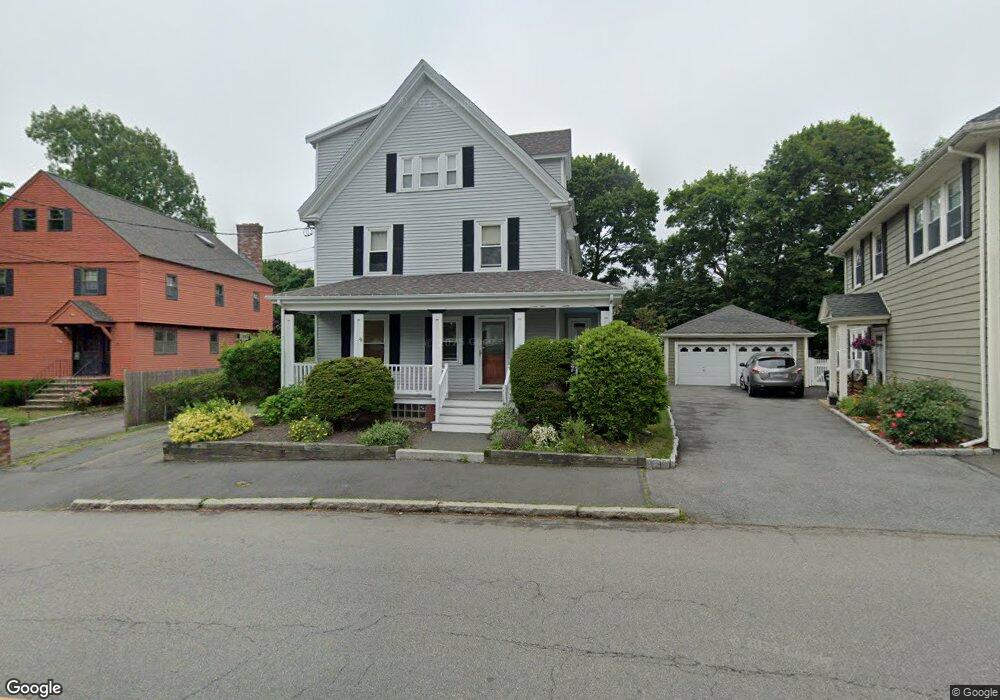
22 Stetson Ave Swampscott, MA 01907
Estimated Value: $833,000 - $907,000
6
Beds
3
Baths
2,295
Sq Ft
$379/Sq Ft
Est. Value
About This Home
This home is located at 22 Stetson Ave, Swampscott, MA 01907 and is currently estimated at $870,501, approximately $379 per square foot. 22 Stetson Ave is a home located in Essex County with nearby schools including Swampscott Middle School and Swampscott High School.
Ownership History
Date
Name
Owned For
Owner Type
Purchase Details
Closed on
Aug 12, 2021
Sold by
Rohde Karen E
Bought by
Rohde Karen E and Rohde Matthew P
Current Estimated Value
Purchase Details
Closed on
Apr 5, 1978
Bought by
Rohde Kevin P and Rohde Karen E
Create a Home Valuation Report for This Property
The Home Valuation Report is an in-depth analysis detailing your home's value as well as a comparison with similar homes in the area
Home Values in the Area
Average Home Value in this Area
Purchase History
| Date | Buyer | Sale Price | Title Company |
|---|---|---|---|
| Rohde Karen E | -- | None Available | |
| Rohde Karen E | -- | None Available | |
| Rohde Karen E | -- | None Available | |
| Rohde Kevin P | -- | -- |
Source: Public Records
Mortgage History
| Date | Status | Borrower | Loan Amount |
|---|---|---|---|
| Previous Owner | Rohde Kevin P | $102,000 | |
| Previous Owner | Rohde Kevin P | $30,000 | |
| Previous Owner | Rohde Kevin P | $50,000 | |
| Previous Owner | Rohde Kevin P | $42,000 |
Source: Public Records
Tax History
| Year | Tax Paid | Tax Assessment Tax Assessment Total Assessment is a certain percentage of the fair market value that is determined by local assessors to be the total taxable value of land and additions on the property. | Land | Improvement |
|---|---|---|---|---|
| 2025 | $8,652 | $754,300 | $336,900 | $417,400 |
| 2024 | $8,424 | $733,200 | $321,800 | $411,400 |
| 2023 | $8,007 | $682,000 | $291,700 | $390,300 |
| 2022 | $7,930 | $618,100 | $251,400 | $366,700 |
| 2021 | $7,807 | $565,700 | $231,300 | $334,400 |
| 2020 | $6,890 | $481,800 | $201,200 | $280,600 |
| 2019 | $6,711 | $441,500 | $160,900 | $280,600 |
| 2018 | $6,570 | $410,600 | $140,800 | $269,800 |
| 2017 | $6,865 | $393,400 | $140,800 | $252,600 |
| 2016 | $6,457 | $372,600 | $130,800 | $241,800 |
| 2015 | $6,303 | $367,500 | $125,700 | $241,800 |
| 2014 | $5,758 | $307,900 | $105,600 | $202,300 |
Source: Public Records
Map
Nearby Homes
- 46 Stetson Ave
- 106 Norfolk Ave
- 64 Stetson Ave
- 178 Norfolk Ave
- 80 Norfolk Ave Unit 1
- 4 Valley Rd Unit 4
- 146 Burrill St
- 11 Boynton St Unit 104
- 11 Boynton St Unit 101
- 11 Boynton St Unit 103
- 11 Boynton St Unit 204
- 60 Roy St
- 50 Mountwood Rd
- 28 Claremont Terrace Unit 6
- 3 Didio Dr
- 32 Kings Beach Terrace
- 49 Blaney St
- 168 Humphrey St Unit PH
- 27 Rockland St
- 16 Isabella St
- 26 Stetson Ave
- 20 Stetson Ave
- 28 Stetson Ave
- 1 Suffolk Ave
- 30 Stetson Ave
- 5 Suffolk Ave Unit 2
- 5 Suffolk Ave Unit 1
- 36 Stetson Ave
- 122 Norfolk Ave
- 9 Suffolk Ave Unit 11
- 37 Stetson Ave
- 40 Stetson Ave
- 39 Stetson Ave
- 15 Suffolk Ave
- 41 Stetson Ave
- 132 Norfolk Ave
- 138 Norfolk Ave
- 142 Norfolk Ave
- 118 Norfolk Ave
- 17 Suffolk Ave
Your Personal Tour Guide
Ask me questions while you tour the home.