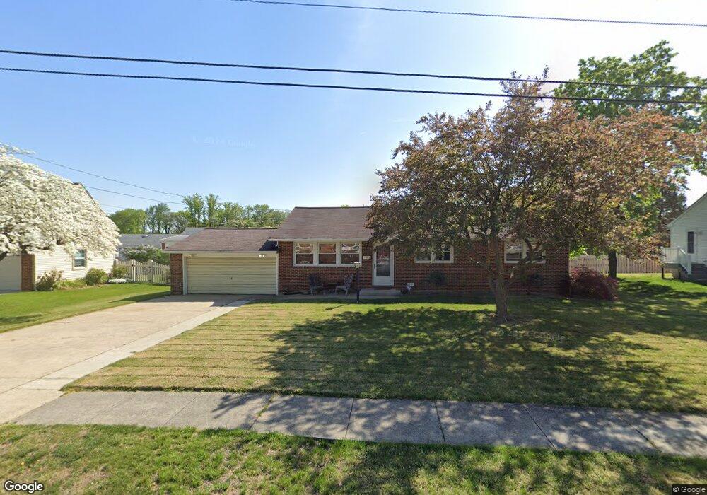
22 Storrie Ave Gibbstown, NJ 08027
Greenwich Township NeighborhoodEstimated Value: $254,851 - $310,000
--
Bed
--
Bath
1,056
Sq Ft
$272/Sq Ft
Est. Value
About This Home
This home is located at 22 Storrie Ave, Gibbstown, NJ 08027 and is currently estimated at $287,713, approximately $272 per square foot. 22 Storrie Ave is a home located in Gloucester County with nearby schools including Nehaunsey Middle School and Guardian Angels Regional School.
Ownership History
Date
Name
Owned For
Owner Type
Purchase Details
Closed on
Nov 25, 2020
Sold by
Brown Gregory V
Bought by
Bradbory Angela
Current Estimated Value
Purchase Details
Closed on
Apr 22, 2016
Sold by
Brown Gregory V and Brown Angela
Bought by
Brown Angela
Home Financials for this Owner
Home Financials are based on the most recent Mortgage that was taken out on this home.
Original Mortgage
$124,898
Interest Rate
3.62%
Mortgage Type
FHA
Purchase Details
Closed on
Mar 1, 2012
Sold by
Burdalski Jennie G
Bought by
Brown Gregory V and Bradbury Angela M
Home Financials for this Owner
Home Financials are based on the most recent Mortgage that was taken out on this home.
Original Mortgage
$128,775
Interest Rate
3.75%
Mortgage Type
FHA
Purchase Details
Closed on
Feb 4, 2003
Sold by
Marabito Mary
Bought by
Burdalksi Jennie G
Create a Home Valuation Report for This Property
The Home Valuation Report is an in-depth analysis detailing your home's value as well as a comparison with similar homes in the area
Home Values in the Area
Average Home Value in this Area
Purchase History
| Date | Buyer | Sale Price | Title Company |
|---|---|---|---|
| Bradbory Angela | -- | None Available | |
| Bradbury Angela | -- | None Listed On Document | |
| Brown Angela | -- | None Available | |
| Brown Gregory V | $135,000 | -- | |
| Burdalksi Jennie G | -- | -- |
Source: Public Records
Mortgage History
| Date | Status | Borrower | Loan Amount |
|---|---|---|---|
| Previous Owner | Brown Angela | $124,898 | |
| Previous Owner | Brown Gregory V | $128,775 |
Source: Public Records
Tax History Compared to Growth
Tax History
| Year | Tax Paid | Tax Assessment Tax Assessment Total Assessment is a certain percentage of the fair market value that is determined by local assessors to be the total taxable value of land and additions on the property. | Land | Improvement |
|---|---|---|---|---|
| 2025 | $4,431 | $128,700 | $32,400 | $96,300 |
| 2024 | $4,198 | $128,700 | $32,400 | $96,300 |
| 2023 | $4,198 | $128,700 | $32,400 | $96,300 |
| 2022 | $4,201 | $128,700 | $32,400 | $96,300 |
| 2021 | $4,157 | $128,700 | $32,400 | $96,300 |
| 2020 | $4,215 | $128,700 | $32,400 | $96,300 |
| 2019 | $4,218 | $128,700 | $32,400 | $96,300 |
| 2018 | $4,098 | $128,700 | $32,400 | $96,300 |
| 2017 | $3,999 | $128,700 | $32,400 | $96,300 |
| 2016 | $3,955 | $128,700 | $32,400 | $96,300 |
| 2015 | $3,828 | $128,700 | $32,400 | $96,300 |
| 2014 | $3,663 | $128,700 | $32,400 | $96,300 |
Source: Public Records
Map
Nearby Homes
- 836 E Broad St
- 330 Croce Ave
- 219 Vanneman Blvd
- 344 W Washington St
- 335 W Buck St
- L18 20 W Broad St
- 0 S Democrat Rd Unit NJGL2065008
- 100 Giammarino Ave
- 255 Elizabeth Ave
- 342 Democrat Rd
- 269 W Broad St
- 1043 Penn Line Rd
- 431 Washington St
- 157 S Poplar St
- 0 Swedesboro Ave Unit NJGL2061592
- 433 Jefferson St
- 227 W Buck St
- 140 142 W Jefferson St
- 1214 Walter Ave
- 1224 Heddon Ave