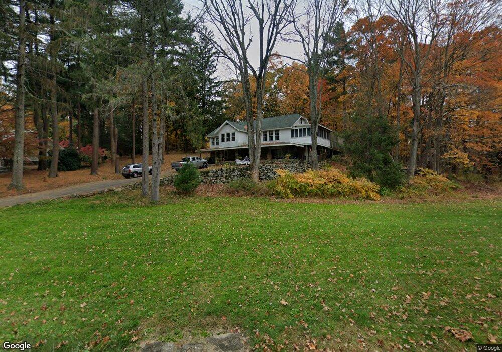
22 Stow Rd Marlborough, MA 01752
Estimated Value: $525,751 - $570,000
2
Beds
3
Baths
1,346
Sq Ft
$406/Sq Ft
Est. Value
About This Home
This home is located at 22 Stow Rd, Marlborough, MA 01752 and is currently estimated at $546,688, approximately $406 per square foot. 22 Stow Rd is a home located in Middlesex County with nearby schools including Marlborough High School, New Covenant Christian School, and Glenhaven Academy - JRI School.
Ownership History
Date
Name
Owned For
Owner Type
Purchase Details
Closed on
Apr 24, 1998
Sold by
Est Difazio Mary A and Evangelista Joseph A
Bought by
Ritter David C and Ritter Elaine M
Current Estimated Value
Home Financials for this Owner
Home Financials are based on the most recent Mortgage that was taken out on this home.
Original Mortgage
$150,860
Outstanding Balance
$28,663
Interest Rate
7.11%
Mortgage Type
Purchase Money Mortgage
Estimated Equity
$518,025
Create a Home Valuation Report for This Property
The Home Valuation Report is an in-depth analysis detailing your home's value as well as a comparison with similar homes in the area
Home Values in the Area
Average Home Value in this Area
Purchase History
| Date | Buyer | Sale Price | Title Company |
|---|---|---|---|
| Ritter David C | $155,000 | -- |
Source: Public Records
Mortgage History
| Date | Status | Borrower | Loan Amount |
|---|---|---|---|
| Open | Ritter David C | $15,000 | |
| Open | Ritter David C | $150,860 |
Source: Public Records
Tax History Compared to Growth
Tax History
| Year | Tax Paid | Tax Assessment Tax Assessment Total Assessment is a certain percentage of the fair market value that is determined by local assessors to be the total taxable value of land and additions on the property. | Land | Improvement |
|---|---|---|---|---|
| 2025 | $4,350 | $441,200 | $233,300 | $207,900 |
| 2024 | $4,223 | $412,400 | $212,600 | $199,800 |
| 2023 | $4,085 | $354,000 | $175,500 | $178,500 |
| 2022 | $4,335 | $330,400 | $167,600 | $162,800 |
| 2021 | $13,686 | $296,000 | $138,000 | $158,000 |
| 2020 | $5,235 | $250,600 | $134,700 | $115,900 |
| 2019 | $3,460 | $245,900 | $132,400 | $113,500 |
| 2018 | $7,488 | $265,100 | $135,400 | $129,700 |
| 2017 | $3,755 | $245,100 | $137,600 | $107,500 |
| 2016 | $3,752 | $244,600 | $137,600 | $107,000 |
| 2015 | $4,091 | $259,600 | $142,000 | $117,600 |
Source: Public Records
Map
Nearby Homes
- 37 Hosmer St Unit 10
- 37 Hosmer St Unit 20
- 116 Boston Post Rd E Unit 105
- 110 Boston Post Rd E Unit 104
- 323 Robert Rd
- 38 Airport Blvd
- 96 Cook Ln
- 97 Cook Ln
- 41 Kane Dr
- 45 Raffaele Rd
- 181 Boston Post Rd E Unit 26
- 256 Robert Rd
- 24 Clinton St
- 16 Clinton St
- 261 Boston Post Rd E Unit 1
- 99 Kings Grant Rd
- 271 Boston Post Rd E Unit 4
- 25 Walnut St
- 70 Phelps St
- 100 Phelps St Unit 7
- 14 Stow Rd
- 10 Lot 10 Stow Rd
- 40 Stow Rd
- 108 Concord Rd
- 35 Stow Rd
- 114 Concord Rd
- 3 Stow Rd
- 41 Stow Rd
- 11 Lot 11 Stow Rd
- 90 Concord Rd
- 51 Stow Rd
- 120 Concord Rd
- 14 Highgate Rd
- 32 Briarwood Ln Unit 1
- 33 Briarwood Ln Unit 10
- 24 Highgate Rd
- 57 Stow Rd
- 80 Concord Rd
- 32 Highgate Rd
- 31 Briarwood Ln Unit 11