Estimated Value: $740,740 - $1,016,000
Studio
--
Bath
2,065
Sq Ft
$432/Sq Ft
Est. Value
About This Home
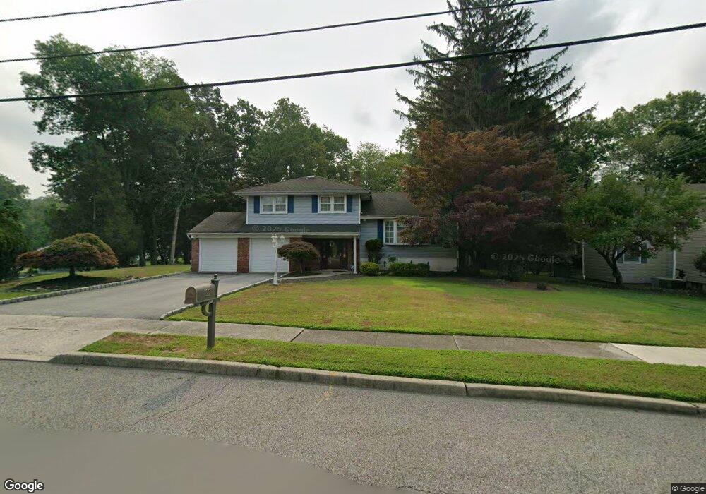
This home is located at 22 Teak Rd, Wayne, NJ 07470 and is currently estimated at $891,685, approximately $431 per square foot. 22 Teak Rd is a home located in Passaic County with nearby schools including Lafayette Elementary School, Anthony Wayne Middle School, and Wayne Valley High School.
Ownership History
Date
Name
Owned For
Owner Type
Purchase Details
Closed on
Jul 24, 1999
Sold by
Gofter Jeffrey and Gofter Barbara K
Bought by
Romano Anthony and Romano Barbara
Current Estimated Value
Home Financials for this Owner
Home Financials are based on the most recent Mortgage that was taken out on this home.
Original Mortgage
$220,000
Outstanding Balance
$61,527
Interest Rate
7.54%
Estimated Equity
$830,158
Purchase Details
Closed on
Sep 15, 1995
Sold by
Yuppa Frank and Yuppa Donna
Bought by
Gofter Jeffrey and Gordon Barbara
Home Financials for this Owner
Home Financials are based on the most recent Mortgage that was taken out on this home.
Original Mortgage
$210,000
Interest Rate
7.62%
Create a Home Valuation Report for This Property
The Home Valuation Report is an in-depth analysis detailing your home's value as well as a comparison with similar homes in the area
Home Values in the Area
Average Home Value in this Area
Purchase History
| Date | Buyer | Sale Price | Title Company |
|---|---|---|---|
| Romano Anthony | $330,000 | -- | |
| Gofter Jeffrey | $265,000 | -- |
Source: Public Records
Mortgage History
| Date | Status | Borrower | Loan Amount |
|---|---|---|---|
| Open | Romano Anthony | $220,000 | |
| Previous Owner | Gofter Jeffrey | $210,000 |
Source: Public Records
Tax History
| Year | Tax Paid | Tax Assessment Tax Assessment Total Assessment is a certain percentage of the fair market value that is determined by local assessors to be the total taxable value of land and additions on the property. | Land | Improvement |
|---|---|---|---|---|
| 2025 | $15,370 | $258,500 | $124,900 | $133,600 |
| 2024 | $14,781 | $258,500 | $124,900 | $133,600 |
| 2022 | $14,616 | $258,500 | $124,900 | $133,600 |
| 2021 | $14,600 | $258,500 | $124,900 | $133,600 |
| 2020 | $14,535 | $258,500 | $124,900 | $133,600 |
| 2019 | $14,254 | $258,500 | $124,900 | $133,600 |
| 2018 | $14,127 | $258,500 | $124,900 | $133,600 |
| 2017 | $13,998 | $258,500 | $124,900 | $133,600 |
| 2016 | $13,801 | $258,500 | $124,900 | $133,600 |
| 2015 | $13,636 | $258,500 | $124,900 | $133,600 |
| 2014 | $13,251 | $258,500 | $124,900 | $133,600 |
Source: Public Records
Map
Nearby Homes
- 14 Weinmanns Blvd
- 4 Highfield Ct
- 20 Maljim Ct
- 61 Carlisle Rd
- 69 Colonial Rd
- 15 Littlewood Ct
- 22 Woodlot Rd
- 4 Michele Ct
- 77 Garside Ave
- 16 Lawrence Rd
- 14 Louisa Ct
- 24 Holmes Ln
- 102 Garside Ave
- 51 Harmer Terrace
- 35 Darlington Dr
- 6 Sherry Ct
- 18 Harwood Place
- 20 Dwight St
- 116 Carol Place
- 107 Hamilton Trail
Your Personal Tour Guide
Ask me questions while you tour the home.