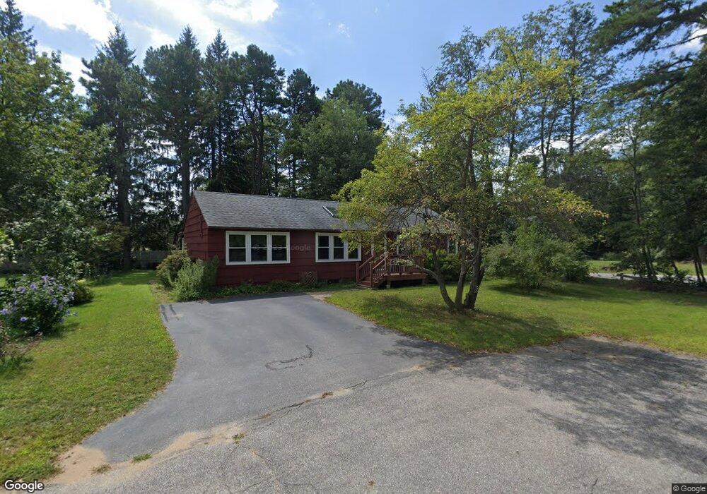
22 Temi Rd Concord, NH 03301
Concord Heights NeighborhoodEstimated Value: $418,000 - $445,000
3
Beds
2
Baths
1,320
Sq Ft
$330/Sq Ft
Est. Value
About This Home
This home is located at 22 Temi Rd, Concord, NH 03301 and is currently estimated at $435,079, approximately $329 per square foot. 22 Temi Rd is a home located in Merrimack County with nearby schools including Broken Ground School, Rundlett Middle School, and Concord High School.
Ownership History
Date
Name
Owned For
Owner Type
Purchase Details
Closed on
Jul 20, 2021
Sold by
Desrosiers Roger and Desrosiers Susanne D
Bought by
Desrosiers Ft 2021 and Desrosiers
Current Estimated Value
Purchase Details
Closed on
Dec 12, 1983
Bought by
Desrosiers Roger and Desrosiers Susanne D
Create a Home Valuation Report for This Property
The Home Valuation Report is an in-depth analysis detailing your home's value as well as a comparison with similar homes in the area
Home Values in the Area
Average Home Value in this Area
Purchase History
| Date | Buyer | Sale Price | Title Company |
|---|---|---|---|
| Desrosiers Ft 2021 | -- | None Available | |
| Desrosiers Roger | $56,000 | -- |
Source: Public Records
Mortgage History
| Date | Status | Borrower | Loan Amount |
|---|---|---|---|
| Previous Owner | Desrosiers Roger | $75,000 |
Source: Public Records
Tax History
| Year | Tax Paid | Tax Assessment Tax Assessment Total Assessment is a certain percentage of the fair market value that is determined by local assessors to be the total taxable value of land and additions on the property. | Land | Improvement |
|---|---|---|---|---|
| 2025 | $8,323 | $285,900 | $110,700 | $175,200 |
| 2024 | $7,917 | $285,900 | $110,700 | $175,200 |
| 2023 | $7,679 | $285,900 | $110,700 | $175,200 |
| 2022 | $7,402 | $285,900 | $110,700 | $175,200 |
| 2021 | $7,139 | $284,200 | $110,700 | $173,500 |
| 2020 | $6,666 | $249,100 | $81,300 | $167,800 |
| 2019 | $6,731 | $242,300 | $80,000 | $162,300 |
| 2018 | $6,196 | $219,800 | $76,800 | $143,000 |
| 2017 | $5,727 | $202,800 | $73,000 | $129,800 |
| 2016 | $5,373 | $199,600 | $73,000 | $126,600 |
| 2015 | $5,020 | $183,900 | $73,000 | $110,900 |
| 2014 | $4,780 | $183,900 | $73,000 | $110,900 |
| 2013 | -- | $180,900 | $73,000 | $107,900 |
| 2012 | -- | $177,900 | $73,000 | $104,900 |
Source: Public Records
Map
Nearby Homes
- 58 Branch Turnpike Unit 73
- 58 Branch Turnpike Unit 26
- 84 Branch Turnpike Unit 101
- 185 Loudon Rd Unit 8
- 8 NE Village Rd
- 12 E Side Dr Unit 4-13
- 12 E Side Dr Unit 13
- 12 E Side Dr Unit 402
- 12 E Side Dr Unit 318
- 54 NE Village Rd
- 41 NE Village Rd
- 83 NE Village Rd
- 296 Loudon Rd
- 306 Portsmouth St
- 95 E Side Dr
- 5 Thomas St
- 169 Portsmouth St Unit 14
- 62 Hampton St
- 20 Fairfield Dr
- 22 Fairfield Dr
Your Personal Tour Guide
Ask me questions while you tour the home.