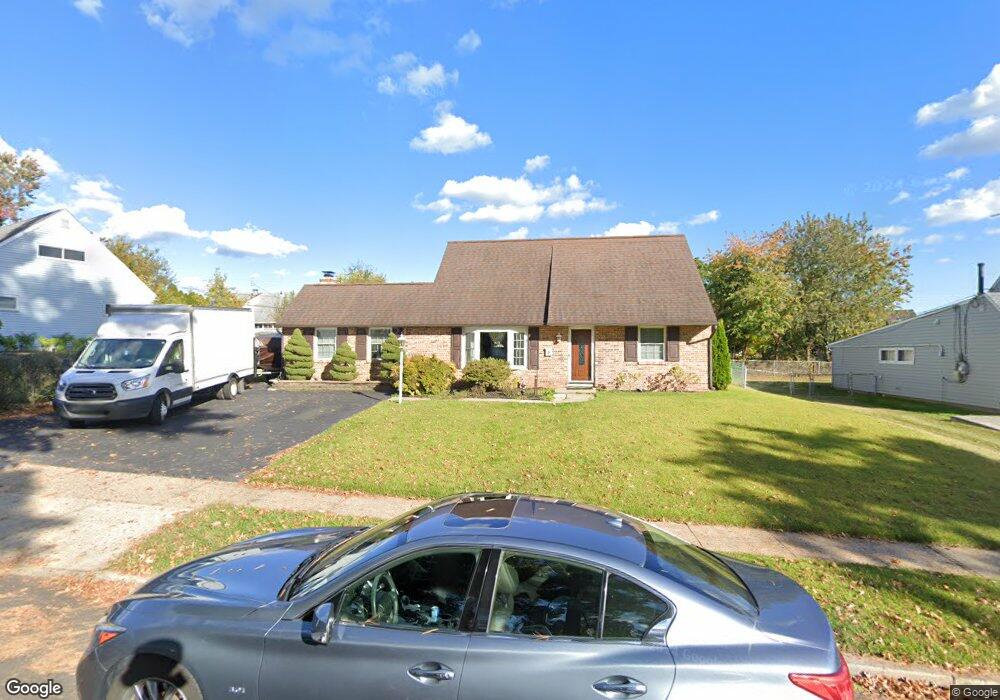
22 Upland Rd Levittown, PA 19056
Estimated Value: $375,000 - $424,000
3
Beds
2
Baths
1,750
Sq Ft
$229/Sq Ft
Est. Value
About This Home
This home is located at 22 Upland Rd, Levittown, PA 19056 and is currently estimated at $400,679, approximately $228 per square foot. 22 Upland Rd is a home located in Bucks County with nearby schools including Walter Miller Elementary School, Sandburg Middle School, and Neshaminy High School.
Ownership History
Date
Name
Owned For
Owner Type
Purchase Details
Closed on
Nov 17, 1995
Sold by
Mahoney John J and Mahoney Kathleen O
Bought by
Martin William R and Martin Patricia
Current Estimated Value
Home Financials for this Owner
Home Financials are based on the most recent Mortgage that was taken out on this home.
Original Mortgage
$112,000
Outstanding Balance
$1,547
Interest Rate
7.47%
Estimated Equity
$399,132
Purchase Details
Closed on
Aug 30, 1985
Bought by
Mahoney John J and Mahoney Kathleen O
Create a Home Valuation Report for This Property
The Home Valuation Report is an in-depth analysis detailing your home's value as well as a comparison with similar homes in the area
Home Values in the Area
Average Home Value in this Area
Purchase History
| Date | Buyer | Sale Price | Title Company |
|---|---|---|---|
| Martin William R | $120,000 | -- | |
| Mahoney John J | $74,900 | -- |
Source: Public Records
Mortgage History
| Date | Status | Borrower | Loan Amount |
|---|---|---|---|
| Open | Martin William R | $112,000 |
Source: Public Records
Tax History Compared to Growth
Tax History
| Year | Tax Paid | Tax Assessment Tax Assessment Total Assessment is a certain percentage of the fair market value that is determined by local assessors to be the total taxable value of land and additions on the property. | Land | Improvement |
|---|---|---|---|---|
| 2025 | $4,528 | $20,800 | $3,960 | $16,840 |
| 2024 | $4,528 | $20,800 | $3,960 | $16,840 |
| 2023 | $4,456 | $20,800 | $3,960 | $16,840 |
| 2022 | $4,339 | $20,800 | $3,960 | $16,840 |
| 2021 | $4,339 | $20,800 | $3,960 | $16,840 |
| 2020 | $4,287 | $20,800 | $3,960 | $16,840 |
| 2019 | $4,192 | $20,800 | $3,960 | $16,840 |
| 2018 | $4,115 | $20,800 | $3,960 | $16,840 |
| 2017 | $4,010 | $20,800 | $3,960 | $16,840 |
| 2016 | $4,010 | $20,800 | $3,960 | $16,840 |
| 2015 | $4,199 | $20,800 | $3,960 | $16,840 |
| 2014 | $4,199 | $20,800 | $3,960 | $16,840 |
Source: Public Records
Map
Nearby Homes
- 154 Juniper Dr
- 94 Juniper Dr
- 0 Durham Rd
- 33 Red Rose Way
- 7 Canal Rd
- 2132 Durham Rd
- 212 Plumbridge Dr
- 28 Rust Hill Rd
- 62 Indian Creek Dr
- 35 Parkside Cir
- 301 Snowball Dr
- 14 Cleft Rock Rd
- 283 Snowball Dr
- L:070 Trenton Rd
- 11 Dolphin Rd
- 298 Mill Dr
- 65 Candle Rd
- 23 Crystal Place
- 88 Forsythia Dr N
- 38 Plumtree Rd