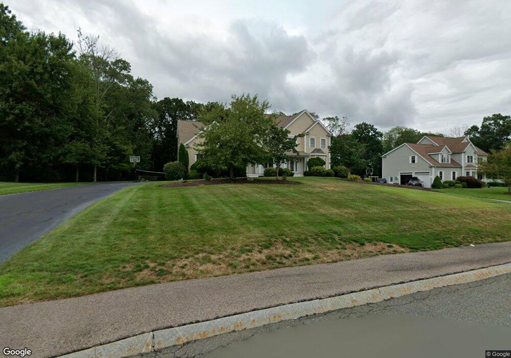
22 Vernon Darrah Rd North Attleboro, MA 02760
North Attleboro NeighborhoodEstimated Value: $1,139,062 - $1,375,000
4
Beds
5
Baths
5,152
Sq Ft
$241/Sq Ft
Est. Value
About This Home
This home is located at 22 Vernon Darrah Rd, North Attleboro, MA 02760 and is currently estimated at $1,240,354, approximately $240 per square foot. 22 Vernon Darrah Rd is a home located in Bristol County with nearby schools including North Attleboro High School.
Ownership History
Date
Name
Owned For
Owner Type
Purchase Details
Closed on
Jun 9, 2010
Sold by
Sadiq Immad and Masood Muniba
Bought by
Thomas Tenny J and Alex Sara J
Current Estimated Value
Home Financials for this Owner
Home Financials are based on the most recent Mortgage that was taken out on this home.
Original Mortgage
$592,000
Outstanding Balance
$399,475
Interest Rate
5.11%
Mortgage Type
Purchase Money Mortgage
Estimated Equity
$840,879
Purchase Details
Closed on
Mar 8, 2006
Sold by
Jennisten Bldrs Inc
Bought by
Sadiq Immad and Masood Muniba
Home Financials for this Owner
Home Financials are based on the most recent Mortgage that was taken out on this home.
Original Mortgage
$656,000
Interest Rate
6.15%
Mortgage Type
Purchase Money Mortgage
Create a Home Valuation Report for This Property
The Home Valuation Report is an in-depth analysis detailing your home's value as well as a comparison with similar homes in the area
Home Values in the Area
Average Home Value in this Area
Purchase History
| Date | Buyer | Sale Price | Title Company |
|---|---|---|---|
| Thomas Tenny J | $740,000 | -- | |
| Sadiq Immad | $820,000 | -- |
Source: Public Records
Mortgage History
| Date | Status | Borrower | Loan Amount |
|---|---|---|---|
| Open | Thomas Tenny J | $592,000 | |
| Previous Owner | Sadiq Immad | $656,000 |
Source: Public Records
Tax History Compared to Growth
Tax History
| Year | Tax Paid | Tax Assessment Tax Assessment Total Assessment is a certain percentage of the fair market value that is determined by local assessors to be the total taxable value of land and additions on the property. | Land | Improvement |
|---|---|---|---|---|
| 2025 | $12,501 | $1,060,300 | $175,100 | $885,200 |
| 2024 | $12,688 | $1,099,500 | $182,400 | $917,100 |
| 2023 | $12,071 | $943,800 | $182,400 | $761,400 |
| 2022 | $11,301 | $811,300 | $189,600 | $621,700 |
| 2021 | $3,444 | $801,500 | $189,600 | $611,900 |
| 2020 | $11,252 | $784,100 | $189,600 | $594,500 |
| 2019 | $11,201 | $786,600 | $172,600 | $614,000 |
| 2018 | $3,158 | $757,400 | $179,300 | $578,100 |
| 2017 | $10,013 | $757,400 | $179,300 | $578,100 |
| 2016 | $9,575 | $724,300 | $206,600 | $517,700 |
| 2015 | $9,122 | $694,200 | $206,600 | $487,600 |
| 2014 | $8,911 | $673,000 | $172,000 | $501,000 |
Source: Public Records
Map
Nearby Homes
- 740 Allen Ave
- 30 Sperry Ln Unit Lot 15
- 0 Anawan Rd
- 25 Gregory Way
- 49 Hoppin Hill Ave
- 31 Paine Rd
- 181 Paine Rd
- 34 Stone Ridge Rd
- 41 Stone Ridge Rd
- 44 Powder Horn Way
- 160 Crescent Ave
- 82 Reservoir St
- 11 Primrose Terrace
- 50 Metcalf Rd
- 334 S Washington St
- 105 Newell Dr
- 46 Westside Ave
- 12 Intervale Dr
- 80 Broadway Unit 9
- 121 E Washington St Unit 13
- 12 Vernon Darrah Rd
- 32 Vernon Darrah Rd
- 31 Vernon Darrah Rd
- 41 Vernon Darrah Rd
- 21 Vernon Darrah Rd
- 21 John Wescott Dr
- 11 Vernon Darrah Rd
- 11 John Wescott Dr
- 31 John Wescott Dr
- 1 John Westcott Dr
- 1 John Wescott Dr
- 11 John Westcott Dr
- 22 John Wescott Dr
- 12 John Wescott Dr
- 485 Hoppin Hill Ave
- 13 Michael Way
- 471 Hoppin Hill Ave
- 3 Michael Carr Rd
- 503 Hoppin Hill Ave
- 457 Hoppin Hill Ave