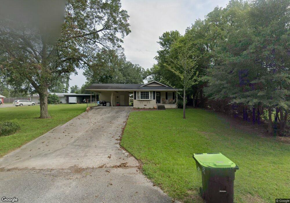
22 W Calhoun St Reynolds, GA 31076
Estimated Value: $88,000 - $137,000
--
Bed
1
Bath
916
Sq Ft
$113/Sq Ft
Est. Value
About This Home
This home is located at 22 W Calhoun St, Reynolds, GA 31076 and is currently estimated at $103,423, approximately $112 per square foot. 22 W Calhoun St is a home located in Taylor County with nearby schools including Taylor County Upper Elementary School, Taylor County Primary School, and Taylor County Middle School.
Ownership History
Date
Name
Owned For
Owner Type
Purchase Details
Closed on
Jul 20, 2024
Sold by
Cosey Joseph Kyle
Bought by
Sagos Properties Llc
Current Estimated Value
Purchase Details
Closed on
Jul 29, 2022
Sold by
Windham James A
Bought by
Cosey Joseph Kyle and Madore Sarah Elizabeth
Home Financials for this Owner
Home Financials are based on the most recent Mortgage that was taken out on this home.
Original Mortgage
$65,656
Interest Rate
5.7%
Mortgage Type
New Conventional
Purchase Details
Closed on
Aug 18, 2009
Sold by
Beeland Kitty Callahan
Bought by
Windom James A
Home Financials for this Owner
Home Financials are based on the most recent Mortgage that was taken out on this home.
Original Mortgage
$56,122
Interest Rate
5.14%
Mortgage Type
New Conventional
Purchase Details
Closed on
Apr 12, 2008
Sold by
Beeland J E
Bought by
Webb Judy B
Create a Home Valuation Report for This Property
The Home Valuation Report is an in-depth analysis detailing your home's value as well as a comparison with similar homes in the area
Home Values in the Area
Average Home Value in this Area
Purchase History
| Date | Buyer | Sale Price | Title Company |
|---|---|---|---|
| Sagos Properties Llc | $105,000 | -- | |
| Cosey Joseph Kyle | $65,000 | -- | |
| Windom James A | $53,000 | -- | |
| Webb Judy B | -- | -- |
Source: Public Records
Mortgage History
| Date | Status | Borrower | Loan Amount |
|---|---|---|---|
| Previous Owner | Cosey Joseph Kyle | $65,656 | |
| Previous Owner | Windom James A | $56,122 |
Source: Public Records
Tax History Compared to Growth
Tax History
| Year | Tax Paid | Tax Assessment Tax Assessment Total Assessment is a certain percentage of the fair market value that is determined by local assessors to be the total taxable value of land and additions on the property. | Land | Improvement |
|---|---|---|---|---|
| 2024 | $968 | $24,760 | $1,640 | $23,120 |
| 2023 | $806 | $19,880 | $1,640 | $18,240 |
| 2022 | $475 | $18,880 | $1,640 | $17,240 |
| 2021 | $402 | $15,600 | $1,640 | $13,960 |
| 2020 | $405 | $15,600 | $1,640 | $13,960 |
| 2019 | $409 | $15,600 | $1,640 | $13,960 |
| 2018 | $536 | $15,600 | $1,640 | $13,960 |
| 2017 | $453 | $17,689 | $3,705 | $13,984 |
| 2016 | $451 | $17,544 | $3,705 | $13,838 |
| 2015 | -- | $17,544 | $3,705 | $13,838 |
| 2014 | -- | $16,942 | $3,120 | $13,822 |
| 2013 | -- | $17,994 | $3,640 | $14,354 |
Source: Public Records
Map
Nearby Homes
- 25 W Marion St
- 9 Friar Tuck Rd
- 46 E Calhoun St
- 67 N Collins St
- 29 Mimms St
- 0 Briar Patch Way Unit 10546919
- 160 Underwood Rd
- 30 Potterville Main St
- 30 Pottervile Main St
- 708 Tommy Purvis Junior Rd
- 296 Boxwood Rd
- Cummings Rd
- 0 Oak Ridge Dr
- 1800 Cummings Rd
- 000 Avera Rd
- Parcel 1 Whipporwill Rd
- 246 Wilville Rd
- 2 Forest Ave
- 60 Booker Montgomery Rd
- 13 Marshall St
- 10 S Crawford St
- 8 N Crawford St
- 24 W Calhoun St
- 21 W Marion St
- 19 W Marion St
- 29 W Calhoun St
- 27 W Marion St
- 26 Marion St
- 12 S Winston St
- 8 N Winston St
- 10 E Haynes St
- 10 S Sumter St
- 4 N Crawford St
- 8 W Haynes St
- 34 S Crawford St
- 23 Talbot St
- 30 S Winston St
- 38 S Crawford St
- 8 E Calhoun St
- 36 S Winston St