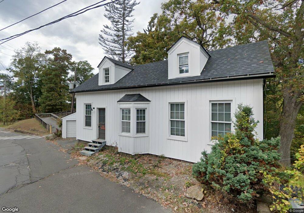
22 Watrous St East Hampton, CT 06424
Estimated Value: $138,000 - $279,000
4
Beds
3
Baths
2,458
Sq Ft
$88/Sq Ft
Est. Value
About This Home
This home is located at 22 Watrous St, East Hampton, CT 06424 and is currently estimated at $216,723, approximately $88 per square foot. 22 Watrous St is a home located in Middlesex County with nearby schools including Memorial School, Center Elementary School, and East Hampton Middle School.
Ownership History
Date
Name
Owned For
Owner Type
Purchase Details
Closed on
Oct 20, 2021
Sold by
Real Estate Partners Llc
Bought by
Carter William
Current Estimated Value
Purchase Details
Closed on
Jul 22, 2021
Sold by
Adams Vicki
Bought by
Real Estate Partners Llc
Purchase Details
Closed on
Jun 24, 2015
Sold by
Cummings Michael
Bought by
Adams Vicki
Create a Home Valuation Report for This Property
The Home Valuation Report is an in-depth analysis detailing your home's value as well as a comparison with similar homes in the area
Home Values in the Area
Average Home Value in this Area
Purchase History
| Date | Buyer | Sale Price | Title Company |
|---|---|---|---|
| Carter William | -- | None Available | |
| Carter William | -- | None Available | |
| Real Estate Partners Llc | $82,000 | None Available | |
| Real Estate Partners Llc | $82,000 | None Available | |
| Adams Vicki | -- | -- | |
| Adams Vicki | -- | -- |
Source: Public Records
Tax History Compared to Growth
Tax History
| Year | Tax Paid | Tax Assessment Tax Assessment Total Assessment is a certain percentage of the fair market value that is determined by local assessors to be the total taxable value of land and additions on the property. | Land | Improvement |
|---|---|---|---|---|
| 2025 | $3,099 | $78,050 | $27,330 | $50,720 |
| 2024 | $2,969 | $78,050 | $27,330 | $50,720 |
| 2023 | $2,814 | $78,050 | $27,330 | $50,720 |
| 2022 | $2,705 | $78,050 | $27,330 | $50,720 |
| 2021 | $2,695 | $78,050 | $27,330 | $50,720 |
| 2020 | $2,325 | $70,170 | $26,030 | $44,140 |
| 2019 | $2,112 | $63,720 | $23,430 | $40,290 |
| 2018 | $1,996 | $63,720 | $23,430 | $40,290 |
| 2017 | $1,996 | $63,720 | $23,430 | $40,290 |
| 2016 | $1,876 | $63,720 | $23,430 | $40,290 |
| 2015 | $2,414 | $86,910 | $24,500 | $62,410 |
| 2014 | -- | $86,910 | $24,500 | $62,410 |
Source: Public Records
Map
Nearby Homes
- 22 Watrous St
- 22 Watrous St
- 17 Watrous St
- 8 Summit St
- 29 Watrous St
- 10 Summit St Unit 4
- 10 Summit St Unit 3
- 10 Summit St Unit 2
- 10 Summit St Unit 1
- 10 Summit St
- 10 Summit St Unit 7
- 10 Summit St Unit 8
- 6 Summit St
- 87 Main St Unit 2
- 8C Summit St Unit 8C
- 8C Summit St Unit 8C
- 8 Starr Place
- 4 Watrous St
- 81 Main St Unit B
- 81 Main St