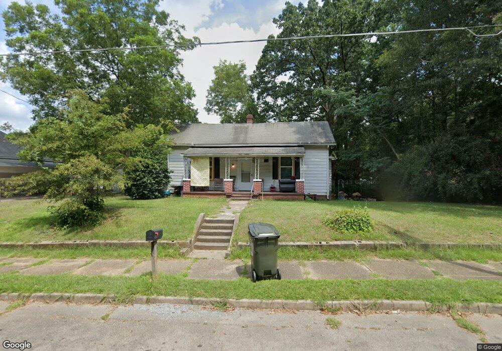
22 Wilson St Manchester, GA 31816
Estimated Value: $63,000 - $99,000
3
Beds
1
Bath
1,170
Sq Ft
$68/Sq Ft
Est. Value
About This Home
This home is located at 22 Wilson St, Manchester, GA 31816 and is currently estimated at $79,080, approximately $67 per square foot. 22 Wilson St is a home located in Meriwether County with nearby schools including Mountain View Elementary School, Manchester Middle School, and Manchester High School.
Ownership History
Date
Name
Owned For
Owner Type
Purchase Details
Closed on
Apr 30, 2023
Sold by
Moore Tammy
Bought by
R E M Llc
Current Estimated Value
Purchase Details
Closed on
May 11, 2020
Sold by
Orr Robert L
Bought by
Moore Tammy
Purchase Details
Closed on
Jun 30, 2000
Sold by
Beck Mary G
Bought by
Orr Robert L and Orr Shirl
Purchase Details
Closed on
Jul 3, 1998
Sold by
Beck Roy
Bought by
Beck James R and Beck Allen
Purchase Details
Closed on
Jan 1, 1952
Bought by
Beck Roy
Create a Home Valuation Report for This Property
The Home Valuation Report is an in-depth analysis detailing your home's value as well as a comparison with similar homes in the area
Home Values in the Area
Average Home Value in this Area
Purchase History
| Date | Buyer | Sale Price | Title Company |
|---|---|---|---|
| R E M Llc | -- | -- | |
| Moore Tammy | $13,150 | -- | |
| Orr Robert L | $27,000 | -- | |
| Beck Mary G | -- | -- | |
| Beck James R | -- | -- | |
| Beck Roy | -- | -- |
Source: Public Records
Tax History Compared to Growth
Tax History
| Year | Tax Paid | Tax Assessment Tax Assessment Total Assessment is a certain percentage of the fair market value that is determined by local assessors to be the total taxable value of land and additions on the property. | Land | Improvement |
|---|---|---|---|---|
| 2024 | $338 | $7,160 | $2,640 | $4,520 |
| 2023 | $347 | $7,160 | $2,640 | $4,520 |
| 2022 | $347 | $7,160 | $2,640 | $4,520 |
| 2021 | $228 | $7,160 | $2,640 | $4,520 |
| 2020 | $230 | $7,160 | $2,640 | $4,520 |
| 2019 | $339 | $10,520 | $2,640 | $7,880 |
| 2018 | $343 | $10,520 | $2,640 | $7,880 |
| 2017 | $347 | $10,520 | $2,640 | $7,880 |
| 2016 | $346 | $10,520 | $2,640 | $7,880 |
| 2015 | $303 | $9,200 | $1,320 | $7,880 |
| 2014 | $303 | $9,200 | $1,320 | $7,880 |
| 2013 | -- | $9,200 | $1,320 | $7,880 |
Source: Public Records
Map
Nearby Homes
- 900 Mountain Ridge Dr Unit 4.89 ACRES
- 12 Truitt St
- 21 North St
- 16 North St
- 380 Elm St
- 94 Cato St
- 3.26 ACRES Mountain Ridge Dr
- 408 Broad St
- 77 Cordwood St
- 322 Chalybeate St
- 304 4th St
- 13.27 ACRES Roosevelt Hwy
- 522 4th St
- 802 Jd Parham Dr
- 919 L S Glencamp Way
- 1600 Grant Ave
- 617 Mayes Way
- 514 Farris Blvd
- 621 Mayes Way
- 286 Starling Rd