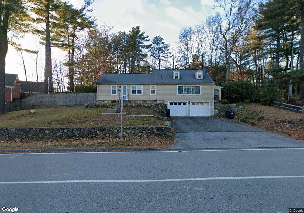
22 Wilson St Marlborough, MA 01752
Estimated Value: $638,000 - $757,000
2
Beds
3
Baths
2,182
Sq Ft
$313/Sq Ft
Est. Value
About This Home
This home is located at 22 Wilson St, Marlborough, MA 01752 and is currently estimated at $681,989, approximately $312 per square foot. 22 Wilson St is a home located in Middlesex County with nearby schools including Marlborough High School, New Covenant Christian School, and Glenhaven Academy - JRI School.
Ownership History
Date
Name
Owned For
Owner Type
Purchase Details
Closed on
Jan 10, 2018
Sold by
Barrett Barbara E
Bought by
Kambosos Demetrios
Current Estimated Value
Purchase Details
Closed on
Oct 31, 1990
Sold by
Ready Caroline D
Bought by
Walker Randall R
Home Financials for this Owner
Home Financials are based on the most recent Mortgage that was taken out on this home.
Original Mortgage
$100,000
Interest Rate
10.07%
Mortgage Type
Purchase Money Mortgage
Purchase Details
Closed on
Oct 12, 1990
Sold by
Frary Charlene L
Bought by
Munroe Diane L
Home Financials for this Owner
Home Financials are based on the most recent Mortgage that was taken out on this home.
Original Mortgage
$100,000
Interest Rate
10.07%
Mortgage Type
Purchase Money Mortgage
Create a Home Valuation Report for This Property
The Home Valuation Report is an in-depth analysis detailing your home's value as well as a comparison with similar homes in the area
Home Values in the Area
Average Home Value in this Area
Purchase History
| Date | Buyer | Sale Price | Title Company |
|---|---|---|---|
| Kambosos Demetrios | $366,000 | -- | |
| Walker Randall R | $112,000 | -- | |
| Munroe Diane L | $98,000 | -- |
Source: Public Records
Mortgage History
| Date | Status | Borrower | Loan Amount |
|---|---|---|---|
| Previous Owner | Munroe Diane L | $100,000 | |
| Previous Owner | Munroe Diane L | $58,000 |
Source: Public Records
Tax History Compared to Growth
Tax History
| Year | Tax Paid | Tax Assessment Tax Assessment Total Assessment is a certain percentage of the fair market value that is determined by local assessors to be the total taxable value of land and additions on the property. | Land | Improvement |
|---|---|---|---|---|
| 2025 | $5,617 | $569,700 | $238,700 | $331,000 |
| 2024 | $5,350 | $522,500 | $217,000 | $305,500 |
| 2023 | $5,512 | $477,600 | $176,500 | $301,100 |
| 2022 | $5,416 | $412,800 | $168,100 | $244,700 |
| 2021 | $4,810 | $365,700 | $140,100 | $225,600 |
| 2020 | $4,711 | $342,400 | $133,500 | $208,900 |
| 2019 | $4,630 | $329,100 | $130,800 | $198,300 |
| 2018 | $11,372 | $295,500 | $111,200 | $184,300 |
| 2017 | $3,613 | $256,100 | $108,700 | $147,400 |
| 2016 | $3,866 | $252,000 | $108,700 | $143,300 |
| 2015 | $3,798 | $241,000 | $116,900 | $124,100 |
Source: Public Records
Map
Nearby Homes
- 608 Boston Post Rd E Unit 11
- 596 Boston Post Rd E Unit 13
- 596 Boston Post Rd E
- 624 Boston Post Rd E Unit 7
- 10 Eldorado Dr
- 109 Westminster Dr Unit 109
- 32 Ethel
- 688 Boston Post Rd E Unit 202
- 688 Boston Post Rd E Unit 304
- 688 Boston Post Rd E Unit 100
- 688 Boston Post Rd E Unit 324
- 688 Boston Post Rd E Unit 228
- 53 Wagon Hill Rd
- 20 Virginia Ave
- 11 Azalea Ln
- 114 Linda Cir
- 23 Victoria Ln
- 31 Sonia Dr
- 271 Boston Post Rd E Unit 4
- 261 Boston Post Rd E Unit 1
- 32 Wilson St
- 530 Boston Post Rd E
- 1 Wilson St
- 486-530 Boston Post Rd
- 24 Wilson St Unit 5
- 24 Wilson St Unit 4
- 24 Wilson St Unit 3
- 24 Wilson St Unit 2
- 24 Wilson St Unit 1
- 24 Wilson St Unit 1 24
- 24 Wilson St Unit 5,1
- 24 Wilson St Unit 1,1
- 24 Wilson St Unit 3-1
- 00 Boston Post Rd E
- 530 Boston Post Rd Unit 2 room
- 530 Boston Post Rd Unit G
- 530 Boston Post Rd Unit E
- 530 Boston Post Rd Unit 104
- 530 Boston Post Rd Unit A-E
- 530 Boston Post Rd