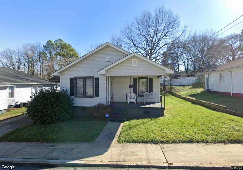
220 10th St Cramerton, NC 28032
Estimated Value: $233,000 - $258,000
2
Beds
1
Bath
1,330
Sq Ft
$185/Sq Ft
Est. Value
About This Home
This home is located at 220 10th St, Cramerton, NC 28032 and is currently estimated at $245,959, approximately $184 per square foot. 220 10th St is a home located in Gaston County with nearby schools including New Hope Elementary School, Cramerton Middle School, and Forestview High School.
Ownership History
Date
Name
Owned For
Owner Type
Purchase Details
Closed on
Apr 20, 2017
Sold by
Ramsey Gerald C
Bought by
Vanvanpelt Steven Van and Pelt Linda W Van
Current Estimated Value
Home Financials for this Owner
Home Financials are based on the most recent Mortgage that was taken out on this home.
Original Mortgage
$95,520
Outstanding Balance
$79,487
Interest Rate
4.21%
Mortgage Type
New Conventional
Estimated Equity
$166,472
Purchase Details
Closed on
Dec 9, 2016
Sold by
Keeter Morris W
Bought by
Ramsey Gerald C
Home Financials for this Owner
Home Financials are based on the most recent Mortgage that was taken out on this home.
Original Mortgage
$68,000
Interest Rate
3.47%
Mortgage Type
Credit Line Revolving
Purchase Details
Closed on
Mar 27, 1963
Bought by
Wiggins Margie B
Create a Home Valuation Report for This Property
The Home Valuation Report is an in-depth analysis detailing your home's value as well as a comparison with similar homes in the area
Home Values in the Area
Average Home Value in this Area
Purchase History
| Date | Buyer | Sale Price | Title Company |
|---|---|---|---|
| Vanvanpelt Steven Van | $119,500 | None Available | |
| Ramsey Gerald C | $50,000 | None Available | |
| Wiggins Margie B | -- | -- |
Source: Public Records
Mortgage History
| Date | Status | Borrower | Loan Amount |
|---|---|---|---|
| Open | Vanvanpelt Steven Van | $95,520 | |
| Previous Owner | Ramsey Gerald C | $68,000 |
Source: Public Records
Tax History Compared to Growth
Tax History
| Year | Tax Paid | Tax Assessment Tax Assessment Total Assessment is a certain percentage of the fair market value that is determined by local assessors to be the total taxable value of land and additions on the property. | Land | Improvement |
|---|---|---|---|---|
| 2025 | $2,099 | $204,010 | $24,000 | $180,010 |
| 2024 | $2,109 | $204,010 | $24,000 | $180,010 |
| 2023 | $2,152 | $213,560 | $24,000 | $189,560 |
| 2022 | $1,534 | $119,360 | $18,000 | $101,360 |
| 2021 | $1,558 | $119,360 | $18,000 | $101,360 |
| 2019 | $1,570 | $119,360 | $18,000 | $101,360 |
| 2018 | $1,236 | $91,927 | $18,000 | $73,927 |
| 2017 | $1,236 | $91,927 | $18,000 | $73,927 |
| 2016 | $1,236 | $91,927 | $0 | $0 |
| 2014 | $470 | $77,380 | $22,500 | $54,880 |
Source: Public Records
Map
Nearby Homes
- 485 Lincoln St
- 304 Greenwood Place
- 325 Treeline Dr
- 2005 Cramerton Village Dr Unit E
- 313 Mayflower Ave
- 380 Woodlawn Ave
- 214 Woodridge Dr
- 202 Woodridge Dr
- 109 Riverside Dr
- 601 Webster Ln
- 603 Webster Ln
- 605 Webster Ln
- 611 Webster Ln
- 506 Webster Ln
- 613 Webster Ln
- 408 Woodlawn Ave
- 2909 Dodsworth Dr
- 2068 Pin Oak Place
- 204 Keyhole Ct
- Mayes Plan at Millstone