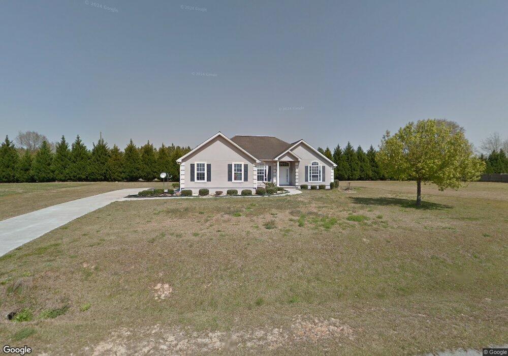
220 Alan's Way Broxton, GA 31519
Estimated Value: $261,309 - $335,000
3
Beds
2
Baths
2,005
Sq Ft
$152/Sq Ft
Est. Value
About This Home
This home is located at 220 Alan's Way, Broxton, GA 31519 and is currently estimated at $304,577, approximately $151 per square foot. 220 Alan's Way is a home located in Coffee County with nearby schools including Broxton-Mary Hayes Elementary School, Coffee Middle School, and Coffee County High School.
Ownership History
Date
Name
Owned For
Owner Type
Purchase Details
Closed on
Dec 20, 2017
Sold by
Patel Kaushik M
Bought by
Patel Kaushik M and Patel Avanikaben Kaushik
Current Estimated Value
Home Financials for this Owner
Home Financials are based on the most recent Mortgage that was taken out on this home.
Original Mortgage
$141,034
Interest Rate
3.92%
Mortgage Type
Purchase Money Mortgage
Purchase Details
Closed on
Dec 11, 2006
Sold by
Deen Grady F
Bought by
Patel Kaushik M and Patel Avni
Home Financials for this Owner
Home Financials are based on the most recent Mortgage that was taken out on this home.
Original Mortgage
$120,000
Interest Rate
6.31%
Mortgage Type
New Conventional
Purchase Details
Closed on
Oct 30, 2006
Sold by
Federal National Mortgage Association
Bought by
Deen Grady F and Deen Carole A
Home Financials for this Owner
Home Financials are based on the most recent Mortgage that was taken out on this home.
Original Mortgage
$120,000
Interest Rate
6.31%
Mortgage Type
New Conventional
Create a Home Valuation Report for This Property
The Home Valuation Report is an in-depth analysis detailing your home's value as well as a comparison with similar homes in the area
Home Values in the Area
Average Home Value in this Area
Purchase History
| Date | Buyer | Sale Price | Title Company |
|---|---|---|---|
| Patel Kaushik M | -- | -- | |
| Patel Kaushik M | $150,000 | -- | |
| Deen Grady F | -- | -- |
Source: Public Records
Mortgage History
| Date | Status | Borrower | Loan Amount |
|---|---|---|---|
| Closed | Patel Kaushik M | $141,034 | |
| Previous Owner | Patel Kaushik M | $120,000 | |
| Previous Owner | Deen Grady F | $101,000 |
Source: Public Records
Tax History Compared to Growth
Tax History
| Year | Tax Paid | Tax Assessment Tax Assessment Total Assessment is a certain percentage of the fair market value that is determined by local assessors to be the total taxable value of land and additions on the property. | Land | Improvement |
|---|---|---|---|---|
| 2024 | $1,233 | $57,656 | $10,000 | $47,656 |
| 2023 | $834 | $57,656 | $10,000 | $47,656 |
| 2022 | $1,351 | $57,656 | $10,000 | $47,656 |
| 2021 | $1,351 | $57,656 | $10,000 | $47,656 |
| 2020 | $1,352 | $57,656 | $10,000 | $47,656 |
| 2019 | $1,352 | $57,656 | $10,000 | $47,656 |
| 2018 | $1,352 | $57,656 | $10,000 | $47,656 |
| 2017 | $1,357 | $57,656 | $10,000 | $47,656 |
| 2016 | $1,358 | $57,656 | $10,000 | $47,656 |
| 2015 | $1,365 | $57,656 | $10,000 | $47,656 |
| 2014 | $1,372 | $57,656 | $10,000 | $47,656 |
Source: Public Records
Map
Nearby Homes
- 310 Leyland Dr
- 2002 Apache Trail
- 161 Green Tree Dr
- 4653 Douglas Braxton Hwy
- 407 Broxton West Green Hwy
- 744 Lotts Crossing
- 3459 Douglas Broxton Hwy (North Hwy 441)
- 3751 Douglas Braxton Hwy
- 3459 Douglas Braxton Hwy
- 504 Miller Ave
- 0 Hwy 301 Hwy Unit 1635753
- 1020 Alabama St N
- 5495 Cross Rd
- 1428 Cross Rd
- 00 Rocky Pond Rd
- 550 Isaac Brigmond Rd
- 00 Georgia 206 Connector
- 1010 Clough Blvd
- 1671 Warren Carter Rd
- 210 Hickory Ridge
- 163 Kingsridge Dr
- 160 Kingsridge Dr
- Lot 27 Kingsridge Dr Unit 27
- Lot 52 Kingsridge Dr Unit 52
- 209 Kingsridge Dr
- 58 Collier Dr
- 232 Kingsridge Dr
- 227 Kingsridge Dr
- 39 Kingsridge Dr
- 52 Kingsridge Dr
- 77 Collier Dr
- 40 Collier Dr
- 89 Kingsridge Dr Unit 1
- 89 Kingsridge Dr
- 260 Kingsridge Dr
- 32 Kingsridge Dr
- 67 Kingsridge Dr
- 298 Alans Way
- 6352 Douglas Broxton Hwy
- 243 Alans Way