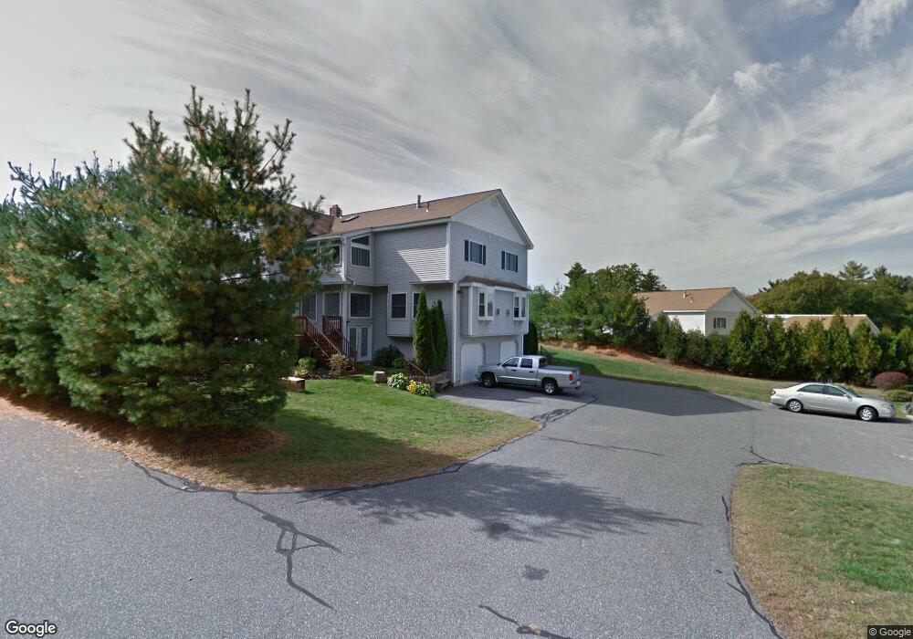
220 Algonquin Trail Ashland, MA 01721
Estimated Value: $647,000 - $669,000
2
Beds
3
Baths
2,113
Sq Ft
$313/Sq Ft
Est. Value
About This Home
This home is located at 220 Algonquin Trail, Ashland, MA 01721 and is currently estimated at $661,653, approximately $313 per square foot. 220 Algonquin Trail is a home located in Middlesex County with nearby schools including William Pittaway Elementary School, Henry E. Warren Elementary School, and David Mindess Elementary School.
Ownership History
Date
Name
Owned For
Owner Type
Purchase Details
Closed on
Jul 6, 2022
Sold by
Galiwango Alan and Galiwango Sandra
Bought by
Subramani Neelamegam
Current Estimated Value
Home Financials for this Owner
Home Financials are based on the most recent Mortgage that was taken out on this home.
Original Mortgage
$584,250
Outstanding Balance
$555,895
Interest Rate
5.1%
Mortgage Type
Purchase Money Mortgage
Estimated Equity
$105,758
Purchase Details
Closed on
Sep 18, 2017
Sold by
Dublikar James A and Dublikar Teresa L
Bought by
Galiwango Sandra and Galiwango Alan
Home Financials for this Owner
Home Financials are based on the most recent Mortgage that was taken out on this home.
Original Mortgage
$308,000
Interest Rate
3.93%
Mortgage Type
New Conventional
Purchase Details
Closed on
Jul 8, 2010
Sold by
Grant David K and Grant Jacqueline
Bought by
Dublikar James A and Dublikar Teresa L
Home Financials for this Owner
Home Financials are based on the most recent Mortgage that was taken out on this home.
Original Mortgage
$345,250
Interest Rate
5.12%
Mortgage Type
FHA
Purchase Details
Closed on
Jul 15, 2004
Sold by
Wilson Karen M
Bought by
Grant David K and Grant Jacqueline
Home Financials for this Owner
Home Financials are based on the most recent Mortgage that was taken out on this home.
Original Mortgage
$59,550
Interest Rate
6.25%
Mortgage Type
Purchase Money Mortgage
Purchase Details
Closed on
Mar 24, 2003
Sold by
North Michaelene R
Bought by
Wilson Karen M
Home Financials for this Owner
Home Financials are based on the most recent Mortgage that was taken out on this home.
Original Mortgage
$310,400
Interest Rate
5.9%
Mortgage Type
Purchase Money Mortgage
Purchase Details
Closed on
Feb 9, 2001
Sold by
Enchanted Forest Dev
Bought by
North Michaelene R
Home Financials for this Owner
Home Financials are based on the most recent Mortgage that was taken out on this home.
Original Mortgage
$176,200
Interest Rate
7.13%
Mortgage Type
Purchase Money Mortgage
Create a Home Valuation Report for This Property
The Home Valuation Report is an in-depth analysis detailing your home's value as well as a comparison with similar homes in the area
Home Values in the Area
Average Home Value in this Area
Purchase History
| Date | Buyer | Sale Price | Title Company |
|---|---|---|---|
| Subramani Neelamegam | $650,000 | None Available | |
| Galiwango Sandra | $385,000 | -- | |
| Dublikar James A | $349,900 | -- | |
| Grant David K | $397,000 | -- | |
| Wilson Karen M | $388,000 | -- | |
| North Michaelene R | $339,380 | -- |
Source: Public Records
Mortgage History
| Date | Status | Borrower | Loan Amount |
|---|---|---|---|
| Open | Subramani Neelamegam | $584,250 | |
| Previous Owner | Galiwango Sandra | $308,000 | |
| Previous Owner | Dublikar James A | $345,250 | |
| Previous Owner | Grant David K | $59,550 | |
| Previous Owner | North Michaelene R | $310,400 | |
| Previous Owner | North Michaelene R | $176,200 |
Source: Public Records
Tax History Compared to Growth
Tax History
| Year | Tax Paid | Tax Assessment Tax Assessment Total Assessment is a certain percentage of the fair market value that is determined by local assessors to be the total taxable value of land and additions on the property. | Land | Improvement |
|---|---|---|---|---|
| 2025 | $7,209 | $564,500 | $0 | $564,500 |
| 2024 | $7,032 | $531,100 | $0 | $531,100 |
| 2023 | $6,421 | $466,300 | $0 | $466,300 |
| 2022 | $6,593 | $415,200 | $0 | $415,200 |
| 2021 | $6,333 | $397,563 | $0 | $397,563 |
| 2020 | $6,202 | $383,800 | $0 | $383,800 |
| 2019 | $5,866 | $360,300 | $0 | $360,300 |
| 2018 | $5,593 | $336,700 | $0 | $336,700 |
| 2017 | $5,296 | $317,100 | $0 | $317,100 |
| 2016 | $5,156 | $303,300 | $0 | $303,300 |
| 2015 | $5,214 | $301,376 | $0 | $301,376 |
| 2014 | $5,104 | $293,500 | $0 | $293,500 |
Source: Public Records
Map
Nearby Homes
- 37 James Rd
- 45 Half Crown Cir
- 158 Algonquin Trail
- 76 Algonquin Trail
- 379 Captain Eames Cir
- 343 Captain Eames Cir Unit 38-C
- 102 Captain Eames Cir
- 72 Pond St
- 9 Adams Rd
- 84 E Bluff Rd
- 1 Adams Rd
- 2 Adams Rd Unit 2
- 67 Spyglass Hill Dr
- 63 Trailside Way Unit 63
- 157 Leland Farm Rd
- 24 Old Connecticut Path
- 306 Trailside Way
- 277 Meeting House Path
- 15 Bates Rd
- 97 Meeting House Path Unit 97
- 218 Algonquin Trail
- 216 Algonquin Trail
- 220 Algonquin Trail Unit 220
- 218 Algonquin Trail Unit 18
- 218 Algonquin Trail Unit 218
- 53 Half Crown Cir
- 69 Half Crown Cir
- 71 Half Crown Cir
- 55 Half Crown Cir
- 69 Half Crown Cir Unit 69
- 226 Algonquin Trail
- 230 Algonquin Trail
- 228 Algonquin Trail
- 224 Algonquin Trail
- 180 Algonquin Trail
- 176 Algonquin Trail
- 178 Algonquin Trail
- 172 Algonquin Trail
- 174 Algonquin Trail
- 172 Algonquin Trail Unit 172