Estimated Value: $332,798 - $434,000
2
Beds
1
Bath
750
Sq Ft
$503/Sq Ft
Est. Value
About This Home
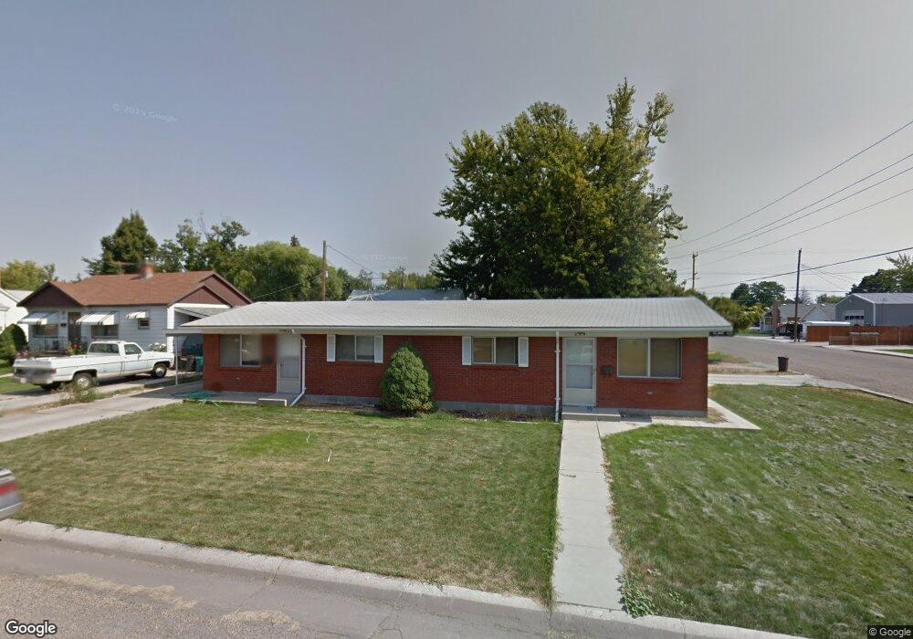
This home is located at 220 Almond St, Nampa, ID 83686 and is currently estimated at $376,950, approximately $502 per square foot. 220 Almond St is a home located in Canyon County with nearby schools including Kamali'i Elementary School, Waikele Elementary School, and Sherman Elementary School.
Ownership History
Date
Name
Owned For
Owner Type
Purchase Details
Closed on
May 5, 2019
Sold by
Reed James C and Reed Rhonda S
Bought by
Tnt Ventures Llc
Current Estimated Value
Purchase Details
Closed on
Feb 19, 2015
Sold by
Benson Margaret
Bought by
Reed James C and Reed Rhonda S
Home Financials for this Owner
Home Financials are based on the most recent Mortgage that was taken out on this home.
Original Mortgage
$84,000
Interest Rate
3.66%
Mortgage Type
New Conventional
Purchase Details
Closed on
Mar 9, 2009
Sold by
Benson George Taft
Bought by
Benson Margaret
Create a Home Valuation Report for This Property
The Home Valuation Report is an in-depth analysis detailing your home's value as well as a comparison with similar homes in the area
Home Values in the Area
Average Home Value in this Area
Purchase History
| Date | Buyer | Sale Price | Title Company |
|---|---|---|---|
| Tnt Ventures Llc | -- | Titleone Boise | |
| Reed James C | -- | Pioneer Title | |
| Benson Margaret | -- | None Available |
Source: Public Records
Mortgage History
| Date | Status | Borrower | Loan Amount |
|---|---|---|---|
| Previous Owner | Reed James C | $84,000 |
Source: Public Records
Tax History Compared to Growth
Tax History
| Year | Tax Paid | Tax Assessment Tax Assessment Total Assessment is a certain percentage of the fair market value that is determined by local assessors to be the total taxable value of land and additions on the property. | Land | Improvement |
|---|---|---|---|---|
| 2025 | $2,209 | $369,200 | $108,600 | $260,600 |
| 2024 | $2,209 | $340,600 | $97,600 | $243,000 |
| 2023 | $2,526 | $335,300 | $97,600 | $237,700 |
| 2022 | $2,469 | $334,500 | $108,600 | $225,900 |
| 2021 | $2,858 | $242,600 | $61,500 | $181,100 |
| 2020 | $2,490 | $192,300 | $42,100 | $150,200 |
| 2019 | $2,776 | $173,000 | $36,600 | $136,400 |
| 2018 | $2,591 | $0 | $0 | $0 |
| 2017 | $2,459 | $0 | $0 | $0 |
| 2016 | $2,170 | $0 | $0 | $0 |
| 2015 | $2,020 | $0 | $0 | $0 |
| 2014 | $1,972 | $101,200 | $16,000 | $85,200 |
Source: Public Records
Map
Nearby Homes
- 216 S Powerline Rd
- 111 S Almond St
- 416 S Powerline Rd
- 516 20th Ave S
- 1207 E Sheridan Ave
- 507 20th Ave S
- 1716 Nixon Ave
- 511 20th Ave S
- 512 19th Ave S
- 223 S Elder St
- 1810 E Sherman Ave
- 1115 E Clark Ave
- 615 18th Ave S
- 2024 2nd St S
- 618 Dufur St
- 912 E Amity Ave
- 1711 1st St S Unit 2, Ground Floor SW s
- 123 17th Ave S
- 219 16th Ave S
- 1047 S 20th St
- 220 & 224 Almond St
- 220 & 224 S Almond St
- 1412 E Lincoln Ave
- 216 Almond St
- 212 Almond St
- 304 Almond St
- 221 S Powerline Rd
- 1411 E Lincoln Ave
- 223 Almond St
- 219 Almond St
- 215 Almond St
- 308 Almond St
- 217 S Powerline Rd
- 303 Almond St
- 223 S Powerline Rd
- 1316 E Lincoln Ave
- 211 Almond St
- 1411 E Washington Ave
- 211 S Powerline Rd
- 312 Almond St