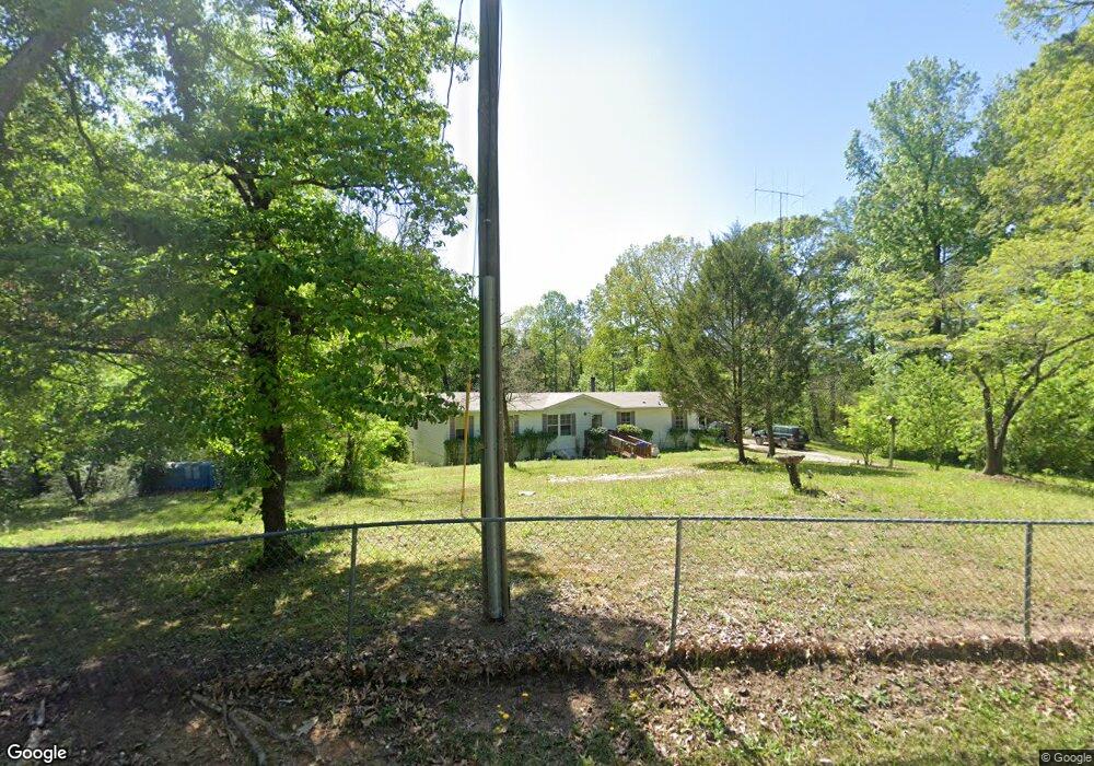
220 Anderson Cir Covington, GA 30016
Estimated Value: $181,336 - $229,000
Studio
2
Baths
1,680
Sq Ft
$119/Sq Ft
Est. Value
About This Home
This home is located at 220 Anderson Cir, Covington, GA 30016 and is currently estimated at $200,084, approximately $119 per square foot. 220 Anderson Cir is a home located in Newton County with nearby schools including Heard-Mixon Elementary School, Indian Creek Middle School, and Alcovy High School.
Ownership History
Date
Name
Owned For
Owner Type
Purchase Details
Closed on
Dec 21, 2019
Sold by
Weaver Debra
Bought by
Weaver Debra and Weaver Robert
Current Estimated Value
Home Financials for this Owner
Home Financials are based on the most recent Mortgage that was taken out on this home.
Original Mortgage
$55,800
Outstanding Balance
$43,232
Interest Rate
3.6%
Mortgage Type
New Conventional
Estimated Equity
$156,852
Purchase Details
Closed on
May 26, 2004
Sold by
Weaver Debra and Weaver Robert W
Bought by
Weaver Debra
Purchase Details
Closed on
Sep 19, 2002
Sold by
Weaver Debra
Bought by
Weaver Debra and Weaver Robert W
Home Financials for this Owner
Home Financials are based on the most recent Mortgage that was taken out on this home.
Original Mortgage
$73,883
Interest Rate
6.18%
Mortgage Type
New Conventional
Create a Home Valuation Report for This Property
The Home Valuation Report is an in-depth analysis detailing your home's value as well as a comparison with similar homes in the area
Home Values in the Area
Average Home Value in this Area
Purchase History
| Date | Buyer | Sale Price | Title Company |
|---|---|---|---|
| Weaver Debra | -- | -- | |
| Weaver Debra | -- | -- | |
| Weaver Debra | -- | -- |
Source: Public Records
Mortgage History
| Date | Status | Borrower | Loan Amount |
|---|---|---|---|
| Open | Weaver Debra | $55,800 | |
| Previous Owner | Weaver Debra | $73,883 |
Source: Public Records
Tax History
| Year | Tax Paid | Tax Assessment Tax Assessment Total Assessment is a certain percentage of the fair market value that is determined by local assessors to be the total taxable value of land and additions on the property. | Land | Improvement |
|---|---|---|---|---|
| 2025 | $388 | $60,640 | $6,000 | $54,640 |
| 2024 | $216 | $50,120 | $6,000 | $44,120 |
| 2023 | $474 | $46,480 | $6,000 | $40,480 |
| 2022 | $276 | $39,200 | $6,000 | $33,200 |
| 2021 | $146 | $33,920 | $6,000 | $27,920 |
| 2020 | $23 | $26,080 | $4,800 | $21,280 |
| 2019 | $658 | $23,200 | $4,800 | $18,400 |
| 2018 | $634 | $22,360 | $4,800 | $17,560 |
| 2017 | $510 | $18,760 | $2,000 | $16,760 |
| 2016 | $538 | $19,560 | $2,800 | $16,760 |
| 2015 | $470 | $17,600 | $2,000 | $15,600 |
| 2014 | $471 | $17,600 | $0 | $0 |
Source: Public Records
Map
Nearby Homes
- 440 Varner St
- 550 Anderson Creek Rd
- 60 Laurie Ln
- 30 Laurie Ln
- 230 Alcovy Reserve Way
- 70 Alcovy Reserve Way
- 219 Channing Cope Rd
- 90 Alcovy Reserve Way
- 10717 Highway 36
- 0 White Laurel Ln Unit 16
- 185 Mountain View Cir
- 915 Navajo Trail
- 0 River Shoals Ct Unit 10620666
- 324 Piper Rd
- 50 Stacia Dr
- 0 Piper Rd Unit 7693971
- 0 Piper Rd Unit 10659921
- 130 Ella Dr
- 13268 Tolstoy Ln
- 12510 Highway 36
- 205 Anderson Cir
- 230 Anderson Cir
- 225 Anderson Cir
- 345 First St
- 200 Anderson Cir
- 505 Varner St
- 240 Anderson Cir
- 195 Anderson Cir
- 235 Anderson Cir
- 175 Anderson Cir
- 250 Anderson Cir
- 325 First St
- 330 First St
- 330 First St St
- 475 Varner St
- 295 First St
- 170 Anderson Cir
- 495 Varner St
- 0 Varner St Unit 10390757
- 0 Varner St Unit 10378782
Your Personal Tour Guide
Ask me questions while you tour the home.