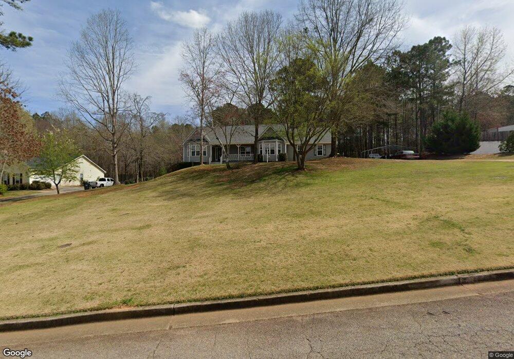
220 Ashley Trace Dr Unit 1 Locust Grove, GA 30248
Estimated Value: $280,447 - $311,000
3
Beds
2
Baths
1,857
Sq Ft
$159/Sq Ft
Est. Value
About This Home
This home is located at 220 Ashley Trace Dr Unit 1, Locust Grove, GA 30248 and is currently estimated at $295,612, approximately $159 per square foot. 220 Ashley Trace Dr Unit 1 is a home located in Henry County with nearby schools including Luella Elementary School, Luella Middle School, and Luella High School.
Ownership History
Date
Name
Owned For
Owner Type
Purchase Details
Closed on
Jun 4, 2024
Sold by
Close Michael D Trust
Bought by
Close Michael D
Current Estimated Value
Purchase Details
Closed on
Jul 19, 2023
Sold by
Close Michael D
Bought by
Close Michael D Trust and Close Michael D Tr
Purchase Details
Closed on
Aug 29, 1997
Sold by
Smith Richard A
Bought by
Close Michael D and Close Dianna C
Home Financials for this Owner
Home Financials are based on the most recent Mortgage that was taken out on this home.
Original Mortgage
$130,810
Interest Rate
7.43%
Mortgage Type
New Conventional
Create a Home Valuation Report for This Property
The Home Valuation Report is an in-depth analysis detailing your home's value as well as a comparison with similar homes in the area
Home Values in the Area
Average Home Value in this Area
Purchase History
| Date | Buyer | Sale Price | Title Company |
|---|---|---|---|
| Close Michael D | -- | -- | |
| Close Michael D Trust | -- | -- | |
| Close Michael D | $127,000 | -- |
Source: Public Records
Mortgage History
| Date | Status | Borrower | Loan Amount |
|---|---|---|---|
| Previous Owner | Close Michael D | $130,810 |
Source: Public Records
Tax History Compared to Growth
Tax History
| Year | Tax Paid | Tax Assessment Tax Assessment Total Assessment is a certain percentage of the fair market value that is determined by local assessors to be the total taxable value of land and additions on the property. | Land | Improvement |
|---|---|---|---|---|
| 2025 | $888 | $123,636 | $12,000 | $111,636 |
| 2024 | $888 | $117,600 | $12,000 | $105,600 |
| 2023 | $600 | $114,080 | $10,000 | $104,080 |
| 2022 | $745 | $98,960 | $10,000 | $88,960 |
| 2021 | $745 | $77,160 | $10,000 | $67,160 |
| 2020 | $745 | $72,240 | $8,000 | $64,240 |
| 2019 | $745 | $63,440 | $8,000 | $55,440 |
| 2018 | $688 | $59,000 | $8,000 | $51,000 |
| 2016 | $593 | $52,560 | $8,000 | $44,560 |
| 2015 | $585 | $49,320 | $8,000 | $41,320 |
| 2014 | $448 | $40,040 | $8,000 | $32,040 |
Source: Public Records
Map
Nearby Homes
- 221 Ashley Trace Dr
- 231 Ashley Trace Dr
- 718 Derek Place
- 179 Ashley Trace Dr
- 170 Ashley Trace Dr
- 163 Ashley Trace Dr Unit 1
- 733 Derek Place Unit 2
- 1871 Weems Rd
- 201 Vandalay Way
- 121 Bradesbury Ln
- 1999 Hampton Locust Grove Rd
- 876 Simpson Mill Rd
- 161 Donovan Ave
- 871 Rocky Creek Rd
- 290 Whistle Way
- 1090 S Hampton Rd
- 1007 S Hampton Rd
- 246 Crabapple Rd Unit 193
- 246 Crabapple Rd
- 191 Westin Park Dr
- 214 Ashley Trace Dr
- 224 Ashley Trace Dr
- 699 Derek Place Unit 1
- 221 Ashley Trace Dr Unit 1
- 210 Ashley Trace Dr Unit I
- 215 Ashley Trace Dr Unit 20
- 695 Derek Place Unit 1
- 230 Ashley Trace Dr
- 701 Derek Place
- 683 Derek Place
- 211 Ashley Trace Dr
- 202 Ashley Trace Dr
- 703 Derek Place
- 234 Ashley Trace Dr Unit 2
- 675 Derek Place
- 235 Ashley Trace Dr
- 694 Derek Place
- 194 Ashley Trace Dr
- 705 Derek Place
- 690 Derek Place