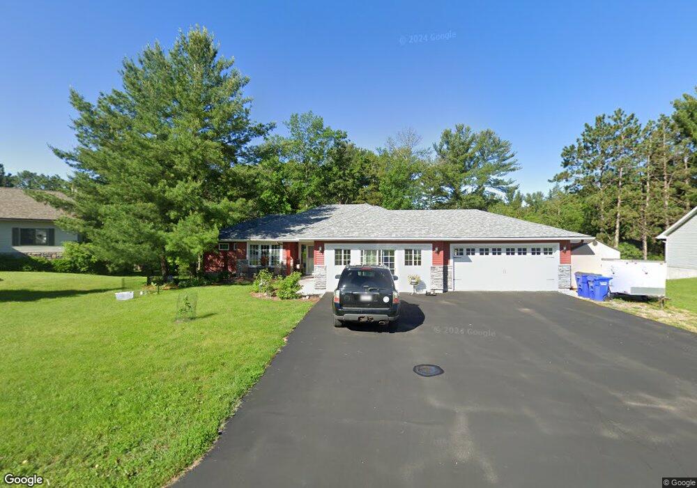
220 Balsam Dr Somerset, WI 54025
Estimated Value: $447,000 - $488,000
3
Beds
2
Baths
--
Sq Ft
0.63
Acres
About This Home
This home is located at 220 Balsam Dr, Somerset, WI 54025 and is currently estimated at $457,481. 220 Balsam Dr is a home located in St. Croix County with nearby schools including Somerset Elementary School, Somerset Middle School, and Somerset High School.
Ownership History
Date
Name
Owned For
Owner Type
Purchase Details
Closed on
May 24, 2018
Sold by
Prefferred Builders Inc
Bought by
Edgar Wesley B and Edgar Patrice M
Current Estimated Value
Purchase Details
Closed on
Mar 1, 2018
Sold by
Kociscak Andrew P
Bought by
Preferred Builders Inc
Home Financials for this Owner
Home Financials are based on the most recent Mortgage that was taken out on this home.
Original Mortgage
$175,000
Interest Rate
4.15%
Mortgage Type
New Conventional
Create a Home Valuation Report for This Property
The Home Valuation Report is an in-depth analysis detailing your home's value as well as a comparison with similar homes in the area
Home Values in the Area
Average Home Value in this Area
Purchase History
| Date | Buyer | Sale Price | Title Company |
|---|---|---|---|
| Edgar Wesley B | -- | Land Title | |
| Preferred Builders Inc | -- | Land Title | |
| Kociscak Andrew P | -- | Land Title |
Source: Public Records
Mortgage History
| Date | Status | Borrower | Loan Amount |
|---|---|---|---|
| Previous Owner | Preferred Builders Inc | $175,000 |
Source: Public Records
Tax History Compared to Growth
Tax History
| Year | Tax Paid | Tax Assessment Tax Assessment Total Assessment is a certain percentage of the fair market value that is determined by local assessors to be the total taxable value of land and additions on the property. | Land | Improvement |
|---|---|---|---|---|
| 2024 | $63 | $348,000 | $33,500 | $314,500 |
| 2023 | $5,371 | $311,000 | $33,500 | $277,500 |
| 2022 | $5,110 | $311,000 | $33,500 | $277,500 |
| 2021 | $5,289 | $311,000 | $33,500 | $277,500 |
| 2020 | $4,972 | $311,000 | $33,500 | $277,500 |
| 2019 | $451 | $198,900 | $17,000 | $181,900 |
| 2018 | $418 | $17,000 | $17,000 | $0 |
| 2017 | $411 | $17,000 | $17,000 | $0 |
| 2016 | $411 | $17,000 | $17,000 | $0 |
| 2015 | $406 | $17,000 | $17,000 | $0 |
| 2014 | $400 | $17,000 | $17,000 | $0 |
| 2013 | $402 | $17,000 | $17,000 | $0 |
Source: Public Records
Map
Nearby Homes
- 316 Evergreen Dr
- 206 Red Pine Dr
- 357 Harriman St
- 315 Harriman St
- 441 White Pine Ln
- 481 Martin Way
- 441 Charles Ln
- 1932 64th St
- 325 Church Hill Rd
- The Rockport Plan at Pine Vale
- The Newport Plan at Pine Vale
- The Brook View Plan at Pine Vale
- The Cheyenne Plan at Pine Vale
- The Ashton Plan at Pine Vale
- The Waverly Plan at Pine Vale
- The Mulbery Plan at Pine Vale
- The Primrose Plan at Pine Vale
- The Water Stone Plan at Pine Vale
- 270 Main St
- 108 Main St
- 216 Balsam Dr
- 224 Balsam Dr
- 212 Balsam Dr
- 228 Balsam Dr
- 205 Balsam Dr
- 221 Balsam Dr
- 227 Balsam Dr
- 208 Balsam Dr
- 231 Balsam Dr
- 232 Balsam Dr
- 333 Evergreen Dr
- 329 Evergreen Dr
- 337 Evergreen Dr
- 327 Evergreen Dr
- 343 Evergreen Dr
- 338 Blue Spruce Ln
- 332 Blue Spruce Ln
- 236 Balsam Dr
- 328 Blue Spruce Ln
- 346 Blue Spruce Ln