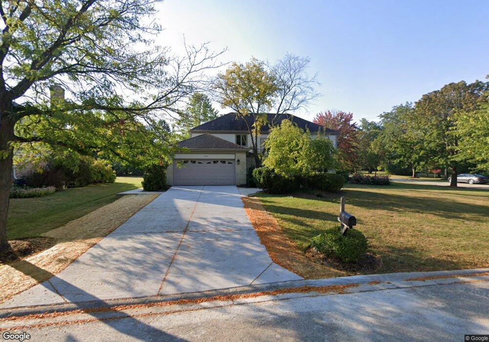
220 Birchwood Dr Barrington, IL 60010
Estimated Value: $722,128 - $824,000
--
Bed
3
Baths
3,291
Sq Ft
$240/Sq Ft
Est. Value
About This Home
This home is located at 220 Birchwood Dr, Barrington, IL 60010 and is currently estimated at $790,532, approximately $240 per square foot. 220 Birchwood Dr is a home located in Lake County with nearby schools including Arnett C. Lines Elementary School, Barrington Middle School Station Campus, and Barrington High School.
Ownership History
Date
Name
Owned For
Owner Type
Purchase Details
Closed on
Mar 14, 2025
Sold by
Weaver Frederick G and Weaver Family Revocable Living Trust
Bought by
Rita C Weaver Revocable Living Trust and Weaver
Current Estimated Value
Purchase Details
Closed on
Jun 21, 2013
Sold by
Weaver Frederick G and The Frederick G Weaver Revocab
Bought by
Weaver Frederick G and Weaver Rita C
Purchase Details
Closed on
Jul 16, 1999
Sold by
Weaver Frederick G and Weaver Rita C
Bought by
Weaver Frederick G and Weaver Rita C
Create a Home Valuation Report for This Property
The Home Valuation Report is an in-depth analysis detailing your home's value as well as a comparison with similar homes in the area
Home Values in the Area
Average Home Value in this Area
Purchase History
| Date | Buyer | Sale Price | Title Company |
|---|---|---|---|
| Rita C Weaver Revocable Living Trust | -- | None Listed On Document | |
| Weaver Frederick G | -- | None Available | |
| Weaver Frederick G | -- | -- |
Source: Public Records
Tax History Compared to Growth
Tax History
| Year | Tax Paid | Tax Assessment Tax Assessment Total Assessment is a certain percentage of the fair market value that is determined by local assessors to be the total taxable value of land and additions on the property. | Land | Improvement |
|---|---|---|---|---|
| 2024 | $12,683 | $191,587 | $42,674 | $148,913 |
| 2023 | $12,683 | $186,441 | $41,528 | $144,913 |
| 2022 | $13,053 | $186,299 | $40,725 | $145,574 |
| 2021 | $12,770 | $181,525 | $39,681 | $141,844 |
| 2020 | $12,489 | $181,525 | $39,681 | $141,844 |
| 2019 | $12,330 | $180,122 | $39,335 | $140,787 |
| 2018 | $12,023 | $178,698 | $42,315 | $136,383 |
| 2017 | $12,004 | $176,542 | $41,805 | $134,737 |
| 2016 | $11,900 | $170,952 | $40,481 | $130,471 |
| 2015 | $11,409 | $162,827 | $38,557 | $124,270 |
| 2014 | $10,732 | $148,839 | $40,131 | $108,708 |
| 2012 | $11,154 | $149,152 | $40,215 | $108,937 |
Source: Public Records
Map
Nearby Homes
- 110 Tudor Dr
- 523 N Ela Rd
- 290 Cold Spring Rd
- 185 Cold Spring Rd
- 104 Lois Ln
- 104 Howe Terrace
- 101 Surrey Ln
- 1312 Lake Shore Dr N Unit 7
- 1288 The Point St
- 44 Oak Ridge Ln
- 175 Hilltop Ave
- 117 Beverly Rd
- 216 Beverly Rd
- 248 Beverly Rd
- 169 Crestview Ct
- 36 Ferndale Rd
- 21 Ferndale Rd
- 432 Whitney Dr
- 1010 Oakland Dr
- 20633 N Primrose Ct
- 230 Birchwood Dr
- 135 Redwood Ln
- 210 Birchwood Dr
- 200 White Oak Ct
- 240 Birchwood Dr
- 150 Redwood Ln
- 130 Ponderosa Ct
- 200 Birchwood Dr
- 125 Redwood Ln
- 225 Birchwood Dr
- 215 Birchwood Dr
- 125 Tall Trees Dr
- 210 White Oak Ct
- 190 Birchwood Dr
- 115 Redwood Ln
- 205 Birchwood Dr
- 205 White Oak Ct
- 120 Ponderosa Ct
- 140 Redwood Ln
- 115 Tall Trees Dr