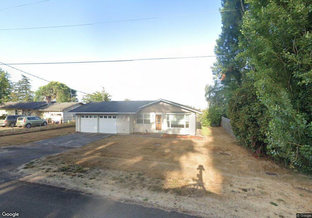
220 Bluebird Ln Tillamook, OR 97141
Estimated Value: $358,000 - $444,000
3
Beds
2
Baths
1,020
Sq Ft
$398/Sq Ft
Est. Value
About This Home
This home is located at 220 Bluebird Ln, Tillamook, OR 97141 and is currently estimated at $405,868, approximately $397 per square foot. 220 Bluebird Ln is a home located in Tillamook County with nearby schools including Tillamook High School, Tillamook Adventist School, and Little Clipper Preschool.
Ownership History
Date
Name
Owned For
Owner Type
Purchase Details
Closed on
Nov 15, 2018
Sold by
Derrick Clifford R and Derrick Martha L
Bought by
Hendrickson Daniel A
Current Estimated Value
Home Financials for this Owner
Home Financials are based on the most recent Mortgage that was taken out on this home.
Original Mortgage
$216,800
Outstanding Balance
$189,100
Interest Rate
4.7%
Mortgage Type
New Conventional
Estimated Equity
$216,768
Create a Home Valuation Report for This Property
The Home Valuation Report is an in-depth analysis detailing your home's value as well as a comparison with similar homes in the area
Home Values in the Area
Average Home Value in this Area
Purchase History
| Date | Buyer | Sale Price | Title Company |
|---|---|---|---|
| Hendrickson Daniel A | $271,000 | Ticor Title |
Source: Public Records
Mortgage History
| Date | Status | Borrower | Loan Amount |
|---|---|---|---|
| Open | Hendrickson Daniel A | $216,800 |
Source: Public Records
Tax History Compared to Growth
Tax History
| Year | Tax Paid | Tax Assessment Tax Assessment Total Assessment is a certain percentage of the fair market value that is determined by local assessors to be the total taxable value of land and additions on the property. | Land | Improvement |
|---|---|---|---|---|
| 2024 | $2,080 | $204,800 | $58,780 | $146,020 |
| 2023 | $2,067 | $198,840 | $57,070 | $141,770 |
| 2022 | $1,995 | $193,050 | $55,410 | $137,640 |
| 2021 | $1,936 | $187,430 | $53,800 | $133,630 |
| 2020 | $1,883 | $181,980 | $52,230 | $129,750 |
| 2019 | $1,830 | $176,680 | $50,710 | $125,970 |
| 2018 | $1,401 | $134,520 | $49,230 | $85,290 |
| 2017 | $1,367 | $130,610 | $47,800 | $82,810 |
| 2016 | $1,314 | $126,810 | $46,410 | $80,400 |
| 2015 | $1,261 | $123,120 | $45,060 | $78,060 |
| 2014 | $1,235 | $119,540 | $43,750 | $75,790 |
| 2013 | -- | $116,060 | $42,480 | $73,580 |
Source: Public Records
Map
Nearby Homes
- 9660 Sollie Smith Rd N
- 810 Marvin Rd
- 0 Valley View Dr Unit 24275744
- 0 Skyview Rd Unit 410604 427457611
- 10360 Skyview Rd
- TL 405 Edelwyss Rd
- 0 Edelwyss Rd Unit 405 731536279
- 1690 Skyline Dr
- 00 Schild Rd
- 00 Schild Rd Unit 201
- 9065 Trask River Rd
- 8100 Briar Ln
- 0 Tl 2809 Briar Ln
- 3995 Westwood Dr
- 0 Tl 300 Westwood Place
- TL# 300 Westwood Dr
- TL #00502 Sollie Smith Rd N
- TL #00100 Sollie Smith Rd N
- 00100 Sollie Smith Rd N
- 00502 Sollie Smith Rd N
- 210 Bluebird Ln
- 230 Bluebird Ln
- 200 Bluebird Ln
- 250 Bluebird Ln
- 235 Bluebird Ln
- 180 Bluebird Ln
- 255 Bluebird Ln
- 200 Hummingbird Ln
- 270 Bluebird Ln
- 220 Hummingbird Ln
- 240 Hummingbird Ln
- 180 Hummingbird Ln
- 275 Bluebird Ln
- 170 Bluebird Ln
- 260 Hummingbird Ln
- 280 Bluebird Ln
- 160 Hummingbird Ln
- 285 Bluebird Ln
- 270 Hummingbird Ln
- 175 Vista Dr