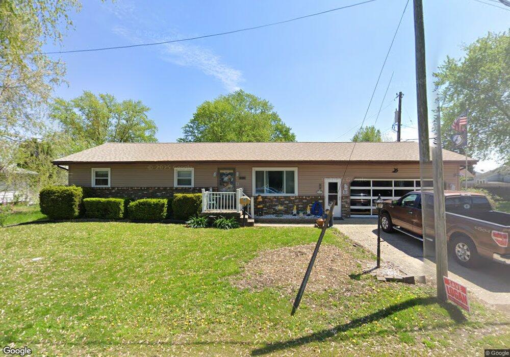
220 Border St Lincoln, IL 62656
Estimated Value: $134,295 - $182,000
Studio
--
Bath
1,288
Sq Ft
$119/Sq Ft
Est. Value
About This Home
This home is located at 220 Border St, Lincoln, IL 62656 and is currently estimated at $153,574, approximately $119 per square foot. 220 Border St is a home located in Logan County with nearby schools including Washington-Monroe Elementary School, Lincoln Junior High School, and Lincoln Community High School.
Ownership History
Date
Name
Owned For
Owner Type
Purchase Details
Closed on
Aug 15, 2014
Sold by
Jodi L Jodi L and Przykopanski Patrick J
Bought by
Clemons Dennis L and Clemons Jill A
Current Estimated Value
Home Financials for this Owner
Home Financials are based on the most recent Mortgage that was taken out on this home.
Original Mortgage
$25,000
Interest Rate
4.1%
Mortgage Type
New Conventional
Purchase Details
Closed on
Apr 29, 2014
Sold by
Mohr Kathy and Billings Karen
Bought by
Clemons Jill A and Deibert Jodi L
Create a Home Valuation Report for This Property
The Home Valuation Report is an in-depth analysis detailing your home's value as well as a comparison with similar homes in the area
Home Values in the Area
Average Home Value in this Area
Purchase History
| Date | Buyer | Sale Price | Title Company |
|---|---|---|---|
| Clemons Dennis L | $75,000 | -- | |
| Clemons Jill A | -- | -- |
Source: Public Records
Mortgage History
| Date | Status | Borrower | Loan Amount |
|---|---|---|---|
| Closed | Clemons Dennis L | $25,000 |
Source: Public Records
Tax History
| Year | Tax Paid | Tax Assessment Tax Assessment Total Assessment is a certain percentage of the fair market value that is determined by local assessors to be the total taxable value of land and additions on the property. | Land | Improvement |
|---|---|---|---|---|
| 2024 | $2,858 | $44,180 | $7,590 | $36,590 |
| 2023 | $2,639 | $40,910 | $7,030 | $33,880 |
| 2022 | $2,687 | $38,230 | $6,570 | $31,660 |
| 2021 | $3,041 | $36,710 | $6,310 | $30,400 |
| 2020 | $2,993 | $36,170 | $6,220 | $29,950 |
| 2019 | $2,918 | $35,460 | $6,100 | $29,360 |
| 2018 | $2,883 | $34,760 | $5,980 | $28,780 |
| 2017 | $2,867 | $34,760 | $5,980 | $28,780 |
| 2016 | $2,791 | $34,720 | $5,970 | $28,750 |
| 2015 | $2,427 | $34,070 | $5,770 | $28,300 |
| 2014 | $2,427 | $34,070 | $5,770 | $28,300 |
| 2013 | $2,427 | $32,340 | $5,480 | $26,860 |
| 2012 | $2,427 | $32,920 | $5,580 | $27,340 |
Source: Public Records
Map
Nearby Homes
- 1121 Pulaski St
- 1717 Pekin St
- 157 Portland Place
- 929 Decatur St
- 211 S Hamilton St
- 145 Debruler Dr
- 152 Debruler Dr
- 113 N Kickapoo St
- 906 Peoria St
- 421 Decatur St
- 323 Nugent Place
- 502 Williamette Ave
- 410 S Chicago St
- 210 S Beason Rd
- 620 Tremont St
- 515 S Maple St Unit 517
- 219 5th St
- 228 4th St
- 1208 N Kankakee St
- 405 5th St
- 230 Border St
- 1709 Tremont St
- 1715 Tremont St
- 225 Border St
- 225 Border St Unit 310 N. Elliott Sreet
- 1516 Delavan St
- 1721 Tremont St
- 1502 Delavan St
- 1514 Delavan St
- 330 N Elliott St
- 310 N Elliott St
- 1430 Delavan St
- 1520 Delavan St
- 1603 Tremont St Unit 330 N Elliott
- 1727 Tremont St
- 1712 Tremont St
- 1716 Tremont St
- 1418 Delavan St
- 1503 Delavan St
- 1511 Delavan St
Your Personal Tour Guide
Ask me questions while you tour the home.