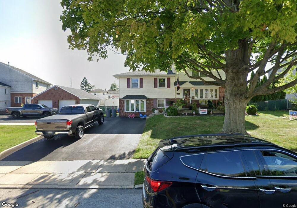
220 Bourne Dr Broomall, PA 19008
Estimated Value: $543,000 - $559,000
3
Beds
2
Baths
1,746
Sq Ft
$314/Sq Ft
Est. Value
About This Home
This home is located at 220 Bourne Dr, Broomall, PA 19008 and is currently estimated at $547,821, approximately $313 per square foot. 220 Bourne Dr is a home located in Delaware County with nearby schools including Loomis Elementary School, Paxon Hollow Middle School, and Marple Newtown Senior High School.
Ownership History
Date
Name
Owned For
Owner Type
Purchase Details
Closed on
Dec 13, 2004
Sold by
Shihadeh Raymond B and Shihadeh Marialisa
Bought by
Shihadeh Raymond B and Shihadeh Marialisa
Current Estimated Value
Home Financials for this Owner
Home Financials are based on the most recent Mortgage that was taken out on this home.
Original Mortgage
$231,000
Outstanding Balance
$115,685
Interest Rate
5.73%
Mortgage Type
Fannie Mae Freddie Mac
Estimated Equity
$432,136
Purchase Details
Closed on
Aug 27, 1996
Sold by
Derescavage Anthony E and Elenewski Loretta
Bought by
Shihadeh Raymond B and Shihadeh Mariatisa
Home Financials for this Owner
Home Financials are based on the most recent Mortgage that was taken out on this home.
Original Mortgage
$120,000
Interest Rate
8.11%
Create a Home Valuation Report for This Property
The Home Valuation Report is an in-depth analysis detailing your home's value as well as a comparison with similar homes in the area
Home Values in the Area
Average Home Value in this Area
Purchase History
| Date | Buyer | Sale Price | Title Company |
|---|---|---|---|
| Shihadeh Raymond B | -- | -- | |
| Shihadeh Raymond B | $150,000 | -- |
Source: Public Records
Mortgage History
| Date | Status | Borrower | Loan Amount |
|---|---|---|---|
| Open | Shihadeh Raymond B | $231,000 | |
| Closed | Shihadeh Raymond B | $120,000 |
Source: Public Records
Tax History Compared to Growth
Tax History
| Year | Tax Paid | Tax Assessment Tax Assessment Total Assessment is a certain percentage of the fair market value that is determined by local assessors to be the total taxable value of land and additions on the property. | Land | Improvement |
|---|---|---|---|---|
| 2025 | $5,578 | $322,790 | $108,270 | $214,520 |
| 2024 | $5,578 | $322,790 | $108,270 | $214,520 |
| 2023 | $5,401 | $322,790 | $108,270 | $214,520 |
| 2022 | $5,299 | $322,790 | $108,270 | $214,520 |
| 2021 | $7,997 | $322,790 | $108,270 | $214,520 |
| 2020 | $5,059 | $175,800 | $56,500 | $119,300 |
| 2019 | $4,998 | $175,800 | $56,500 | $119,300 |
| 2018 | $4,946 | $175,800 | $0 | $0 |
| 2017 | $4,949 | $175,800 | $0 | $0 |
| 2016 | $965 | $175,800 | $0 | $0 |
| 2015 | $965 | $175,800 | $0 | $0 |
| 2014 | $965 | $175,800 | $0 | $0 |
Source: Public Records
Map
Nearby Homes
- Petersburg Plan at Cedar View
- Gilfillan Plan at Cedar View
- Balvenie Plan at Cedar View
- Bowmore Plan at Cedar View
- Clayton Plan at Cedar View
- 240 N Central Blvd
- 407 S Central Blvd
- 516 Portland Dr
- 228 S Pkwy
- 416 Warren Blvd
- 429 Portland Dr
- 306 Rock Run Cir
- 631 S Central Blvd
- 333 Sussex Blvd
- 1 Brighton Village Dr
- 301 S New Ardmore Ave
- 7 Brighton Village Dr
- 2119 Boxwood Dr
- 1 Lawrence Rd Unit A3A
- 63 S Greenhill Rd
- 218 Bourne Dr
- 334 N Central Blvd
- 223 Ashford Dr
- 225 Ashford Dr
- 221 Ashford Dr
- 216 Bourne Dr
- 338 N Central Blvd
- 219 Bourne Dr
- 326 N Central Blvd
- 219 Ashford Dr
- 217 Bourne Dr
- 214 Bourne Dr
- 217 Ashford Dr
- 215 Bourne Dr
- 322 N Central Blvd
- 212 Bourne Dr
- 333 N Central Blvd
- 213 Bourne Dr
- 337 N Central Blvd
- 329 N Central Blvd