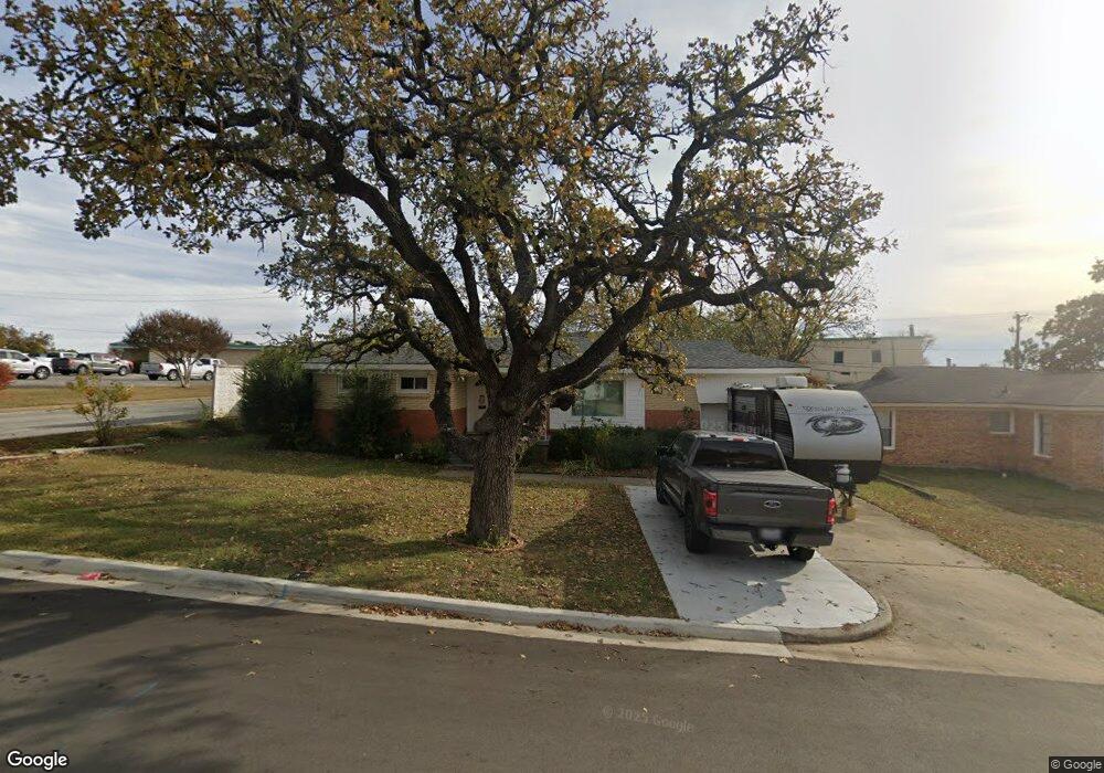
220 Cheryl Ave Bedford, TX 76022
Estimated Value: $244,000 - $282,000
3
Beds
2
Baths
1,375
Sq Ft
$194/Sq Ft
Est. Value
About This Home
This home is located at 220 Cheryl Ave, Bedford, TX 76022 and is currently estimated at $266,353, approximately $193 per square foot. 220 Cheryl Ave is a home located in Tarrant County with nearby schools including Harrison Lane Elementary School, Hurst J High School, and L.D. Bell High School.
Ownership History
Date
Name
Owned For
Owner Type
Purchase Details
Closed on
Mar 28, 2014
Sold by
Biesterveld Tanya
Bought by
Rosales Stephanie A and Rosales Justin L
Current Estimated Value
Home Financials for this Owner
Home Financials are based on the most recent Mortgage that was taken out on this home.
Original Mortgage
$110,854
Outstanding Balance
$82,753
Interest Rate
3.87%
Mortgage Type
FHA
Estimated Equity
$183,600
Purchase Details
Closed on
Dec 2, 2013
Sold by
Traylor Loquita and Cansler Lila
Bought by
Biesterveld Tanya
Create a Home Valuation Report for This Property
The Home Valuation Report is an in-depth analysis detailing your home's value as well as a comparison with similar homes in the area
Home Values in the Area
Average Home Value in this Area
Purchase History
| Date | Buyer | Sale Price | Title Company |
|---|---|---|---|
| Rosales Stephanie A | -- | Old Republic Title | |
| Biesterveld Tanya | -- | None Available |
Source: Public Records
Mortgage History
| Date | Status | Borrower | Loan Amount |
|---|---|---|---|
| Open | Rosales Stephanie A | $110,854 |
Source: Public Records
Tax History Compared to Growth
Tax History
| Year | Tax Paid | Tax Assessment Tax Assessment Total Assessment is a certain percentage of the fair market value that is determined by local assessors to be the total taxable value of land and additions on the property. | Land | Improvement |
|---|---|---|---|---|
| 2025 | $2,236 | $246,920 | $55,000 | $191,920 |
| 2024 | $2,236 | $246,920 | $55,000 | $191,920 |
| 2023 | $3,034 | $228,053 | $35,000 | $193,053 |
| 2022 | $3,141 | $196,377 | $35,000 | $161,377 |
| 2021 | $3,080 | $190,701 | $35,000 | $155,701 |
| 2020 | $2,826 | $152,374 | $35,000 | $117,374 |
| 2019 | $2,625 | $148,813 | $35,000 | $113,813 |
| 2018 | $2,004 | $98,228 | $16,000 | $82,228 |
| 2017 | $2,160 | $124,498 | $16,000 | $108,498 |
| 2016 | $1,964 | $103,063 | $16,000 | $87,063 |
| 2015 | $1,853 | $73,800 | $15,000 | $58,800 |
| 2014 | $1,853 | $73,800 | $15,000 | $58,800 |
Source: Public Records
Map
Nearby Homes
- 905 Brown Trail
- 802 Brown Trail
- 803 Glenda Dr
- 341 Hurst Dr
- 344 Bedford Ct E
- 1136 Simpson Dr
- 849 Russell Ln
- 1016 Keith Dr
- 1008 Russell Ln
- 1220 Norwood Dr
- 127 W Cedar St
- 644 Caduceus Ln
- 501 Merrill Dr
- 1236 King Dr
- 624 Harrison Ln
- 116 Oakhurst Dr
- 933 Wade Dr
- 409 Vicki Place
- 420 Bedford Ct W
- 1108 Wade Dr
- 216 W Cheryl Ave
- 216 Cheryl Ave
- 212 W Cheryl Ave
- 212 Cheryl Ave
- 221 Cheryl Ave
- 217 Cheryl Ave
- 208 W Cheryl Ave
- 208 Cheryl Ave
- 213 Cheryl Ave
- 900 Walter St
- 901 Walter St
- 896 Acorn St
- 849 Brown Trail
- 204 W Cheryl Ave
- 853 Brown Trail
- 204 Cheryl Ave
- 900 Acorn St
- 901 Brown Trail
- 905 Walter St
- 908 Walter St