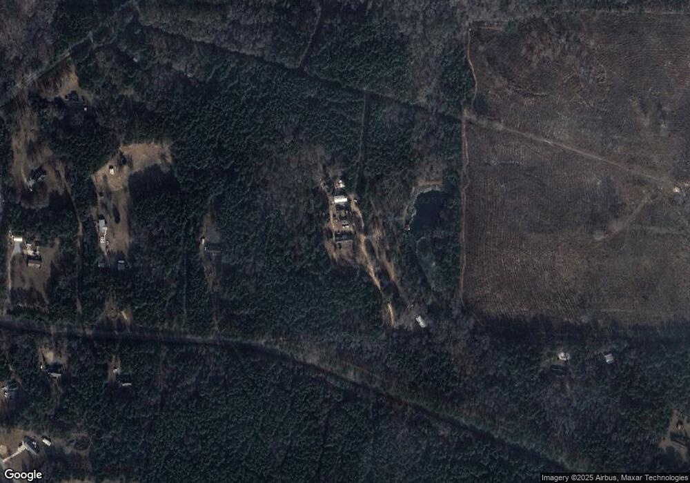
220 Craig Rd Forsyth, GA 31029
Estimated Value: $206,881 - $486,000
Studio
2
Baths
1,605
Sq Ft
$200/Sq Ft
Est. Value
About This Home
This home is located at 220 Craig Rd, Forsyth, GA 31029 and is currently estimated at $321,294, approximately $200 per square foot. 220 Craig Rd is a home located in Monroe County with nearby schools including Katherine B. Sutton Elementary School and Mary Persons High School.
Ownership History
Date
Name
Owned For
Owner Type
Purchase Details
Closed on
Sep 6, 2022
Sold by
Andrews Lori Ex Offcio Sheriff
Bought by
Big Peach Properties Llc
Current Estimated Value
Purchase Details
Closed on
Dec 22, 2015
Sold by
Bailey Myrtle J
Bought by
Bailey Mark J
Purchase Details
Closed on
Oct 22, 2007
Sold by
Not Provided
Bought by
Bailey Myrtle
Purchase Details
Closed on
Feb 5, 1999
Sold by
Bailey Myrtle J
Bought by
Bailey Bennie L
Purchase Details
Closed on
Jan 2, 1976
Sold by
Freeman Mae J Mrs
Bought by
Bailey Myrtle J
Create a Home Valuation Report for This Property
The Home Valuation Report is an in-depth analysis detailing your home's value as well as a comparison with similar homes in the area
Home Values in the Area
Average Home Value in this Area
Purchase History
| Date | Buyer | Sale Price | Title Company |
|---|---|---|---|
| Big Peach Properties Llc | $150,000 | -- | |
| Bailey Mark J | -- | -- | |
| Bailey Myrtle | -- | -- | |
| Bailey Bennie L | -- | -- | |
| Bailey Myrtle J | $5,100 | -- |
Source: Public Records
Tax History
| Year | Tax Paid | Tax Assessment Tax Assessment Total Assessment is a certain percentage of the fair market value that is determined by local assessors to be the total taxable value of land and additions on the property. | Land | Improvement |
|---|---|---|---|---|
| 2025 | $2,338 | $83,040 | $35,400 | $47,640 |
| 2024 | $2,338 | $83,040 | $35,400 | $47,640 |
| 2023 | $1,507 | $77,440 | $35,400 | $42,040 |
| 2022 | $1,444 | $77,440 | $35,400 | $42,040 |
| 2021 | $1,492 | $77,440 | $35,400 | $42,040 |
| 2020 | $1,481 | $70,400 | $28,360 | $42,040 |
| 2019 | $1,515 | $70,400 | $28,360 | $42,040 |
| 2018 | $1,517 | $71,240 | $28,360 | $42,880 |
| 2017 | $2,071 | $71,240 | $28,360 | $42,880 |
| 2016 | $1,391 | $69,520 | $28,360 | $41,160 |
| 2015 | $1,359 | $76,560 | $0 | $0 |
| 2014 | $500 | $76,560 | $0 | $0 |
Source: Public Records
Map
Nearby Homes
- 6418 Georgia 42
- 170 Aaron Ct
- 160 Aaron Ct
- 120 Homestead Cir
- 170 Homestead Cir
- 40 Timber Dr
- 381 Homestead Cir
- 341 Homestead Cir Unit LOT 22A
- 351 Homestead Circle Lot 23a Cir Unit LOT 23A
- 3528 Highway 42 S
- 120 Torbet Rd
- 738 Teagle Rd
- 0 Brownlee Rd Unit 10671220
- 56 Ivey Cir
- LOT 48 Stokes Store Rd
- 49 Stokes Store Rd
- 1649 Stokes Store Rd
- 1649 Stokes Store Rd Unit 52
- 1645 Stokes Store Rd Unit 53
- Magnolia Plan at Providence Ridge
- 490 Craig Rd
- 153 Craig Rd
- 348 Craig Rd
- 6599 Ga Highway 42 N
- 6599 Georgia 42
- 6599 Ga Hwy
- 6589 Ga Highway 42 N
- 103 Craig Rd
- 6577 Ga Highway 42 N
- 6684 Ga Highway 42 N
- 202 Gordon Rd
- 450 Gordon Rd
- 230 Gordon Rd
- 48 Craig Rd
- 466 Gordon Rd
- 101 Gordon Rd
- 201 Gordon Rd
- 225 Gordon Rd
- 445 Gordon Rd
- 215 Gordon Rd
Your Personal Tour Guide
Ask me questions while you tour the home.
