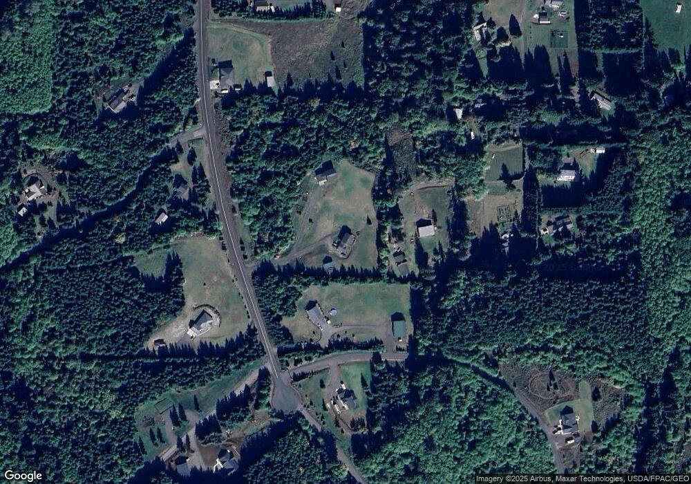
220 Cranberry Dr Castle Rock, WA 98611
Estimated Value: $682,916 - $832,000
4
Beds
3
Baths
2,776
Sq Ft
$275/Sq Ft
Est. Value
About This Home
This home is located at 220 Cranberry Dr, Castle Rock, WA 98611 and is currently estimated at $763,639, approximately $275 per square foot. 220 Cranberry Dr is a home located in Cowlitz County with nearby schools including Toutle Lake Elementary School and Toutle Lake High School.
Ownership History
Date
Name
Owned For
Owner Type
Purchase Details
Closed on
Nov 14, 2008
Sold by
Polehn Neil Scott and Jacobs Thomas
Bought by
Smith Mitchell W and Smith Billie J
Current Estimated Value
Home Financials for this Owner
Home Financials are based on the most recent Mortgage that was taken out on this home.
Original Mortgage
$287,347
Outstanding Balance
$188,248
Interest Rate
6.04%
Mortgage Type
VA
Estimated Equity
$575,391
Create a Home Valuation Report for This Property
The Home Valuation Report is an in-depth analysis detailing your home's value as well as a comparison with similar homes in the area
Home Values in the Area
Average Home Value in this Area
Purchase History
| Date | Buyer | Sale Price | Title Company |
|---|---|---|---|
| Smith Mitchell W | $281,300 | Cowlitz County Title Company |
Source: Public Records
Mortgage History
| Date | Status | Borrower | Loan Amount |
|---|---|---|---|
| Open | Smith Mitchell W | $287,347 |
Source: Public Records
Tax History Compared to Growth
Tax History
| Year | Tax Paid | Tax Assessment Tax Assessment Total Assessment is a certain percentage of the fair market value that is determined by local assessors to be the total taxable value of land and additions on the property. | Land | Improvement |
|---|---|---|---|---|
| 2024 | $5,216 | $586,110 | $90,310 | $495,800 |
| 2023 | $5,128 | $578,910 | $77,850 | $501,060 |
| 2022 | $4,407 | $556,970 | $77,740 | $479,230 |
| 2021 | $4,276 | $470,920 | $68,200 | $402,720 |
| 2020 | $4,105 | $421,000 | $61,440 | $359,560 |
| 2019 | $3,516 | $398,296 | $55,851 | $342,445 |
| 2018 | $3,668 | $356,240 | $55,850 | $300,390 |
| 2017 | $3,577 | $310,380 | $52,690 | $257,690 |
| 2016 | $3,303 | $299,440 | $64,150 | $235,290 |
| 2015 | $2,906 | $279,300 | $64,150 | $215,150 |
| 2013 | -- | $248,430 | $59,400 | $189,030 |
Source: Public Records
Map
Nearby Homes
- 374 Bellwood Dr
- 213 Sudden Valley Dr
- 0 S Silver Lake Rd Unit 5 24160382
- 0 S Silver Lake Rd Unit 6 24653045
- 0 S Silver Lake Rd Unit 7 24033336
- 0 S Silver Lake Rd Unit 4 23427454
- 0 S Silver Lake Rd Unit 1 23501672
- 0 Silverwood Dr Unit Lot C2 132343749
- 0 Silverwood Dr Unit Lot C2 NWM2388996
- 0 Silverwood Dr Unit Lot H NWM2389000
- 0 Silverwood Dr Unit F2 206261297
- 0 Silverwood Dr Unit Lot F2 NWM2365845
- 306 Van Horn Rd
- 175 Elwood Rd
- 0 S Silver Lake Lot #1 Rd
- 0 S Silver Lake Lot #4 Rd
- 0 S Rd
- 315 Dolan Rd
- 312 Dolan Rd
- 324 Dolan Rd
- 220 Cranberry Dr
- 212 Cranberry Dr
- 735 Carnine Rd
- 260 Cranberry Dr
- 0 Tract K Silver Ridge Unit 8007646
- 241 Cranberry Dr
- 737 Carnine Rd
- 120 Elk Heights Dr
- 24 Elk Heights Dr
- 727 Carnine Rd
- 136 Cranberry Dr
- 130 Maywood Dr
- 741 Carnine Rd
- 747 Carnine Rd
- 731 Carnine Rd
- 201 Bellwood
- 625 Carnine Rd
- 179 Cranberry Dr
- 190 Bellwood
- 159 Elk Heights Dr
