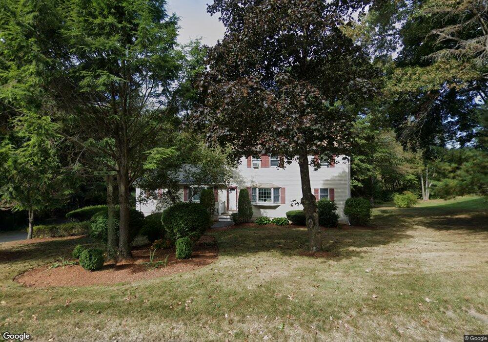
220 Dale St North Andover, MA 01845
Estimated Value: $893,417 - $1,043,000
5
Beds
3
Baths
2,300
Sq Ft
$420/Sq Ft
Est. Value
About This Home
This home is located at 220 Dale St, North Andover, MA 01845 and is currently estimated at $965,604, approximately $419 per square foot. 220 Dale St is a home located in Essex County with nearby schools including Franklin Elementary School, North Andover Middle School, and North Andover High School.
Ownership History
Date
Name
Owned For
Owner Type
Purchase Details
Closed on
May 30, 2025
Sold by
Stewart Francis R
Bought by
Francis R Stewart Ft and Stewart
Current Estimated Value
Purchase Details
Closed on
Aug 18, 2011
Sold by
Bajan Jan and Bajan Stephanie
Bought by
Stewart Frank
Purchase Details
Closed on
Oct 29, 1990
Sold by
Davis Scott N
Bought by
Bajan Jan
Home Financials for this Owner
Home Financials are based on the most recent Mortgage that was taken out on this home.
Original Mortgage
$145,000
Interest Rate
10.08%
Mortgage Type
Purchase Money Mortgage
Create a Home Valuation Report for This Property
The Home Valuation Report is an in-depth analysis detailing your home's value as well as a comparison with similar homes in the area
Home Values in the Area
Average Home Value in this Area
Purchase History
| Date | Buyer | Sale Price | Title Company |
|---|---|---|---|
| Francis R Stewart Ft | -- | -- | |
| Francis R Stewart Ft | -- | -- | |
| Stewart Frank | $355,000 | -- | |
| Stewart Frank | $355,000 | -- | |
| Bajan Jan | $171,000 | -- |
Source: Public Records
Mortgage History
| Date | Status | Borrower | Loan Amount |
|---|---|---|---|
| Previous Owner | Bajan Jan | $147,600 | |
| Previous Owner | Bajan Jan | $145,000 |
Source: Public Records
Tax History Compared to Growth
Tax History
| Year | Tax Paid | Tax Assessment Tax Assessment Total Assessment is a certain percentage of the fair market value that is determined by local assessors to be the total taxable value of land and additions on the property. | Land | Improvement |
|---|---|---|---|---|
| 2025 | $9,139 | $811,600 | $419,800 | $391,800 |
| 2024 | $9,080 | $818,800 | $398,000 | $420,800 |
| 2023 | $8,395 | $685,900 | $336,100 | $349,800 |
| 2022 | $8,053 | $595,200 | $305,600 | $289,600 |
| 2021 | $7,789 | $549,700 | $277,300 | $272,400 |
| 2020 | $7,347 | $534,700 | $277,300 | $257,400 |
| 2019 | $7,170 | $534,700 | $277,300 | $257,400 |
| 2018 | $7,769 | $534,700 | $277,300 | $257,400 |
| 2017 | $6,405 | $448,500 | $217,200 | $231,300 |
| 2016 | $6,170 | $432,400 | $215,900 | $216,500 |
| 2015 | $5,307 | $368,800 | $212,400 | $156,400 |
Source: Public Records
Map
Nearby Homes
- 378 Salem St
- 75 Thistle Rd
- 45 Thistle Rd
- 495 Johnson St
- 479 Stevens St
- 80 Sandra Ln
- 447 Stevens St
- 3 Great Pond Rd
- 65 Saile Way
- 174 Chestnut St Unit 14
- 141 Cortland Dr Unit 141
- 141 Cortland Dr
- 116 Mill Pond
- 115 Mill Pond
- 112 Mill Pond
- 121 Cortland Dr
- 124 Quail Run Rd
- 136 Quail Run Rd
- 98 Mill Pond
- 76 Hillside Rd
- 218 Dale St
- 218 Dale St Unit 220
- 228 Dale St
- 10 Bear Hill Rd
- 234 Dale St
- 259 Dale St
- 11 Bear Hill Rd
- 0 Confidential Way Unit 72274761
- 999 0000
- 9999 Confidential Address
- 0 Confidential Way Unit 71313543
- 0 Confidential Way Unit 71334794
- 0 Confidential Way Unit 71383010
- 0 Confidential Way Unit 71430307
- 129-131 N Ramp Rd
- 0 Confidential Way Unit 71271555
- 0 Confidential Way Unit 70226247
- lot 3N-A Berry St
- lot 2N-A Berry St
- lot 1N-A Berry St