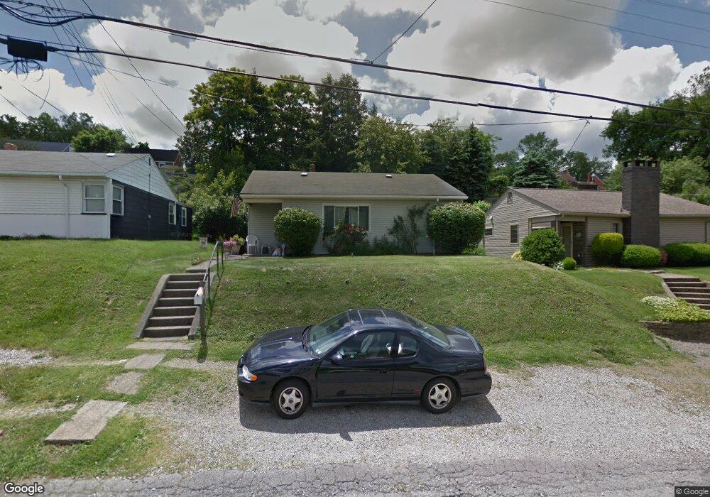
220 Dersam St McKeesport, PA 15133
Estimated Value: $102,000 - $112,000
3
Beds
1
Bath
1,078
Sq Ft
$99/Sq Ft
Est. Value
About This Home
This home is located at 220 Dersam St, McKeesport, PA 15133 and is currently estimated at $106,354, approximately $98 per square foot. 220 Dersam St is a home located in Allegheny County with nearby schools including South Allegheny Elementary School, South Allegheny High School, and Young Scholars of Greater Allegheny Charter School.
Ownership History
Date
Name
Owned For
Owner Type
Purchase Details
Closed on
Aug 23, 2017
Sold by
Kudla Rachael B and Kudla Shannon N
Bought by
Kudla Shannon N
Current Estimated Value
Purchase Details
Closed on
Aug 19, 1994
Sold by
Hud
Bought by
Kudla Edward J
Purchase Details
Closed on
Aug 9, 1994
Sold by
Coon Eugene L
Bought by
Hud
Purchase Details
Closed on
Jul 1, 1994
Sold by
Coon Eugene L
Bought by
Hud
Create a Home Valuation Report for This Property
The Home Valuation Report is an in-depth analysis detailing your home's value as well as a comparison with similar homes in the area
Home Values in the Area
Average Home Value in this Area
Purchase History
| Date | Buyer | Sale Price | Title Company |
|---|---|---|---|
| Kudla Shannon N | -- | None Available | |
| Kudla Edward J | $5,020 | -- | |
| Hud | $2,187 | -- | |
| Hud | $2,187 | -- |
Source: Public Records
Tax History Compared to Growth
Tax History
| Year | Tax Paid | Tax Assessment Tax Assessment Total Assessment is a certain percentage of the fair market value that is determined by local assessors to be the total taxable value of land and additions on the property. | Land | Improvement |
|---|---|---|---|---|
| 2025 | $1,151 | $30,200 | $12,100 | $18,100 |
| 2024 | $1,151 | $30,200 | $12,100 | $18,100 |
| 2023 | $1,106 | $30,200 | $12,100 | $18,100 |
| 2022 | $1,036 | $30,200 | $12,100 | $18,100 |
| 2021 | $1,008 | $30,200 | $12,100 | $18,100 |
| 2020 | $985 | $30,200 | $12,100 | $18,100 |
| 2019 | $936 | $30,200 | $12,100 | $18,100 |
| 2018 | $143 | $30,200 | $12,100 | $18,100 |
| 2017 | $887 | $30,200 | $12,100 | $18,100 |
| 2016 | $143 | $30,200 | $12,100 | $18,100 |
| 2015 | $143 | $30,200 | $12,100 | $18,100 |
| 2014 | $887 | $30,200 | $12,100 | $18,100 |
Source: Public Records
Map
Nearby Homes
- 1332 Beverly Rd
- 1310 Beverly Rd
- 1317 New York Ave
- 320 Dersam St
- 1009 Oakland Ave
- 335-345 Dersam St
- 1220 Romine Ave
- 1419 Washington Blvd
- 732 Upston St
- 1000 Washington Blvd
- 706 Upston St
- 706 Upston St Unit 2
- 505 Manning Ave
- 0 Washington Blvd
- 1120 Portsmouth Dr
- 524 Archer St
- 1817 Gray St
- 502 Archer St
- 800 Romine Ave
- 533 Monterey St