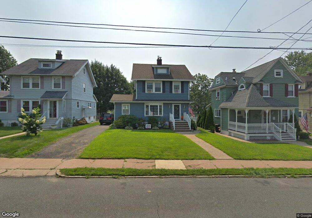
220 Division Ave Hasbrouck Heights, NJ 07604
Estimated Value: $680,000 - $737,000
--
Bed
--
Bath
1,774
Sq Ft
$402/Sq Ft
Est. Value
About This Home
This home is located at 220 Division Ave, Hasbrouck Heights, NJ 07604 and is currently estimated at $713,565, approximately $402 per square foot. 220 Division Ave is a home located in Bergen County with nearby schools including Hasbrouck Heights High School and Corpus Christi School.
Ownership History
Date
Name
Owned For
Owner Type
Purchase Details
Closed on
Mar 15, 2006
Sold by
Rosso Donna Del
Bought by
Formisano Lori
Current Estimated Value
Home Financials for this Owner
Home Financials are based on the most recent Mortgage that was taken out on this home.
Original Mortgage
$300,000
Outstanding Balance
$170,548
Interest Rate
6.27%
Estimated Equity
$543,017
Purchase Details
Closed on
Jun 26, 1998
Sold by
Patrick Jacqueline C
Bought by
Delrosso Donna and Bernstein Elinor
Home Financials for this Owner
Home Financials are based on the most recent Mortgage that was taken out on this home.
Original Mortgage
$162,000
Interest Rate
6.92%
Create a Home Valuation Report for This Property
The Home Valuation Report is an in-depth analysis detailing your home's value as well as a comparison with similar homes in the area
Home Values in the Area
Average Home Value in this Area
Purchase History
| Date | Buyer | Sale Price | Title Company |
|---|---|---|---|
| Formisano Lori | $514,000 | -- | |
| Delrosso Donna | $222,000 | -- |
Source: Public Records
Mortgage History
| Date | Status | Borrower | Loan Amount |
|---|---|---|---|
| Open | Formisano Lori | $300,000 | |
| Previous Owner | Delrosso Donna | $162,000 |
Source: Public Records
Tax History Compared to Growth
Tax History
| Year | Tax Paid | Tax Assessment Tax Assessment Total Assessment is a certain percentage of the fair market value that is determined by local assessors to be the total taxable value of land and additions on the property. | Land | Improvement |
|---|---|---|---|---|
| 2025 | $13,881 | $543,300 | $231,200 | $312,100 |
| 2024 | $13,429 | $543,300 | $231,200 | $312,100 |
| 2023 | $12,876 | $521,100 | $221,200 | $299,900 |
| 2022 | $12,876 | $478,300 | $201,200 | $277,100 |
| 2021 | $12,482 | $442,000 | $188,700 | $253,300 |
| 2020 | $11,794 | $410,100 | $178,700 | $231,400 |
| 2019 | $11,460 | $402,800 | $176,200 | $226,600 |
| 2018 | $11,146 | $390,800 | $173,700 | $217,100 |
| 2017 | $10,956 | $383,600 | $171,200 | $212,400 |
| 2016 | $11,011 | $362,800 | $161,200 | $201,600 |
| 2015 | $10,833 | $362,800 | $161,200 | $201,600 |
| 2014 | $10,536 | $362,800 | $161,200 | $201,600 |
Source: Public Records
Map
Nearby Homes
- 208 Jefferson Ave
- 417 Franklin Ave
- 243 Cleveland Ave
- 74 Kipp Ave
- 38 Springfield Ave
- 35 Franklin Ave
- 2 Passaic Ave
- 8800 Boulevard Unit 5F
- 8800 Boulevard Unit 7K
- 8800 Boulevard Unit 4B
- 30 Woodside Ave
- 110 Harrison Ave
- 14 Jefferson Ave Unit 16
- 311 Harrison Ave
- 18 Hasbrouck Ave
- 444 Washington Place
- 48 Hasbrouck Ave
- 25 Roosevelt Dr
- 27 Roosevelt Dr
- 233 Lasalle Ave
- 216 Division Ave
- 224 Division Ave
- 214 Division Ave
- 228 Division Ave
- 223 Raymond St
- 217 Raymond St
- 227 Raymond St
- 232 Division Ave
- 215 Raymond St
- 223 Division Ave
- 231 Raymond St
- 219 Division Ave
- 227 Division Ave
- 215 Division Ave
- 236 Division Ave
- 211 Division Ave
- 235 Raymond St
- 231 Division Ave
- 240 Division Ave
- 237 Division Ave