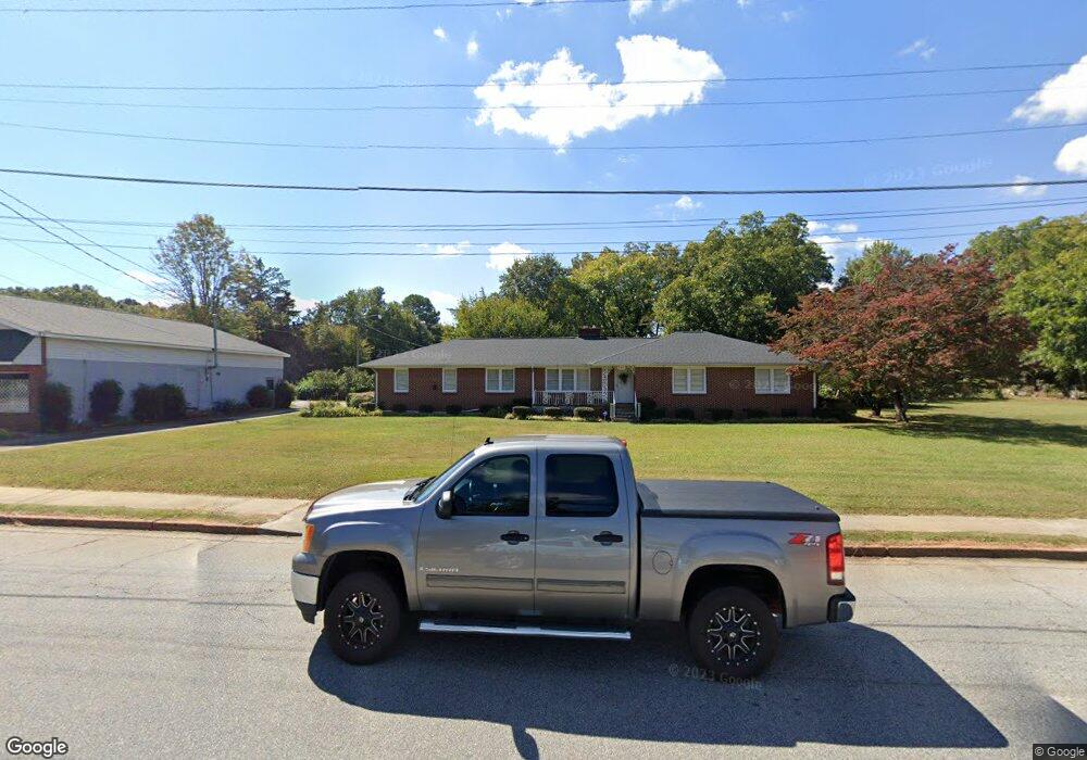
220 E Main St West Union, SC 29696
Estimated Value: $224,518 - $354,000
3
Beds
2
Baths
2,240
Sq Ft
$127/Sq Ft
Est. Value
About This Home
This home is located at 220 E Main St, West Union, SC 29696 and is currently estimated at $283,880, approximately $126 per square foot. 220 E Main St is a home with nearby schools including Walhalla Elementary School, Walhalla Middle School, and Walhalla High School.
Ownership History
Date
Name
Owned For
Owner Type
Purchase Details
Closed on
Sep 4, 2025
Sold by
Laye Lois Selma and Hunnicutt Nee
Bought by
Laye Family Revocable Trust and Crow
Current Estimated Value
Purchase Details
Closed on
Jun 4, 2014
Sold by
Estate Of Lois Selma Laye Nee Hunnicutt
Bought by
Will Of Lois Selma Laye Nee Hunnicutt
Purchase Details
Closed on
Jun 24, 2013
Sold by
Estate Of John Sam Laye Jr
Bought by
Estate Of Lois Selma Laye
Create a Home Valuation Report for This Property
The Home Valuation Report is an in-depth analysis detailing your home's value as well as a comparison with similar homes in the area
Home Values in the Area
Average Home Value in this Area
Purchase History
| Date | Buyer | Sale Price | Title Company |
|---|---|---|---|
| Laye Family Revocable Trust | -- | None Listed On Document | |
| Will Of Lois Selma Laye Nee Hunnicutt | -- | -- | |
| Estate Of Lois Selma Laye | -- | -- |
Source: Public Records
Tax History
| Year | Tax Paid | Tax Assessment Tax Assessment Total Assessment is a certain percentage of the fair market value that is determined by local assessors to be the total taxable value of land and additions on the property. | Land | Improvement |
|---|---|---|---|---|
| 2025 | $491 | $5,033 | $635 | $4,398 |
| 2024 | $491 | $5,033 | $635 | $4,398 |
| 2023 | $478 | $5,033 | $635 | $4,398 |
| 2022 | $470 | $5,033 | $635 | $4,398 |
| 2021 | $460 | $4,807 | $645 | $4,162 |
| 2020 | $305 | $0 | $0 | $0 |
| 2019 | $305 | $0 | $0 | $0 |
| 2018 | $1,053 | $0 | $0 | $0 |
| 2017 | $460 | $0 | $0 | $0 |
| 2016 | $460 | $0 | $0 | $0 |
| 2015 | -- | $0 | $0 | $0 |
| 2014 | -- | $5,045 | $861 | $4,184 |
| 2013 | -- | $0 | $0 | $0 |
Source: Public Records
Map
Nearby Homes
- 115 Burns Mill Rd
- 209 Moore Ave
- 437 Burns Mill Rd
- 146 Jefferson Rd
- 807 W Main St
- 140 Davis Hill Rd
- 00 Keowee St
- 320 Jaynes St
- 132 Kare Fre Blvd
- 205 Union Ct
- 304 S Spring St
- 143 W Waters Edge Ln
- 141 W Waters Edge Ln
- 707 S Spring St
- 130 Raleighs Ln
- 137 W Waters Edge Ln
- 130 W Waters Edge Ln
- Lot 57 W Waters Edge Ln
- Lot 55 W Waters Edge Ln
- 00 Eleanore Dr
- 300 E Main St
- 613 Anderson St
- 00 E Main St
- 215 Church St
- 623 Anderson St
- 321 E Main St
- 625 Anderson St
- 213 Church St
- 395 Caroline St
- 211 Church St
- 627 Anderson St
- 629 Anderson St
- 103 Peninsula Dr
- 701 Anderson St
- 416 E Main St
- 415 E Main St
- 420 E Main St
- 350 W Railroad St
- 421 E Main St
- 426A E Main St
Your Personal Tour Guide
Ask me questions while you tour the home.