Estimated Value: $465,000 - $496,000
3
Beds
2
Baths
1,763
Sq Ft
$270/Sq Ft
Est. Value
About This Home
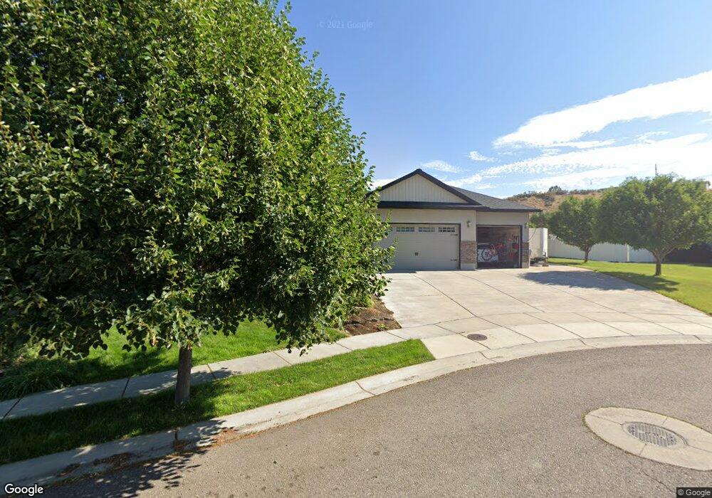
This home is located at 220 E Putnam Mountain Loop, Inkom, ID 83245 and is currently estimated at $476,609, approximately $270 per square foot. 220 E Putnam Mountain Loop is a home located in Bannock County with nearby schools including Inkom Elementary School, Marsh Valley Middle School, and Marsh Valley High School.
Ownership History
Date
Name
Owned For
Owner Type
Purchase Details
Closed on
Jul 7, 2025
Sold by
Dye Robb D and Dye Keiko D
Bought by
Baker Matthew Shaun and Baker Sharayn
Current Estimated Value
Home Financials for this Owner
Home Financials are based on the most recent Mortgage that was taken out on this home.
Original Mortgage
$472,000
Outstanding Balance
$471,207
Interest Rate
6.89%
Mortgage Type
New Conventional
Estimated Equity
$5,402
Purchase Details
Closed on
Feb 6, 2018
Sold by
Dye Robb and Dye Kelko
Bought by
Dye Robb D and Dye Kelko D
Home Financials for this Owner
Home Financials are based on the most recent Mortgage that was taken out on this home.
Original Mortgage
$105,000
Interest Rate
3.95%
Mortgage Type
New Conventional
Purchase Details
Closed on
Sep 1, 2006
Sold by
S Systems Inc
Bought by
Dye Robb and Dye Keiks
Create a Home Valuation Report for This Property
The Home Valuation Report is an in-depth analysis detailing your home's value as well as a comparison with similar homes in the area
Purchase History
| Date | Buyer | Sale Price | Title Company |
|---|---|---|---|
| Baker Matthew Shaun | -- | Alliance Title | |
| Dye Robb D | -- | First American Title | |
| Dye Robb | -- | -- |
Source: Public Records
Mortgage History
| Date | Status | Borrower | Loan Amount |
|---|---|---|---|
| Open | Baker Matthew Shaun | $472,000 | |
| Previous Owner | Dye Robb D | $105,000 |
Source: Public Records
Tax History
| Year | Tax Paid | Tax Assessment Tax Assessment Total Assessment is a certain percentage of the fair market value that is determined by local assessors to be the total taxable value of land and additions on the property. | Land | Improvement |
|---|---|---|---|---|
| 2025 | $3,416 | $511,785 | $60,000 | $451,785 |
| 2024 | $3,613 | $458,951 | $60,000 | $398,951 |
| 2023 | $3,667 | $479,139 | $59,000 | $420,139 |
| 2022 | $3,667 | $322,800 | $43,750 | $279,050 |
| 2021 | $2,716 | $368,874 | $43,750 | $325,124 |
| 2020 | $2,583 | $289,147 | $35,000 | $254,147 |
| 2019 | $2,971 | $282,294 | $35,700 | $246,594 |
| 2018 | $2,469 | $234,672 | $35,000 | $199,672 |
| 2017 | $2,454 | $234,672 | $35,000 | $199,672 |
| 2016 | $2,641 | $236,239 | $35,000 | $201,239 |
| 2015 | $2,722 | $0 | $0 | $0 |
| 2012 | -- | $236,239 | $35,000 | $201,239 |
Source: Public Records
Map
Nearby Homes
- TBD Marsh Valley Rd
- 355 Skyline Peak Loop
- 500 Toponce
- 112 E Leta Dr
- TBD Lot 1 Block 2 Castle Creek
- 1100 N Rapid Creek Rd
- 651 Steed Rd
- 0 Green Canyon Rd Unit 2066133
- 0 Green Canyon Rd Unit 578496
- 250 E Pidcock Rd
- 159 Washington Ave
- TBD E Pidcock Rd
- TBD Lot 6 BLK 1 Tamarack Way
- TBD Portneuf Rd
- TBD Lot 13 Grey Fox Loop
- TBD Lot 9 Grey Fox Loop
- TBD Lot 10 Grey Fox Loop
- TBD Lot 6 Grey Fox Loop
- 611 Grey Fox Loop
- TBD Lot 9 BLK 1 Barberry Grove
- 221 E Putnam Mountain Loop
- 218 E Putnam Mountain Loop
- 219 E Putnam Mountain Loop
- 217 E Putnam Mountain Loop
- 2493 N Inkom Rd
- 216 E Putnam Mountain Loop
- 2483 N Inkom Rd
- 328 Oxford Peak Dr
- 328 Oxford Dr
- 210 W Putnam Mountain Loop
- 205 Snow Peak Blvd
- 318 Oxford Peak Dr
- 211 W Putnam Mountain Loop
- 215 Snow Peak Blvd
- 175 Snow Peak Blvd
- 175 Snow Peak Blvd Unit 2
- 308 Oxford Peak Dr
- 155 Snow Peak Blvd
- 204 Haystack Loop
- 212 W Putnam Mountain Loop
Your Personal Tour Guide
Ask me questions while you tour the home.