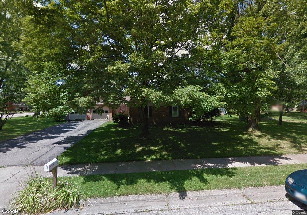
220 Fieldcrest Dr Oxford, OH 45056
Estimated Value: $242,000 - $340,000
3
Beds
2
Baths
1,635
Sq Ft
$176/Sq Ft
Est. Value
About This Home
This home is located at 220 Fieldcrest Dr, Oxford, OH 45056 and is currently estimated at $288,183, approximately $176 per square foot. 220 Fieldcrest Dr is a home located in Butler County with nearby schools including Talawanda Middle School, Talawanda High School, and Mcguffey Montessori School.
Ownership History
Date
Name
Owned For
Owner Type
Purchase Details
Closed on
May 9, 2003
Sold by
Peterson John H and Peterson Michelle P
Bought by
Smith Leslie C
Current Estimated Value
Home Financials for this Owner
Home Financials are based on the most recent Mortgage that was taken out on this home.
Original Mortgage
$140,100
Outstanding Balance
$61,909
Interest Rate
6.02%
Mortgage Type
Purchase Money Mortgage
Estimated Equity
$226,274
Purchase Details
Closed on
May 12, 1999
Sold by
First National Bank Of Sw
Bought by
Peterson John H and Peterson Michelle P
Home Financials for this Owner
Home Financials are based on the most recent Mortgage that was taken out on this home.
Original Mortgage
$123,500
Interest Rate
7.04%
Mortgage Type
Purchase Money Mortgage
Purchase Details
Closed on
Jul 3, 1995
Sold by
Miller Barbara P
Bought by
Wolke Harry G and Wolke Verna
Purchase Details
Closed on
Sep 1, 1991
Create a Home Valuation Report for This Property
The Home Valuation Report is an in-depth analysis detailing your home's value as well as a comparison with similar homes in the area
Home Values in the Area
Average Home Value in this Area
Purchase History
| Date | Buyer | Sale Price | Title Company |
|---|---|---|---|
| Smith Leslie C | $164,900 | -- | |
| Peterson John H | $130,000 | -- | |
| Wolke Harry G | $127,000 | -- | |
| -- | $73,000 | -- |
Source: Public Records
Mortgage History
| Date | Status | Borrower | Loan Amount |
|---|---|---|---|
| Open | Smith Leslie C | $140,100 | |
| Previous Owner | Peterson John H | $123,500 |
Source: Public Records
Tax History Compared to Growth
Tax History
| Year | Tax Paid | Tax Assessment Tax Assessment Total Assessment is a certain percentage of the fair market value that is determined by local assessors to be the total taxable value of land and additions on the property. | Land | Improvement |
|---|---|---|---|---|
| 2024 | $2,665 | $72,300 | $17,690 | $54,610 |
| 2023 | $2,557 | $72,300 | $17,690 | $54,610 |
| 2022 | $2,122 | $54,640 | $17,690 | $36,950 |
| 2021 | $2,020 | $54,640 | $17,690 | $36,950 |
| 2020 | $2,113 | $54,640 | $17,690 | $36,950 |
| 2019 | $3,732 | $49,400 | $16,870 | $32,530 |
| 2018 | $2,014 | $49,400 | $16,870 | $32,530 |
| 2017 | $1,810 | $49,400 | $16,870 | $32,530 |
| 2016 | $1,713 | $45,220 | $16,870 | $28,350 |
| 2015 | $1,743 | $45,220 | $16,870 | $28,350 |
| 2014 | $2,000 | $45,220 | $16,870 | $28,350 |
| 2013 | $2,000 | $50,980 | $16,870 | $34,110 |
Source: Public Records
Map
Nearby Homes
- 1020 Tollgate Dr
- 7 Robin Ct
- 6171 Vereker Dr
- 100 Hilltop Rd
- 118 Hilltop Rd
- 6101 Contreras Rd
- 509 White Oak Dr
- 446 Emerald Woods Dr
- 5 Quail Ridge Dr
- 5999 Contreras Rd
- 620 Brill Dr
- 111 Prevalent Dr
- 616 Brill Dr
- 141 Prevalent Dr
- 715 W Chestnut St
- 812 Winding Brook Dr
- 60 Autumn Dr
- 4 Olde Stone Ct
- 51 Savannah Dr
- 62 Great Horned Dr
- 6275 Timothy Ln
- 6285 Timothy Ln
- 6294 Fairfield Rd
- 1223 Albert Cir
- 223 Fieldcrest Dr
- 6263 Timothy Ln
- 1224 Albert Cir
- 6295 Timothy Ln
- 1228 Tollgate Dr
- 1221 Albert Cir
- 6304 Fairfield Rd
- 6253 Timothy Ln
- 6305 Timothy Ln
- 6274 Timothy Ln
- 1224 Tollgate Dr
- 6242 Fairfield Rd
- 6284 Timothy Ln
- 125 Fieldcrest Dr
- 6243 Timothy Ln
- 1219 Albert Cir