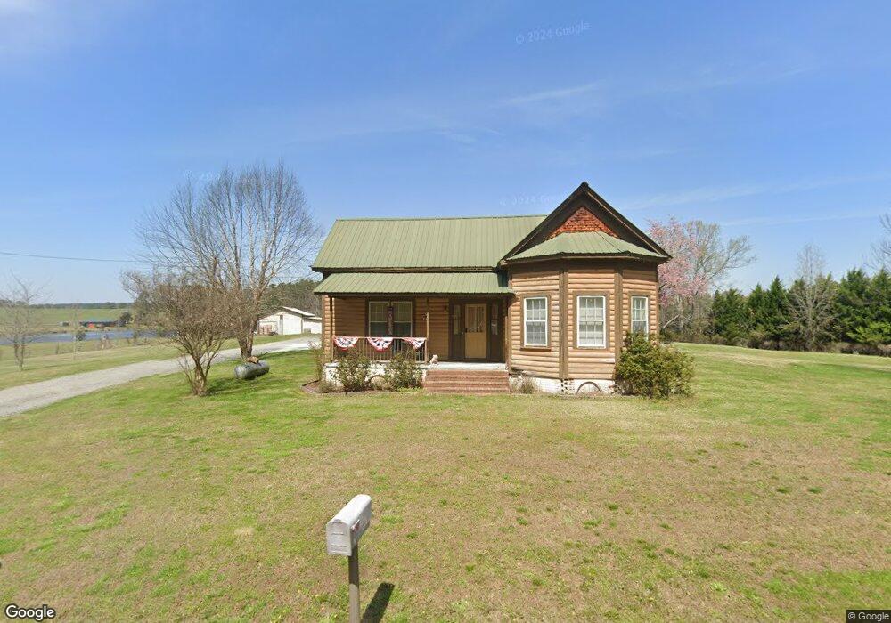
220 Fite Rd Cedartown, GA 30125
Estimated Value: $313,838 - $356,000
3
Beds
2
Baths
1,523
Sq Ft
$219/Sq Ft
Est. Value
About This Home
This home is located at 220 Fite Rd, Cedartown, GA 30125 and is currently estimated at $333,460, approximately $218 per square foot. 220 Fite Rd is a home located in Polk County.
Ownership History
Date
Name
Owned For
Owner Type
Purchase Details
Closed on
May 15, 2025
Sold by
Marshall Hollis
Bought by
Hollis Crystal and Hollis Marshall
Current Estimated Value
Home Financials for this Owner
Home Financials are based on the most recent Mortgage that was taken out on this home.
Original Mortgage
$330,000
Outstanding Balance
$303,350
Interest Rate
6.83%
Mortgage Type
New Conventional
Estimated Equity
$30,110
Purchase Details
Closed on
Apr 23, 2009
Sold by
The Bank Of New York Mellon
Bought by
Hollis Marshall and Hollis Crystal
Purchase Details
Closed on
Mar 3, 2009
Sold by
The Bank Of New York
Bought by
The Bank Of New York
Purchase Details
Closed on
Jan 13, 2005
Sold by
Lester Ricky T
Bought by
Moody James M
Home Financials for this Owner
Home Financials are based on the most recent Mortgage that was taken out on this home.
Original Mortgage
$135,960
Interest Rate
5.5%
Mortgage Type
New Conventional
Purchase Details
Closed on
Jul 12, 2001
Sold by
Copelan Robert E
Bought by
Lester Ricky T
Create a Home Valuation Report for This Property
The Home Valuation Report is an in-depth analysis detailing your home's value as well as a comparison with similar homes in the area
Home Values in the Area
Average Home Value in this Area
Purchase History
| Date | Buyer | Sale Price | Title Company |
|---|---|---|---|
| Hollis Crystal | -- | -- | |
| Hollis Marshall | $90,000 | -- | |
| The Bank Of New York | -- | -- | |
| Moody James M | $169,950 | -- | |
| Lester Ricky T | $105,000 | -- |
Source: Public Records
Mortgage History
| Date | Status | Borrower | Loan Amount |
|---|---|---|---|
| Open | Hollis Crystal | $330,000 | |
| Previous Owner | James M Moody | $45,000 | |
| Previous Owner | Moody James M | $135,960 | |
| Previous Owner | Moody James M | $33,990 |
Source: Public Records
Tax History Compared to Growth
Tax History
| Year | Tax Paid | Tax Assessment Tax Assessment Total Assessment is a certain percentage of the fair market value that is determined by local assessors to be the total taxable value of land and additions on the property. | Land | Improvement |
|---|---|---|---|---|
| 2024 | $2,134 | $104,109 | $26,619 | $77,490 |
| 2023 | $1,733 | $75,019 | $26,619 | $48,400 |
| 2022 | $1,350 | $58,887 | $17,746 | $41,141 |
| 2021 | $1,368 | $58,887 | $17,746 | $41,141 |
| 2020 | $1,370 | $58,887 | $17,746 | $41,141 |
| 2019 | $950 | $51,644 | $17,746 | $33,898 |
| 2018 | $944 | $50,607 | $17,746 | $32,861 |
| 2017 | $929 | $50,607 | $17,746 | $32,861 |
| 2016 | $927 | $49,146 | $16,285 | $32,861 |
| 2015 | $932 | $49,341 | $16,285 | $33,056 |
| 2014 | $936 | $49,341 | $16,285 | $33,056 |
Source: Public Records
Map
Nearby Homes
- 176 Runyon Loop
- 0 Runyon Loop Unit 10606366
- 0 Runyon Loop Unit 7650113
- 1838 Antioch Rd
- 1912 Hightower Rd
- 0 Everett Mtn Rd
- 160 Tate Rd
- 0 Hightower Rd Unit 10584768
- 0 Hightower Rd Unit 7633002
- 0 Hightower Rd Unit 10584778
- 0 Hightower Rd Unit 7632982
- 4267 Buchanan Hwy
- 0 Youngs Farm Rd Unit 24829378
- 0 Buchanan Hwy Unit 10558945
- 102 acres Youngs Farm Rd
- 4550 Buchanan Hwy
- 600 Grady Rd
- 45 York Cir
- 296 Winkle Rd
- 470 Knight Rd
- 0A Fite Rd
- 182 Fite Rd
- 290 Fite Rd
- 142 Fite Rd
- 382 Hampton Rd
- 73 Fite Rd
- 294 Fite Rd
- 355 Hampton Rd
- 759 Wood Fall Rd
- 791 Wood Fall Rd
- 326 Hampton Rd
- 781 Wood Fall Rd
- 795 Lee Rd
- 746 Wood Fall Rd
- 779 Wood Fall Rd
- 281 Hampton Rd
- 0 Fite Rd Unit 10202577
- 0 Fite Rd Unit 7274994
- 0 Fite Rd Unit 20054859
- 0 Fite Rd Unit 7292310