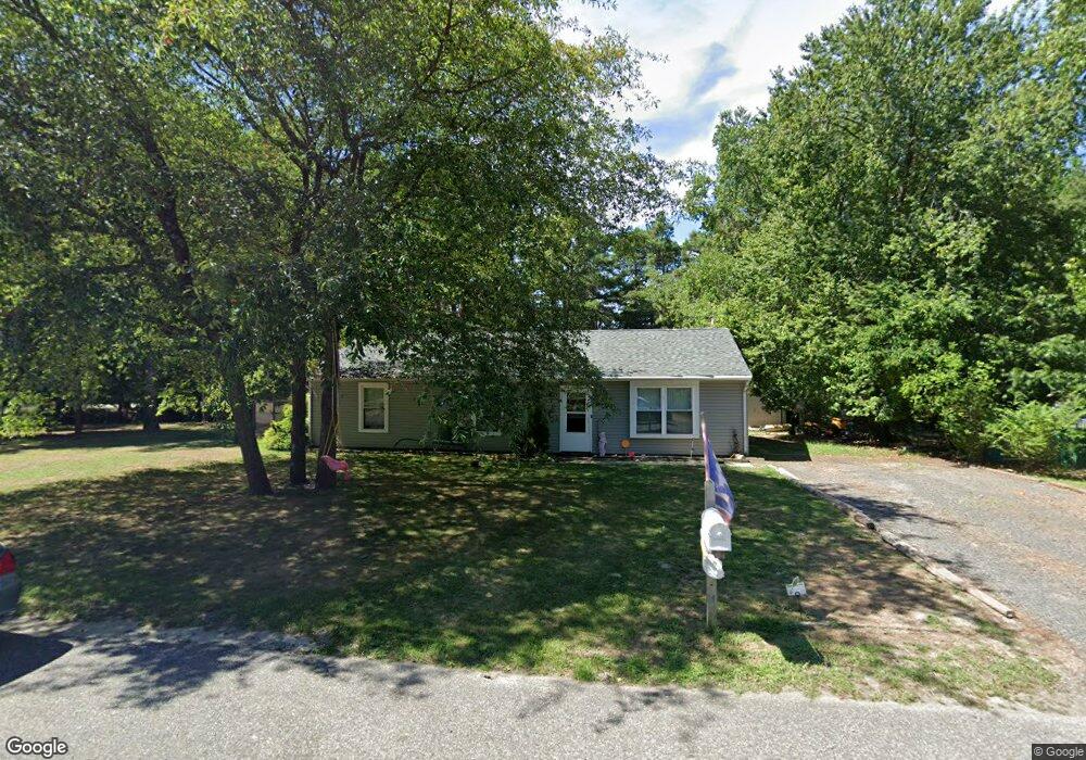
220 Haddon Rd Browns Mills, NJ 08015
Estimated Value: $325,000 - $356,000
3
Beds
1
Bath
1,196
Sq Ft
$281/Sq Ft
Est. Value
About This Home
This home is located at 220 Haddon Rd, Browns Mills, NJ 08015 and is currently estimated at $336,375, approximately $281 per square foot. 220 Haddon Rd is a home located in Burlington County.
Ownership History
Date
Name
Owned For
Owner Type
Purchase Details
Closed on
May 16, 2008
Sold by
Butler Michael C
Bought by
Beam Richard A
Current Estimated Value
Home Financials for this Owner
Home Financials are based on the most recent Mortgage that was taken out on this home.
Original Mortgage
$193,471
Outstanding Balance
$122,716
Interest Rate
5.91%
Mortgage Type
FHA
Estimated Equity
$213,659
Purchase Details
Closed on
Nov 30, 1998
Sold by
Mann Dileo Kathryn C and Dileo Brian
Bought by
Butler Michael C
Home Financials for this Owner
Home Financials are based on the most recent Mortgage that was taken out on this home.
Original Mortgage
$86,190
Interest Rate
6.85%
Mortgage Type
VA
Create a Home Valuation Report for This Property
The Home Valuation Report is an in-depth analysis detailing your home's value as well as a comparison with similar homes in the area
Home Values in the Area
Average Home Value in this Area
Purchase History
| Date | Buyer | Sale Price | Title Company |
|---|---|---|---|
| Beam Richard A | $195,000 | Surety Title Corporation | |
| Butler Michael C | $84,500 | Congress Title Corp |
Source: Public Records
Mortgage History
| Date | Status | Borrower | Loan Amount |
|---|---|---|---|
| Open | Beam Richard A | $193,471 | |
| Previous Owner | Butler Michael C | $86,190 |
Source: Public Records
Tax History Compared to Growth
Tax History
| Year | Tax Paid | Tax Assessment Tax Assessment Total Assessment is a certain percentage of the fair market value that is determined by local assessors to be the total taxable value of land and additions on the property. | Land | Improvement |
|---|---|---|---|---|
| 2025 | $4,824 | $157,400 | $41,600 | $115,800 |
| 2024 | $4,527 | $157,400 | $41,600 | $115,800 |
| 2023 | $4,527 | $157,400 | $41,600 | $115,800 |
| 2022 | $4,190 | $157,400 | $41,600 | $115,800 |
| 2021 | $4,018 | $157,400 | $41,600 | $115,800 |
| 2020 | $3,867 | $157,400 | $41,600 | $115,800 |
| 2019 | $3,704 | $157,400 | $41,600 | $115,800 |
| 2018 | $3,578 | $157,400 | $41,600 | $115,800 |
| 2017 | $3,379 | $151,800 | $41,600 | $110,200 |
| 2016 | $3,346 | $89,500 | $34,000 | $55,500 |
| 2015 | $3,319 | $89,500 | $34,000 | $55,500 |
| 2014 | $3,173 | $89,500 | $34,000 | $55,500 |
Source: Public Records
Map
Nearby Homes
- 1714 Red Feather Trail
- 419 Chippewa Trail
- 203 Seneca Trail
- 224 Cherokee Dr
- 219 Chippewa Trail
- 304 Mohawk Trail
- 13 Muskogean Trail
- 22 Maricopa Trail
- 77 Sepulga Dr
- 304 Spring Lake Blvd
- 2 Kiowa Trail
- 1 S Branch Dr
- 306 Apache Trail
- 315 Algonquin Trail
- 764 Lakehurst Rd
- 208 Wichita Trail
- 206 Piute Trail
- 310 Piute Trail
- 111 Huckleberry Ln
- 0 Margaret St
- 218 Haddon Rd
- 1733 Red Feather Trail
- 216 Haddon Rd
- 1748 Red Feather Trail
- 1731 Red Feather Trail
- 214 Haddon Rd
- 1746 Red Feather Trail
- 1729 Red Feather Trail
- 212 Haddon Rd
- 1744 Red Feather Trail
- 211 Allen Rd
- 1727 Red Feather Trail
- 210 Haddon Rd
- 209 Allen Rd
- 1742 Red Feather Trail
- 208 Haddon Rd
- 1740 Red Feather Trail
- 207 Allen Rd
- 1725 Red Feather Trail
- 206 Haddon Rd