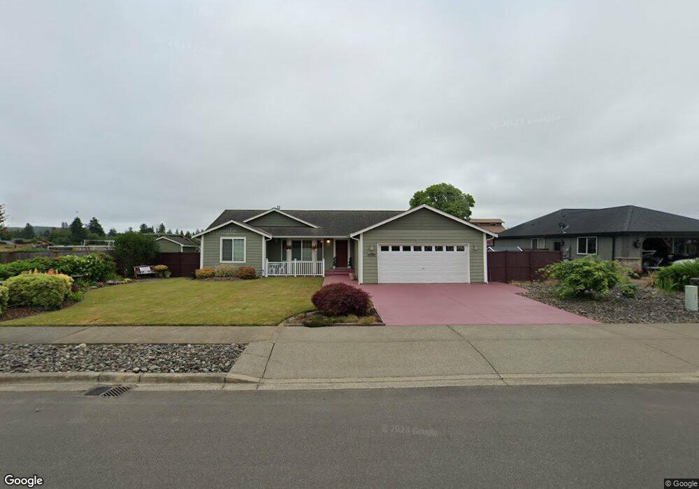
220 Hemlock St Montesano, WA 98563
Estimated Value: $415,802 - $612,000
--
Bed
--
Bath
1,675
Sq Ft
$305/Sq Ft
Est. Value
About This Home
This home is located at 220 Hemlock St, Montesano, WA 98563 and is currently estimated at $510,451, approximately $304 per square foot. 220 Hemlock St is a home located in Grays Harbor County with nearby schools including Beacon Avenue Elementary School, Simpson Avenue Elementary School, and Montesano Junior/Senior High School.
Ownership History
Date
Name
Owned For
Owner Type
Purchase Details
Closed on
Sep 28, 2011
Sold by
First Citizens Bank & Trust Company
Bought by
Dierick Mary
Current Estimated Value
Purchase Details
Closed on
Mar 17, 2010
Sold by
The Federal Deposit Insurance Corporatio
Bought by
First Citizens Bank & Trust Company
Create a Home Valuation Report for This Property
The Home Valuation Report is an in-depth analysis detailing your home's value as well as a comparison with similar homes in the area
Home Values in the Area
Average Home Value in this Area
Purchase History
| Date | Buyer | Sale Price | Title Company |
|---|---|---|---|
| Dierick Mary | $20,000 | Grays Harbor Title | |
| First Citizens Bank & Trust Company | -- | Accommodation |
Source: Public Records
Tax History Compared to Growth
Tax History
| Year | Tax Paid | Tax Assessment Tax Assessment Total Assessment is a certain percentage of the fair market value that is determined by local assessors to be the total taxable value of land and additions on the property. | Land | Improvement |
|---|---|---|---|---|
| 2025 | $3,677 | $397,702 | $85,000 | $312,702 |
| 2023 | $3,716 | $419,465 | $56,600 | $362,865 |
| 2022 | $3,535 | $326,674 | $51,440 | $275,234 |
| 2021 | $3,268 | $326,674 | $51,440 | $275,234 |
| 2020 | $3,432 | $274,639 | $45,920 | $228,719 |
| 2019 | $2,804 | $278,153 | $54,000 | $224,153 |
| 2018 | $3,103 | $247,549 | $40,000 | $207,549 |
| 2017 | $2,779 | $214,954 | $35,000 | $179,954 |
| 2016 | $2,511 | $206,385 | $35,000 | $171,385 |
| 2014 | -- | $189,425 | $22,000 | $167,425 |
| 2013 | -- | $189,485 | $22,000 | $167,485 |
Source: Public Records
Map
Nearby Homes
- 180 Hemlock St
- 535 Meadow Loop
- 100 Simmons Rd
- 23 Garden Tracts Rd
- 0 Lake Dr Unit NWM2394205
- 124 N Chehalis St
- 126 S Chehalis St
- 418 E Pioneer Ave
- 10 Coyote Rd
- 125 N Sylvia St
- 357 N Sylvia St
- 312 E Wilder Hill Ln
- 213 Monte Elma Rd
- 132 S Fleet St
- 122 S 3rd St
- 404 W Marcy Ave
- 530 W Spruce Ave
- 527 S 5th St
- 621 N 6th St
- 733 Washington 107