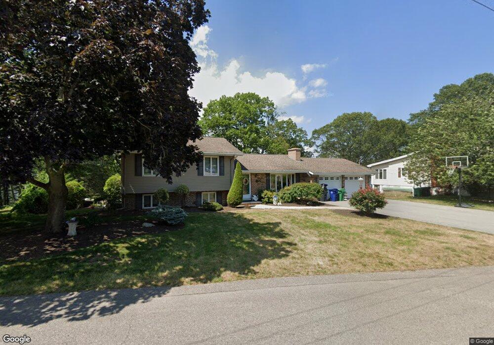
220 Hilton Rd Warwick, RI 02889
Hoxie NeighborhoodEstimated Value: $439,000 - $574,000
3
Beds
3
Baths
1,439
Sq Ft
$367/Sq Ft
Est. Value
About This Home
This home is located at 220 Hilton Rd, Warwick, RI 02889 and is currently estimated at $528,214, approximately $367 per square foot. 220 Hilton Rd is a home located in Kent County with nearby schools including Saint Kevin School and Bishop Hendricken High School.
Ownership History
Date
Name
Owned For
Owner Type
Purchase Details
Closed on
Dec 10, 2019
Sold by
Melucci Kathleen J
Bought by
Kathleen J Melucci T J and Kathleen Melucci
Current Estimated Value
Purchase Details
Closed on
Dec 9, 2019
Sold by
Melucci Frank A and Melucci Kathleen J
Bought by
Melucci Kathleen J
Purchase Details
Closed on
Sep 16, 1996
Sold by
Bettez Keith A and Bettez Debra
Bought by
Melucci Frank A and Mcguirl Kathleen J
Purchase Details
Closed on
Jan 15, 1993
Sold by
Carbone Arthur L Est
Bought by
Bettez Keith A and Betz Debra
Purchase Details
Closed on
Mar 7, 1990
Sold by
Butler James L
Bought by
Carbone Arthur L
Create a Home Valuation Report for This Property
The Home Valuation Report is an in-depth analysis detailing your home's value as well as a comparison with similar homes in the area
Home Values in the Area
Average Home Value in this Area
Purchase History
| Date | Buyer | Sale Price | Title Company |
|---|---|---|---|
| Kathleen J Melucci T J | -- | None Available | |
| Melucci Kathleen J | -- | None Available | |
| Melucci Frank A | $148,000 | -- | |
| Bettez Keith A | $150,000 | -- | |
| Bettez Keith A | $150,000 | -- | |
| Carbone Arthur L | $200,000 | -- | |
| Carbone Arthur L | $200,000 | -- |
Source: Public Records
Mortgage History
| Date | Status | Borrower | Loan Amount |
|---|---|---|---|
| Previous Owner | Carbone Arthur L | $212,000 | |
| Previous Owner | Carbone Arthur L | $215,000 | |
| Previous Owner | Carbone Arthur L | $137,250 |
Source: Public Records
Tax History
| Year | Tax Paid | Tax Assessment Tax Assessment Total Assessment is a certain percentage of the fair market value that is determined by local assessors to be the total taxable value of land and additions on the property. | Land | Improvement |
|---|---|---|---|---|
| 2025 | $7,346 | $578,400 | $204,100 | $374,300 |
| 2024 | $6,977 | $482,200 | $159,500 | $322,700 |
| 2023 | $6,842 | $482,200 | $159,500 | $322,700 |
| 2022 | $6,426 | $343,100 | $111,900 | $231,200 |
| 2021 | $6,426 | $343,100 | $111,900 | $231,200 |
| 2020 | $6,426 | $343,100 | $111,900 | $231,200 |
| 2019 | $6,426 | $343,100 | $111,900 | $231,200 |
| 2018 | $5,961 | $294,500 | $100,000 | $194,500 |
| 2017 | $5,961 | $294,500 | $100,000 | $194,500 |
| 2016 | $5,961 | $294,500 | $100,000 | $194,500 |
| 2015 | $6,293 | $303,300 | $126,200 | $177,100 |
| 2014 | $6,084 | $303,300 | $126,200 | $177,100 |
| 2013 | $6,002 | $303,300 | $126,200 | $177,100 |
Source: Public Records
Map
Nearby Homes
- 38 Bowman Dr
- 46 Royland Rd
- 54 Ansonia Rd
- 207 Stillwater Dr
- 108 Fern St
- 64 Ormsby Ave
- 101 Omaha Blvd
- 700 Sandy Ln Unit 16
- 700 Sandy Ln Unit 15
- 700 Sandy Ln Unit 3
- 700 Sandy Ln Unit 5
- 700 Sandy Ln Unit 6
- 700 Sandy Ln Unit 19
- 700 Sandy Ln Unit 17
- 700 Sandy Ln Unit 4
- 700 Sandy Ln Unit 20
- 700 Sandy Ln Unit 2
- 55 Dixie Ave
- 33 Recess Ln
- 52 Recess Ln