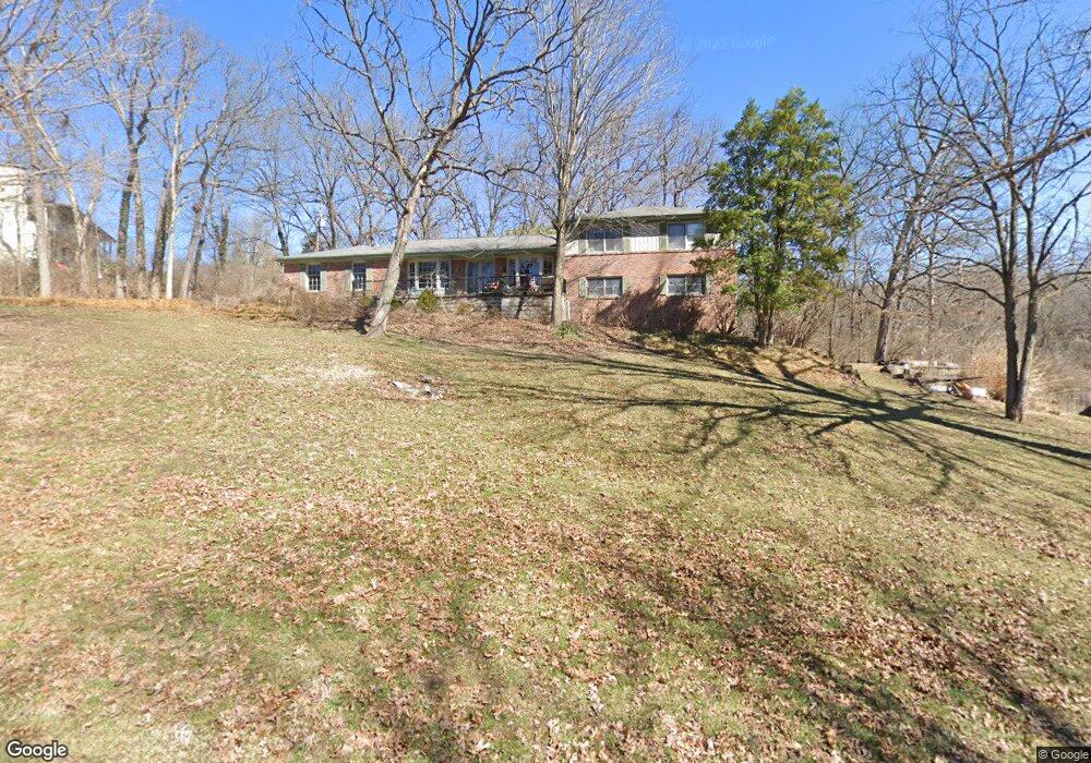
220 Lindeman Rd Saint Louis, MO 63122
Estimated Value: $936,871 - $1,179,000
5
Beds
4
Baths
4,200
Sq Ft
$258/Sq Ft
Est. Value
About This Home
This home is located at 220 Lindeman Rd, Saint Louis, MO 63122 and is currently estimated at $1,082,218, approximately $257 per square foot. 220 Lindeman Rd is a home located in St. Louis County with nearby schools including W.W. Keysor Elementary School, North Kirkwood Middle School, and Kirkwood Senior High School.
Ownership History
Date
Name
Owned For
Owner Type
Purchase Details
Closed on
Jun 30, 2021
Sold by
Poe John B and Poe Teresa A
Bought by
Kim David S and Kim Sarah D
Current Estimated Value
Home Financials for this Owner
Home Financials are based on the most recent Mortgage that was taken out on this home.
Original Mortgage
$600,000
Outstanding Balance
$543,225
Interest Rate
2.9%
Mortgage Type
New Conventional
Estimated Equity
$538,993
Create a Home Valuation Report for This Property
The Home Valuation Report is an in-depth analysis detailing your home's value as well as a comparison with similar homes in the area
Home Values in the Area
Average Home Value in this Area
Purchase History
| Date | Buyer | Sale Price | Title Company |
|---|---|---|---|
| Kim David S | $750,000 | Freedom Title |
Source: Public Records
Mortgage History
| Date | Status | Borrower | Loan Amount |
|---|---|---|---|
| Open | Kim David S | $600,000 |
Source: Public Records
Tax History Compared to Growth
Tax History
| Year | Tax Paid | Tax Assessment Tax Assessment Total Assessment is a certain percentage of the fair market value that is determined by local assessors to be the total taxable value of land and additions on the property. | Land | Improvement |
|---|---|---|---|---|
| 2025 | $8,052 | $155,050 | $84,270 | $70,780 |
| 2024 | $8,052 | $128,930 | $63,190 | $65,740 |
| 2023 | $7,926 | $128,930 | $63,190 | $65,740 |
| 2022 | $8,766 | $133,090 | $57,930 | $75,160 |
| 2021 | $8,651 | $133,090 | $57,930 | $75,160 |
| 2020 | $8,312 | $122,950 | $43,470 | $79,480 |
| 2019 | $8,341 | $122,950 | $43,470 | $79,480 |
| 2018 | $8,115 | $105,640 | $30,150 | $75,490 |
| 2017 | $8,104 | $105,640 | $30,150 | $75,490 |
| 2016 | $7,868 | $103,360 | $26,350 | $77,010 |
| 2015 | $7,829 | $103,360 | $26,350 | $77,010 |
| 2014 | $7,023 | $90,670 | $21,260 | $69,410 |
Source: Public Records
Map
Nearby Homes
- 1612 Dougherty Ferry Rd
- 1314 W Adams Ave
- 512 Bryan Ave
- 1312 W Essex Ave
- 1800 W Adams Ave
- 425 Gabriel Dr
- 340 S Ballas Rd
- 320 Frieda Ave
- 1710 Lynkirk Ln
- 406 Meyer Ave
- 699 W Washington Ave
- 410 Bach Ave
- 2002 Woodland Knoll
- 456 Wilcox Ave
- 1912 Windy Hill Rd
- 416 S Ballas Rd
- 2005 Woodland Knoll
- 2017 Woodland Knoll
- 2025 Woodland Knoll
- 2033 Woodland Knoll
- 1540 View Woods Dr
- 236 Lindeman Rd
- 214 Lindeman Rd
- 1534 View Woods Dr
- 221 Lindeman Rd
- 1610 View Woods Dr
- 1527 View Woods Dr
- 1539 View Woods Dr
- 1630 View Woods Dr
- 1333 W Adams Ave
- 248 Lindeman Rd
- 1400 W Adams Ave
- 1607 View Woods Dr
- 1398 W Adams Ave
- 1623 View Woods Dr
- 255 Lindeman Rd
- 1643 View Woods Dr
- 469 Bryan Ave
- 1633 View Woods Dr
- 1394 W Adams Ave