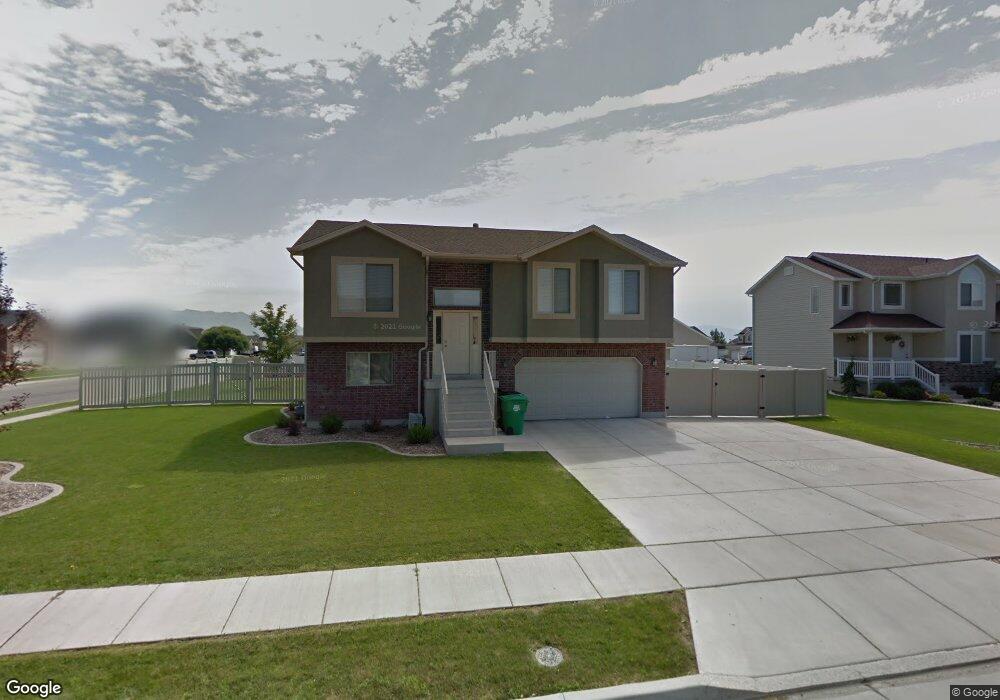
220 N 4950 W West Point, UT 84015
Estimated Value: $501,000 - $545,000
4
Beds
3
Baths
1,736
Sq Ft
$305/Sq Ft
Est. Value
About This Home
This home is located at 220 N 4950 W, West Point, UT 84015 and is currently estimated at $530,228, approximately $305 per square foot. 220 N 4950 W is a home located in Davis County with nearby schools including West Point School, West Point Junior High School, and Syracuse High School.
Ownership History
Date
Name
Owned For
Owner Type
Purchase Details
Closed on
Nov 30, 2021
Sold by
Leciesma Juan J
Bought by
Marshall Heather
Current Estimated Value
Home Financials for this Owner
Home Financials are based on the most recent Mortgage that was taken out on this home.
Original Mortgage
$27,450
Outstanding Balance
$25,136
Interest Rate
3.09%
Estimated Equity
$505,092
Purchase Details
Closed on
Aug 6, 2020
Sold by
Poll Travis
Bought by
Ledesma Juan J
Home Financials for this Owner
Home Financials are based on the most recent Mortgage that was taken out on this home.
Original Mortgage
$313,500
Interest Rate
3%
Mortgage Type
New Conventional
Purchase Details
Closed on
Apr 6, 2016
Sold by
Young Chelsea and Young Thomas W
Bought by
Poll Travis
Purchase Details
Closed on
Jan 12, 2007
Sold by
Young Chelsea and Young Thomas W
Bought by
Young Thomas W and Young Chelsea
Home Financials for this Owner
Home Financials are based on the most recent Mortgage that was taken out on this home.
Original Mortgage
$21,500
Interest Rate
5.82%
Mortgage Type
Stand Alone Second
Purchase Details
Closed on
Mar 1, 2005
Sold by
Krjitbosch Chousea and Young Chelsea
Bought by
Doons Thelsea and Doons Thomas
Home Financials for this Owner
Home Financials are based on the most recent Mortgage that was taken out on this home.
Original Mortgage
$12,000
Interest Rate
5.7%
Mortgage Type
Purchase Money Mortgage
Purchase Details
Closed on
Oct 6, 2004
Sold by
S M Carter Co
Bought by
Young Thomas W and Kruitbosch Chelsea
Purchase Details
Closed on
Oct 29, 2003
Sold by
Paice Farms Llc
Bought by
S M Carter Co
Home Financials for this Owner
Home Financials are based on the most recent Mortgage that was taken out on this home.
Original Mortgage
$114,750
Interest Rate
5.98%
Mortgage Type
Construction
Purchase Details
Closed on
Apr 16, 2003
Sold by
Mark Higley Construction Lc and Boothe Gordon
Bought by
Paice Farms Llc
Create a Home Valuation Report for This Property
The Home Valuation Report is an in-depth analysis detailing your home's value as well as a comparison with similar homes in the area
Home Values in the Area
Average Home Value in this Area
Purchase History
| Date | Buyer | Sale Price | Title Company |
|---|---|---|---|
| Marshall Heather | -- | Amicus Title | |
| Marshall Heather | -- | Amicus Title | |
| Ledesma Juan J | -- | Silver Leaf Title Ins | |
| Poll Travis | -- | Intermountain Title | |
| Young Thomas W | -- | Security Title | |
| Doons Thelsea | -- | None Available | |
| Young Thomas W | -- | Security Title Company | |
| S M Carter Co | -- | Security Title Company | |
| Paice Farms Llc | -- | Heritage West Title Insuranc |
Source: Public Records
Mortgage History
| Date | Status | Borrower | Loan Amount |
|---|---|---|---|
| Open | Marshall Heather | $27,450 | |
| Closed | Marshall Heather | $27,450 | |
| Open | Marshall Heather | $457,559 | |
| Closed | Marshall Heather | $457,559 | |
| Previous Owner | Ledesma Juan J | $313,500 | |
| Previous Owner | Young Thomas W | $21,500 | |
| Previous Owner | Young Thomas W | $128,000 | |
| Previous Owner | Doons Thelsea | $12,000 | |
| Previous Owner | S M Carter Co | $114,750 |
Source: Public Records
Tax History Compared to Growth
Tax History
| Year | Tax Paid | Tax Assessment Tax Assessment Total Assessment is a certain percentage of the fair market value that is determined by local assessors to be the total taxable value of land and additions on the property. | Land | Improvement |
|---|---|---|---|---|
| 2025 | $2,874 | $264,550 | $109,684 | $154,866 |
| 2024 | $2,767 | $255,750 | $98,735 | $157,015 |
| 2023 | $2,542 | $432,000 | $123,821 | $308,179 |
| 2022 | $2,737 | $254,650 | $64,617 | $190,033 |
| 2021 | $2,415 | $336,000 | $100,151 | $235,849 |
| 2020 | $2,110 | $289,000 | $84,283 | $204,717 |
| 2019 | $2,052 | $277,000 | $81,727 | $195,273 |
| 2018 | $1,866 | $248,000 | $81,405 | $166,595 |
| 2016 | $1,523 | $106,150 | $31,512 | $74,638 |
| 2015 | $1,531 | $101,145 | $31,512 | $69,633 |
| 2014 | $1,485 | $99,281 | $31,512 | $67,769 |
| 2013 | -- | $94,255 | $30,787 | $63,468 |
Source: Public Records
Map
Nearby Homes
- 4669 W 75 N
- 4594 W 75 N Unit 405
- 4719 W 650 N
- 477 N 4500 W
- 128 N 4500 W
- 4352 W 300 N
- 4366 W 200 N
- 4325 W 75 N
- 120 N 4325 W
- 4362 West St Unit 106
- 4358 West St Unit 105
- 356 S 4300 W Unit 611
- 364 S 4300 W Unit 610
- 357 N 4000 W
- 3949 W 250 N
- 696 S 4500 W
- Charleston Plan at Bluff View
- 4469 W 1000 N Unit 120
- 3851 W 50 S Unit 425
- 3849 W 50 S Unit 426
- 190 N 4950 W
- 4923 W Mallard Dr
- 4924 W 175 N
- 4938 W 250 N
- 4926 W 250 N
- 255 Quail Run Unit 109
- 255 Quail Run
- 223 N 4950 W Unit 108
- 223 N 4950 W
- 195 N 4950 W
- 255 N 4950 W
- 4911 W Mallard Dr
- 4911 W Mallard Dr
- 168 N 4950 W
- 4912 W 175 N
- 284 N 4950 W
- 4914 W 250 N
- 4921 W 175 N
- 4914 W Mallard Dr
- 4914 W Mallard Dr