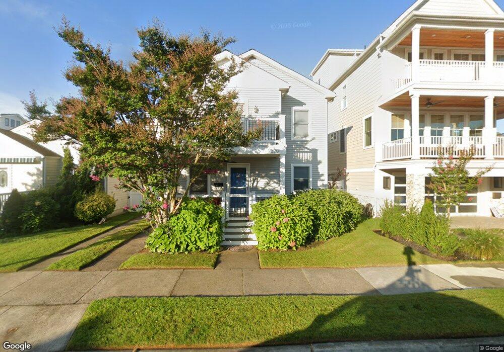
220 N Sumner Ave Margate City, NJ 08402
Estimated Value: $1,234,000 - $1,816,000
4
Beds
3
Baths
2,072
Sq Ft
$708/Sq Ft
Est. Value
About This Home
This home is located at 220 N Sumner Ave, Margate City, NJ 08402 and is currently estimated at $1,467,170, approximately $708 per square foot. 220 N Sumner Ave is a home located in Atlantic County with nearby schools including William H. Ross III Intermediate School, Eugene A. Tighe Middle School, and Blessed Sacrament Regional School.
Ownership History
Date
Name
Owned For
Owner Type
Purchase Details
Closed on
May 12, 2011
Sold by
Leeds Edward and Leeds Amy M Armour
Bought by
Goodman Steven and Goodman Janis
Current Estimated Value
Purchase Details
Closed on
Dec 15, 2000
Sold by
Leeds James P and Leeds Anne B
Bought by
Leeds Edward and Leeds Amy M Armour
Home Financials for this Owner
Home Financials are based on the most recent Mortgage that was taken out on this home.
Original Mortgage
$64,000
Interest Rate
7.38%
Create a Home Valuation Report for This Property
The Home Valuation Report is an in-depth analysis detailing your home's value as well as a comparison with similar homes in the area
Home Values in the Area
Average Home Value in this Area
Purchase History
| Date | Buyer | Sale Price | Title Company |
|---|---|---|---|
| Goodman Steven | $565,000 | Foundation Title | |
| Leeds Edward | $80,000 | -- |
Source: Public Records
Mortgage History
| Date | Status | Borrower | Loan Amount |
|---|---|---|---|
| Previous Owner | Leeds Edward | $64,000 |
Source: Public Records
Tax History Compared to Growth
Tax History
| Year | Tax Paid | Tax Assessment Tax Assessment Total Assessment is a certain percentage of the fair market value that is determined by local assessors to be the total taxable value of land and additions on the property. | Land | Improvement |
|---|---|---|---|---|
| 2025 | $7,512 | $439,800 | $244,300 | $195,500 |
| 2024 | $7,512 | $439,800 | $244,300 | $195,500 |
| 2023 | $6,940 | $439,800 | $244,300 | $195,500 |
| 2022 | $6,940 | $439,800 | $244,300 | $195,500 |
| 2021 | $6,843 | $439,800 | $244,300 | $195,500 |
| 2020 | $6,808 | $439,800 | $244,300 | $195,500 |
| 2019 | $6,782 | $439,800 | $244,300 | $195,500 |
| 2018 | $6,874 | $439,800 | $244,300 | $195,500 |
| 2017 | $6,883 | $439,800 | $244,300 | $195,500 |
| 2016 | $6,650 | $439,800 | $244,300 | $195,500 |
| 2015 | $6,544 | $439,800 | $244,300 | $195,500 |
| 2014 | $6,421 | $439,800 | $244,300 | $195,500 |
Source: Public Records
Map
Nearby Homes
- 304 N Thurlow Ave
- 316 N Thurlow Ave
- 116 N Wilson Ave Unit A
- 9007 Fremont Ave
- 202 N Harding Ave
- 121 N Quincy Ave
- 215 N Decatur Ave
- 13 N Vendome Ave
- 437 N Rumson Ave
- 437 N Thurlow Ave
- 201 N Washington Ave Unit 1
- 201 N Washington Ave Unit 3
- 201 N Washington Ave Unit 5
- 201 N Washington Ave Unit 2
- 201 N Washington Ave Unit 6
- 201 N Washington Ave Unit 4
- 9009 Ventnor Ave
- 215 N Nassau Ave
- 302 N Mansfield Ave
- 2 N Pembroke Ave
- 218 N Sumner Ave
- 222 N Sumner Ave
- 8902 Amherst Ave
- 216 N Sumner Ave
- 217 N Thurlow Ave
- 214 N Sumner Ave
- 219 N Sumner Ave
- 215 N Sumner Ave
- 8903 Amherst Ave
- 8901 Amherst Ave
- 208 N Sumner Ave
- 209 N Thurlow Ave
- 301 N Thurlow Ave
- 211 N Sumner Ave
- 8809 Amherst Ave
- 206 N Sumner Ave
- 219 N Thurlow Ave
- 201 N Thurlow Ave
- 207 N Thurlow Ave