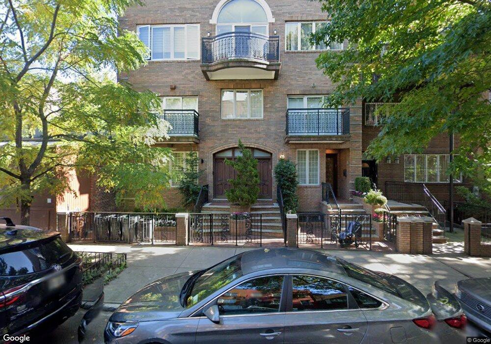
220 Rutledge St Brooklyn, NY 11211
South Williamsburg NeighborhoodEstimated Value: $2,129,000
--
Bed
--
Bath
10,160
Sq Ft
$210/Sq Ft
Est. Value
About This Home
This home is located at 220 Rutledge St, Brooklyn, NY 11211 and is currently estimated at $2,129,000, approximately $209 per square foot. 220 Rutledge St is a home located in Kings County with nearby schools including Ps 380 John Wayne Elementary School, Bnos Yakov School For Girls, and Central Uta.
Ownership History
Date
Name
Owned For
Owner Type
Purchase Details
Closed on
Mar 2, 2020
Sold by
Mittelman As Trustee Samuel
Bought by
Mittelman Samuel
Current Estimated Value
Purchase Details
Closed on
Mar 26, 2009
Sold by
Mittelman David
Bought by
Mittelman Samuel and Y G W Realty Trust
Purchase Details
Closed on
Aug 15, 2007
Sold by
Mittelman David
Bought by
Berger Chaim and Berger Chanie
Purchase Details
Closed on
Jan 14, 2004
Sold by
Weinstock Aurelia
Bought by
Mittelman David and Weinstock Aurelia
Create a Home Valuation Report for This Property
The Home Valuation Report is an in-depth analysis detailing your home's value as well as a comparison with similar homes in the area
Home Values in the Area
Average Home Value in this Area
Purchase History
| Date | Buyer | Sale Price | Title Company |
|---|---|---|---|
| Mittelman Samuel | -- | -- | |
| Mittelman Samuel | -- | -- | |
| Berger Chaim | $499,900 | -- | |
| Mittelman David | $400,000 | -- |
Source: Public Records
Tax History Compared to Growth
Tax History
| Year | Tax Paid | Tax Assessment Tax Assessment Total Assessment is a certain percentage of the fair market value that is determined by local assessors to be the total taxable value of land and additions on the property. | Land | Improvement |
|---|---|---|---|---|
| 2025 | $10,799 | $478,980 | $15,540 | $463,440 |
| 2024 | $10,799 | $447,300 | $15,540 | $431,760 |
| 2023 | $10,301 | $395,340 | $15,540 | $379,800 |
| 2022 | $9,553 | $345,180 | $15,540 | $329,640 |
| 2021 | $9,501 | $296,280 | $15,540 | $280,740 |
| 2020 | $9,440 | $289,800 | $15,540 | $274,260 |
| 2019 | $9,373 | $230,400 | $15,540 | $214,860 |
| 2018 | $8,617 | $42,269 | $4,128 | $38,141 |
| 2017 | $8,129 | $39,877 | $5,073 | $34,804 |
| 2016 | $7,521 | $37,620 | $6,461 | $31,159 |
| 2015 | $4,638 | $37,380 | $7,228 | $30,152 |
| 2014 | $4,638 | $37,380 | $8,672 | $28,708 |
Source: Public Records
Map
Nearby Homes
- 68A Middleton St
- 90 Heyward St
- 57 Lorimer St Unit 1A
- 274 Wallabout St Unit 7B
- 616 Bedford Ave Unit 5C
- 616 Bedford Ave Unit 6B
- 616 Bedford Ave Unit 5A
- 43 Gerry St Unit 5
- 323 S 5th St Unit TWNH
- 543 Bedford Ave
- 29 Montrose Ave Unit 4B
- 360 S 3rd St
- 307 S 4th St
- 330 S 3rd St Unit 1
- 764 Kent Ave Unit 2
- 374 S 2nd St Unit 33
- 272 S 5th St Unit A2
- 397 S 2nd St
- 150 E 56th St Unit 2A
- 56 Meserole St
- 218 Rutledge St Unit 2
- 218 Rutledge St Unit 1
- 218 Rutledge St
- 216 Rutledge St
- 330 Marcy Ave
- 332 Marcy Ave
- 214 Rutledge St
- 326 Marcy Ave
- 328 Marcy Ave
- 334 Marcy Ave
- 212 Rutledge St
- 336 Marcy Ave
- 336 Marcy Ave Unit 201
- 338 Marcy Ave
- 210 Rutledge St
- 185 Heyward St
- 187 Heyward St
- 183 Heyward St
- 181 Heyward St
- 340 Marcy Ave